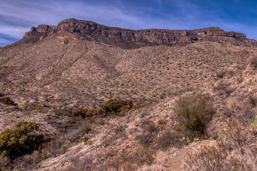
My friend Ken, his son Derek, and his grandson Alec made a trip to Big Bend to hike the classic “Outer Mountain Loop,” a 4-day, 3-night epic backpack journey across the high trails of the Chisos Mountains, down into the high desert south of the Chisos, and finishing at the trail up Juniper Canyon and back into the high Chisos. At least, that was the plan…until a 1300+ acre fire in the high Chisos complex shut down all hiking and camping on the central and eastern sections of the mountains. With the trail closures, we opted to cut the trip a day short and do the hike without the return across the mountains.
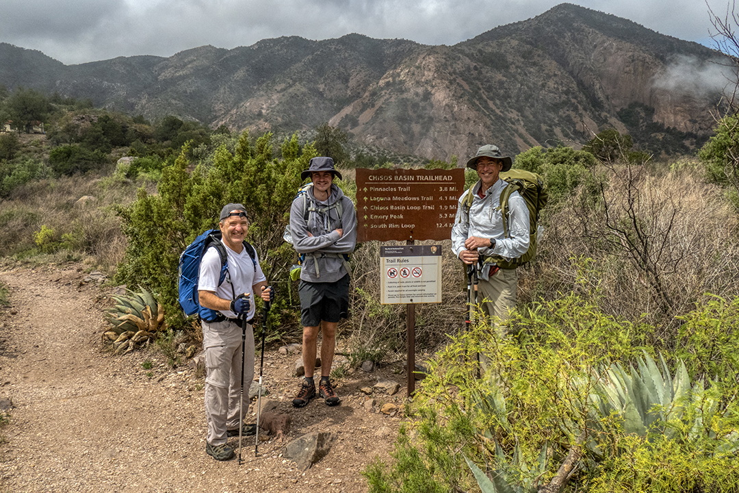
Ken, Alec and Derek at the trailhead in the Basin area of the Chisos Mountains. The Laguna Meadow Trail, and connecting Blue Creek Trail, were not affected by the fire, so the first day (and second day) were as originally planned.
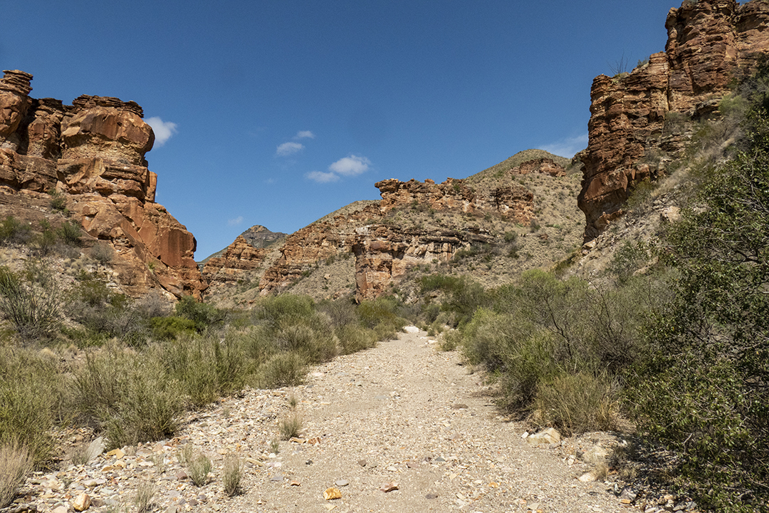
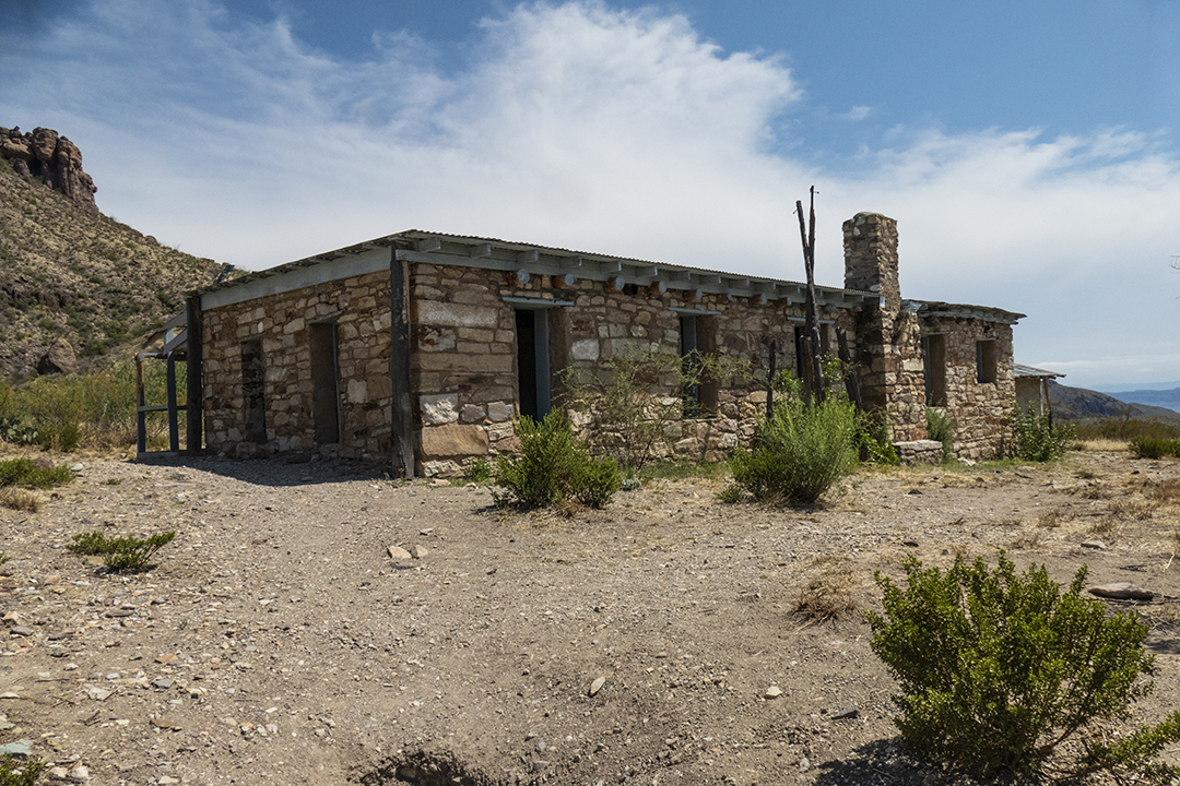
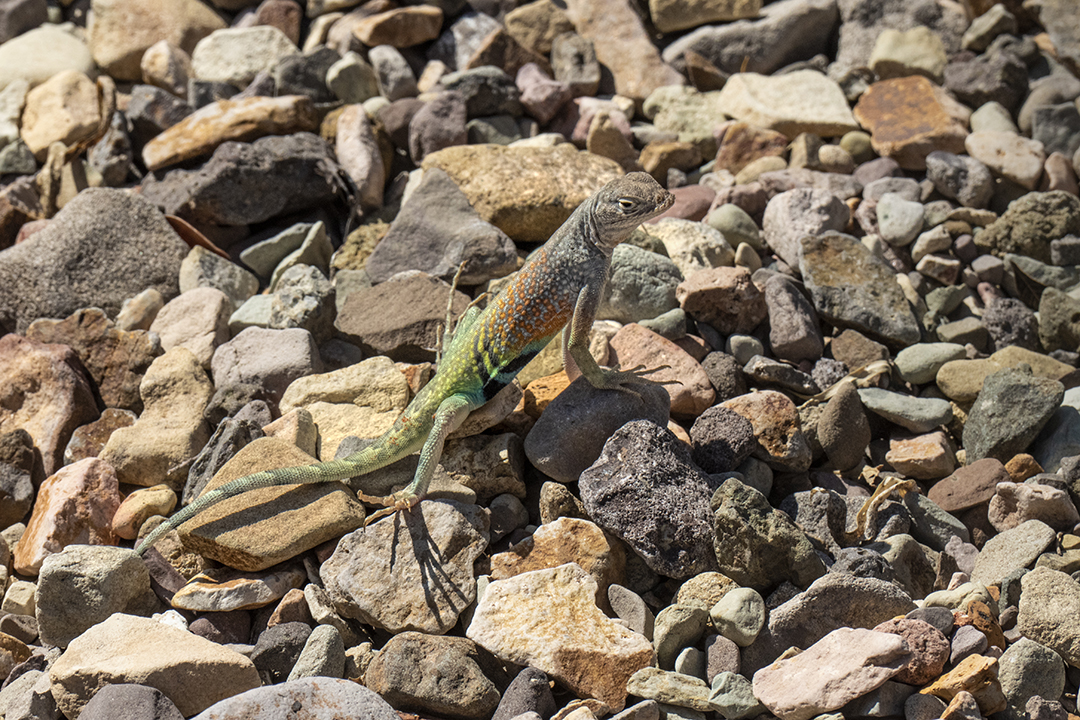
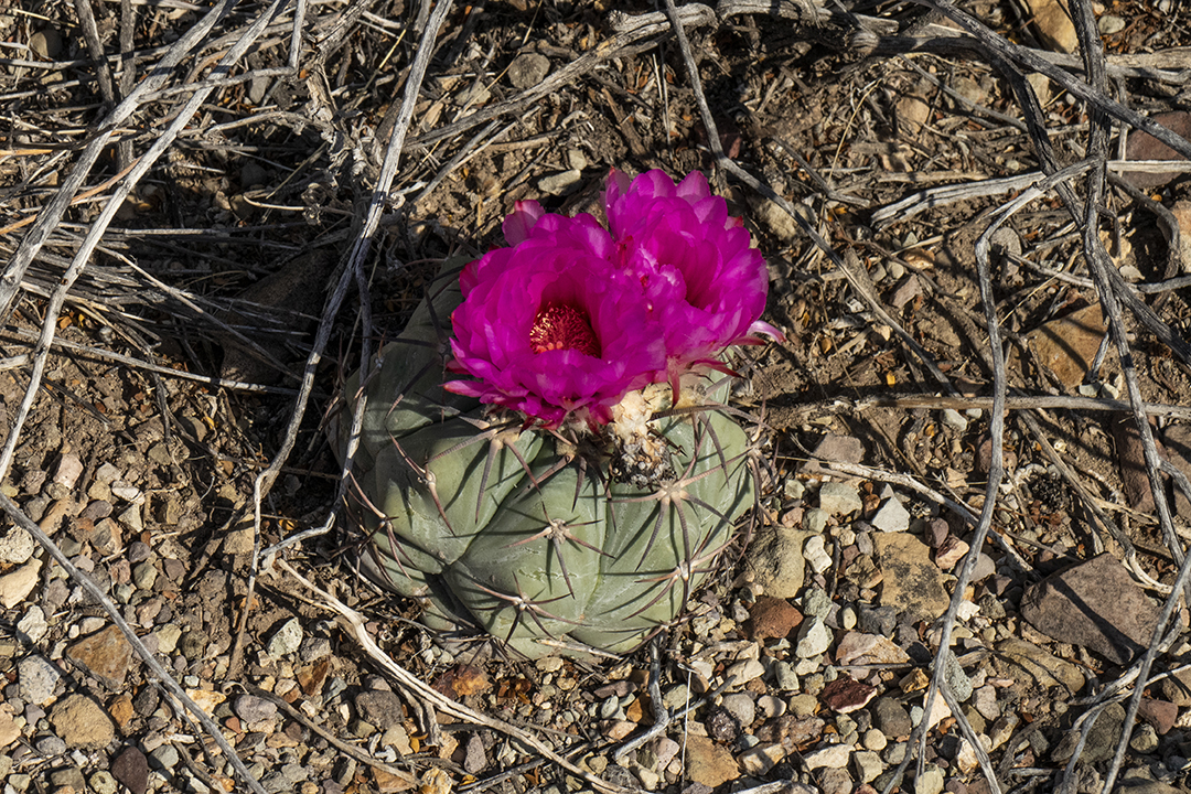
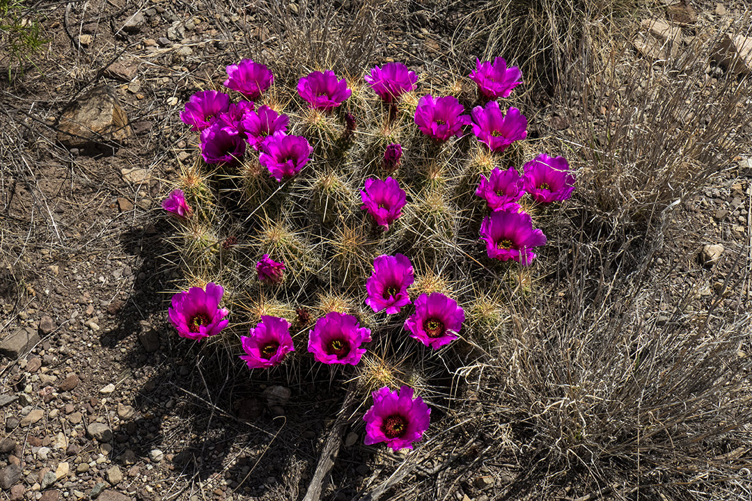
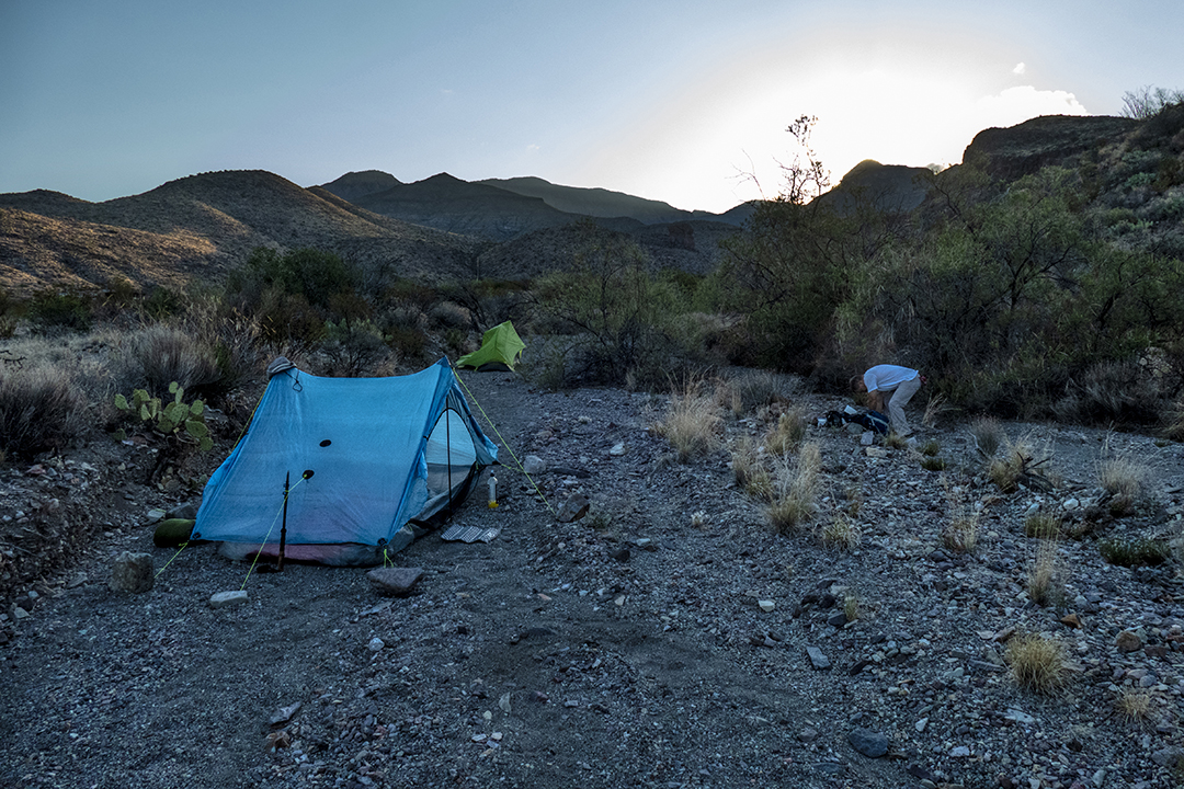
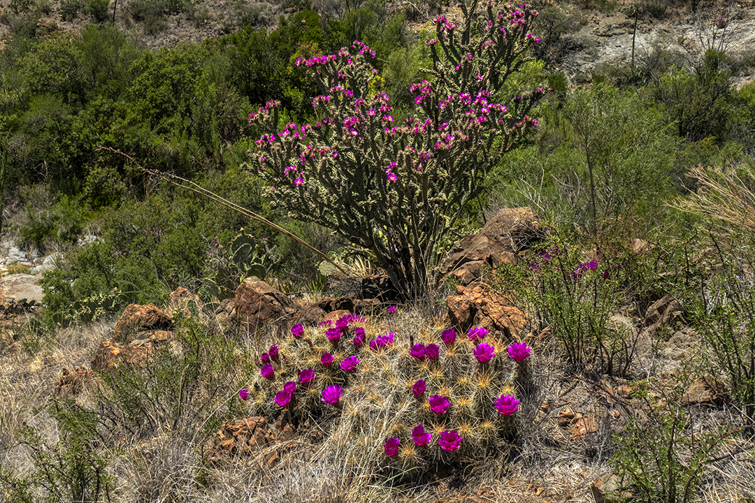
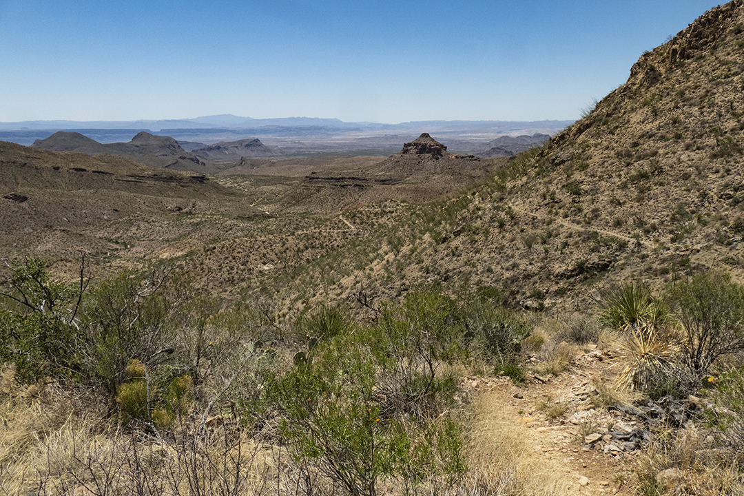
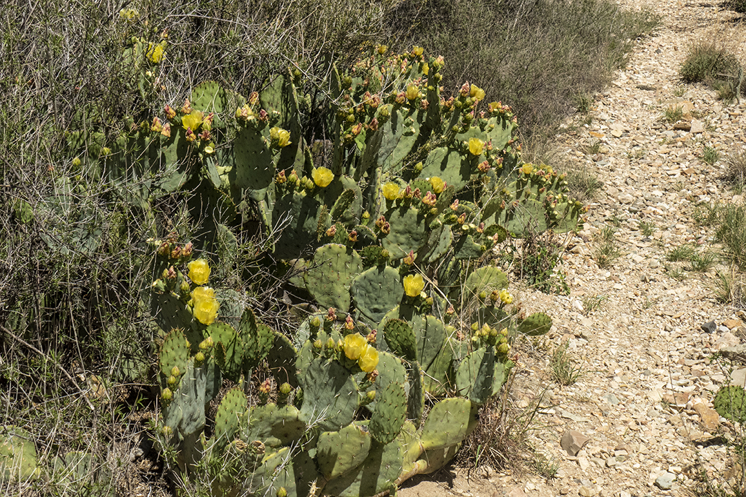
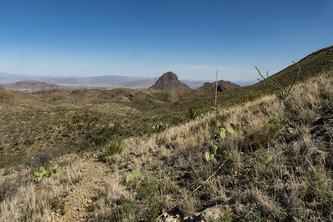
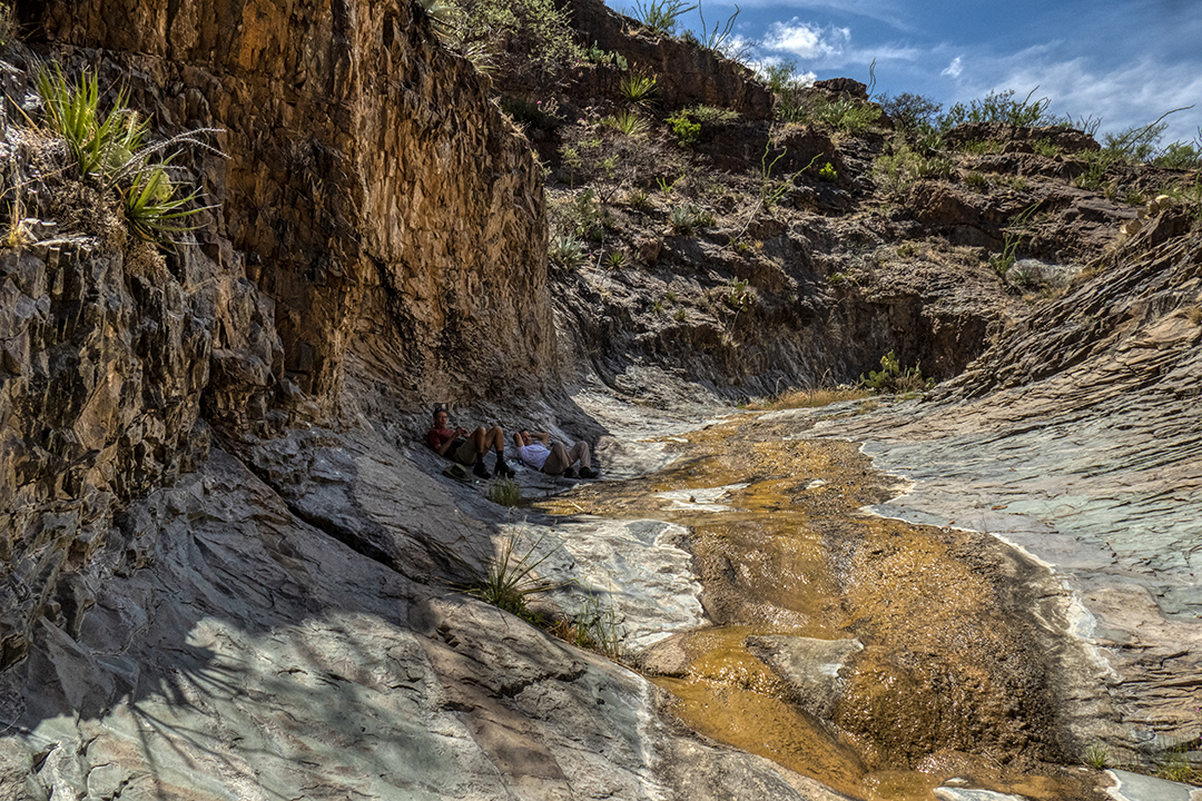
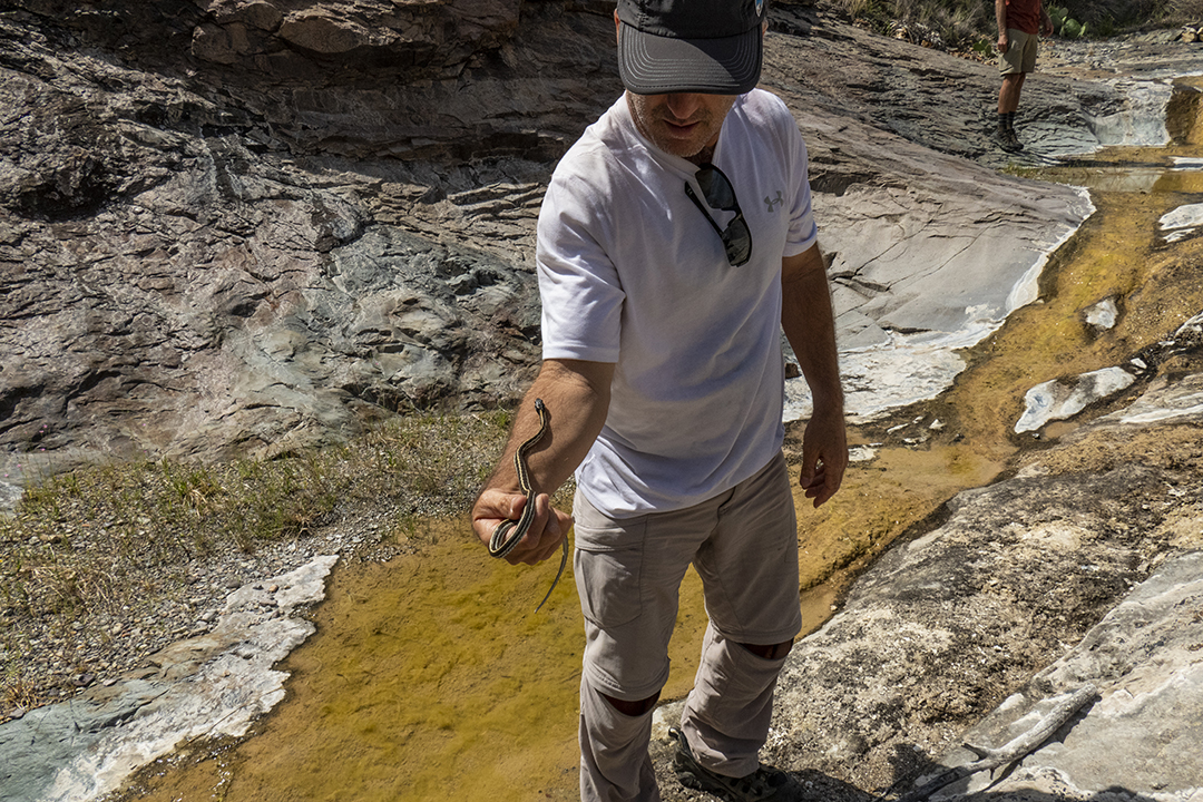
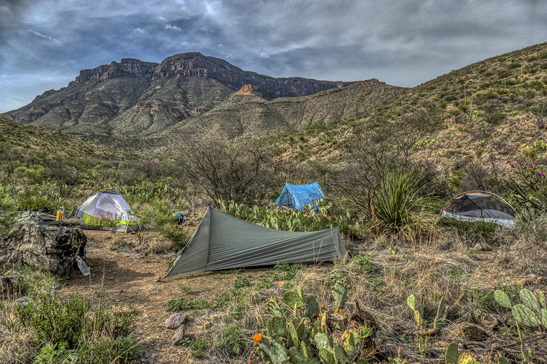
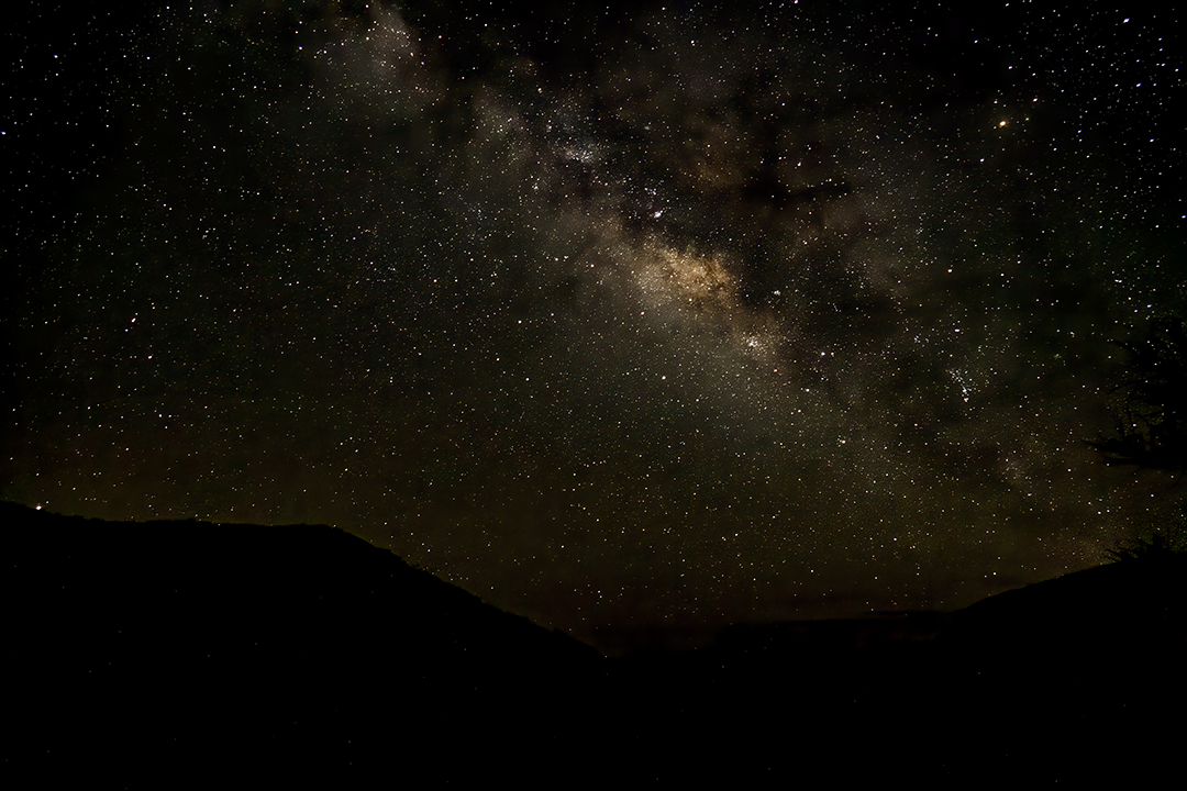
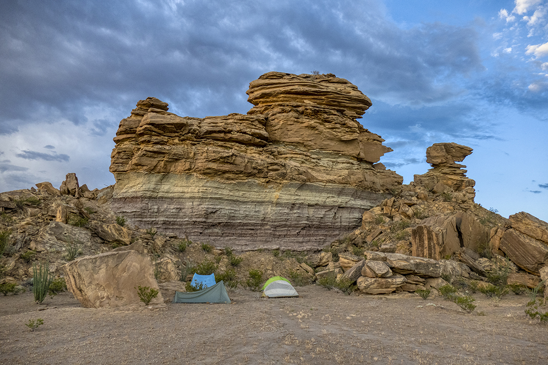
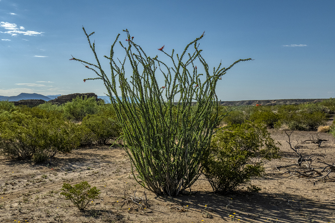
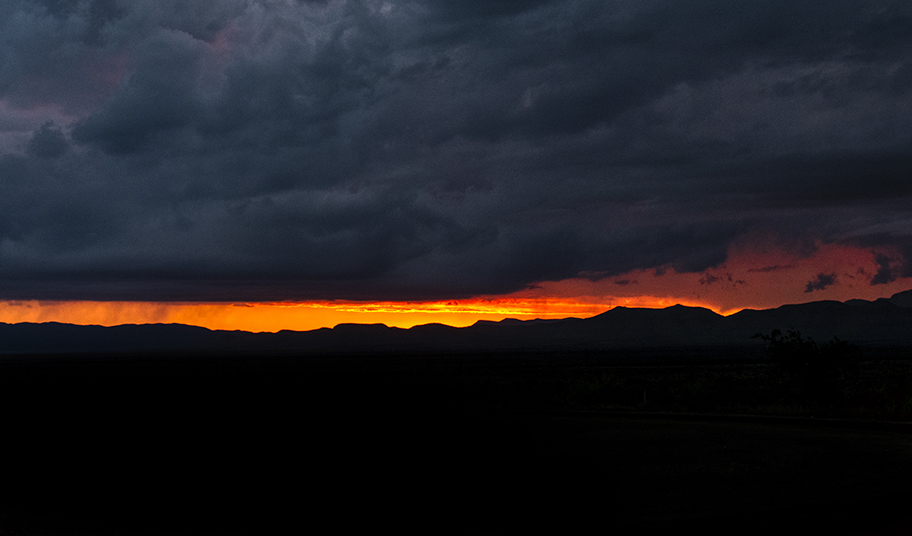
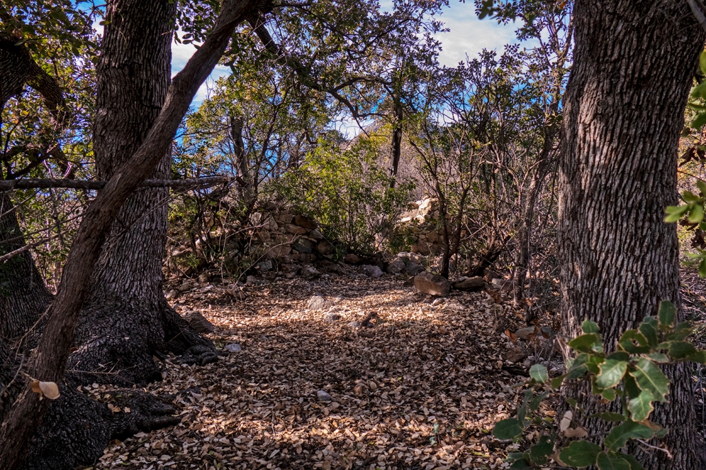
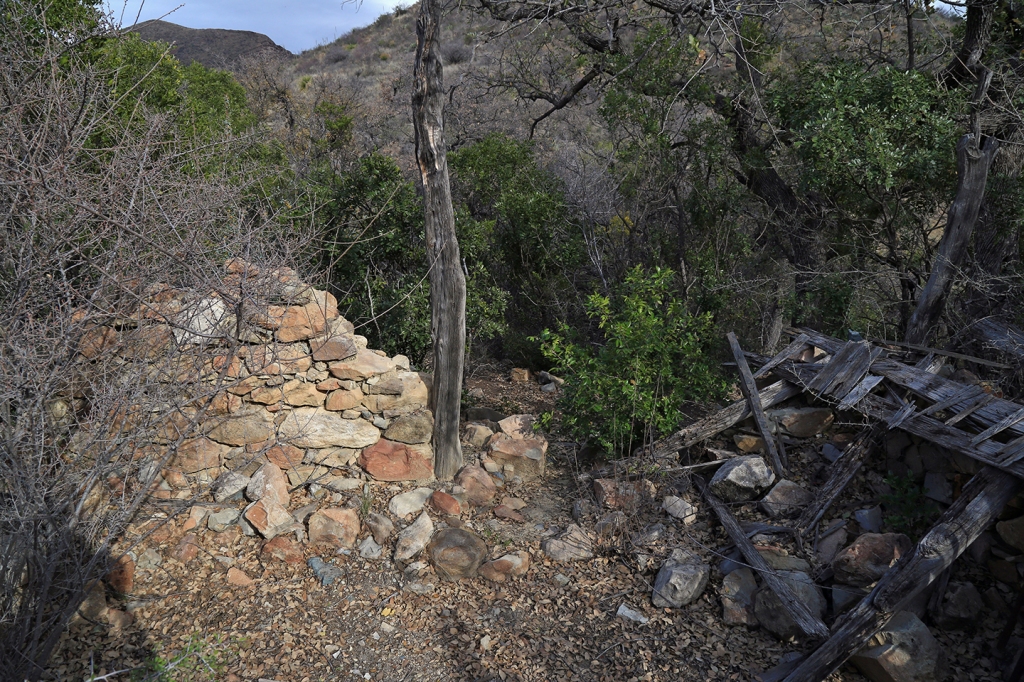
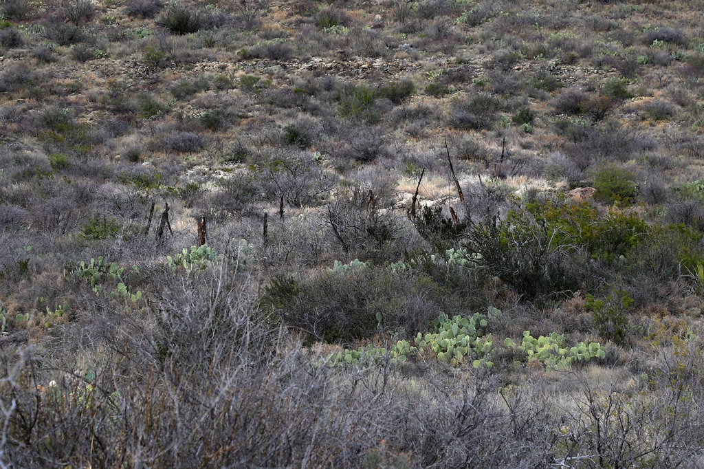
Ken, Alec and Derek at the TrailheadTrail through the red igneous “dikes” from the high Chisos, down Blue Creek Canyon to Homer Wilson Ranch.Line cabin of the Homer Wilson Ranch at the location of camp #1.Greater Earless Lizard watches as we pass by.Turks Head Cactus in full double bloom along the trail.After a dry spring, a recent rain rewarded us with a plethora of blooming cactus, such as this Strawberry Pitaya (Hedgehog).Campsite a quarter mile east of the historic Homer Wilson Ranch line cabin.Beautiful setting of blooming Cane Cholla and Strawberry Pitaya on the trail between Homer Wilson and the spring at Fresno Creek, about 7 miles east of camp.A look back down the switchbacks of the Dodson Trail at the first saddle, at about 5,000′ altitude (a climb of about 900′ above our campsite).Engelmann Pricklypear cactus in bloom along the trail.The landmark “Elephant Tusk” as seen from the Dodson Trail just before we drop down into the Fresno Creek drainage.The water flowing through the Fresno Creek bedrock is welcome to hot and tired backpackers Ken and Derek, as well as another very rare pleasure…SHADE.Ken admires a not-so-shy Garter Snake enjoying the cool water in the spring. Campsite the second night out, at the foot of the Chisos Mountains, which rise to a height of 7400′ above our campsite at 4600′ altitude.A beautiful night for stars, the Milky Way rises in the southeast after midnight above our camp.The ruins of the Dodson Ranch, a homestead in this very rough and remote area where a family ranched sheep and goats before the creation of Big Bend NP in the late 1940’s.Ken, Derek and Alec next to an Agave, or Century Plant, in full bloom below the southeast rim of the Chisos Mountains.After our hike out to the Jeep at the Juniper Canyon trailheadon day 3, we made a short drive down to the mouth of Santa Elena Canyon, where the Rio Grande River cuts through a fault that resulted in a 1500′ uplift, creating the canyon (Mexico on the left, the US on the right, as you look upcanyon).Our third night on the trail was a short hike into the “Taj Mahal Hoodoo,” where we spent a loud, wet and windy night with thunderstorms dancing all around. No stars this night.A really large Ocotillo, in full leaf and bloom, near our campsite.Typical sunset as seen through storm clouds in the Chihuahua Desert.
We had a great time wandering around together through the desert, an unusually cool trip for this time of the year. This Outer Mountain Loop is not for novice hikers, as it requires a lot of planning to insure adequate water for multiple people. Be sure to use the expertise of the Big Bend National Park staff in making plans for this trip.
Postscript:
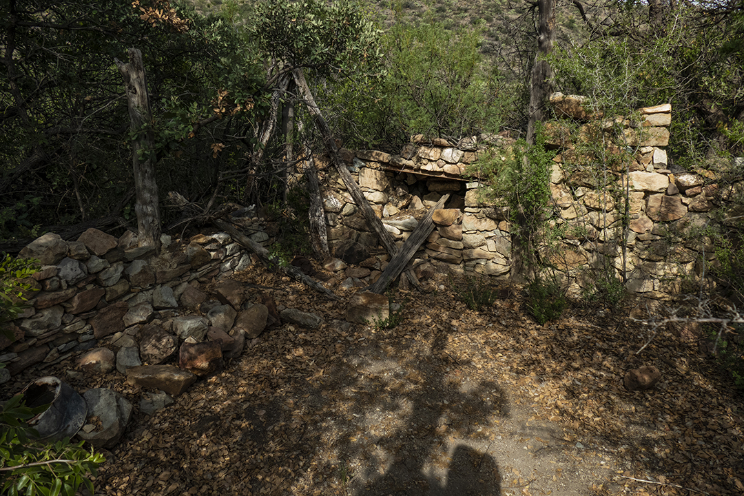
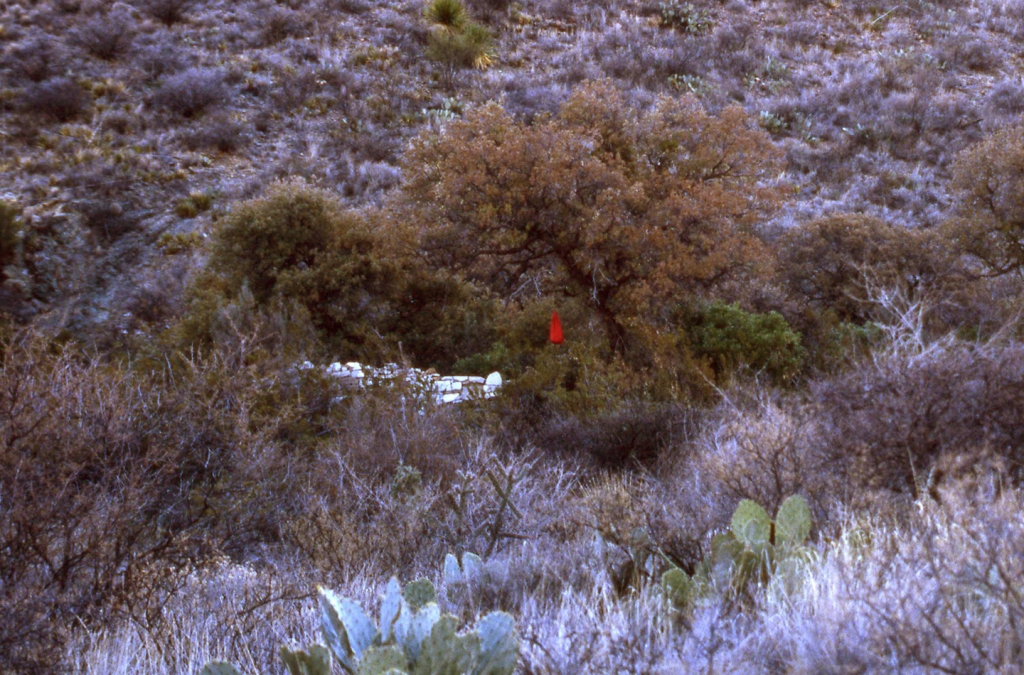
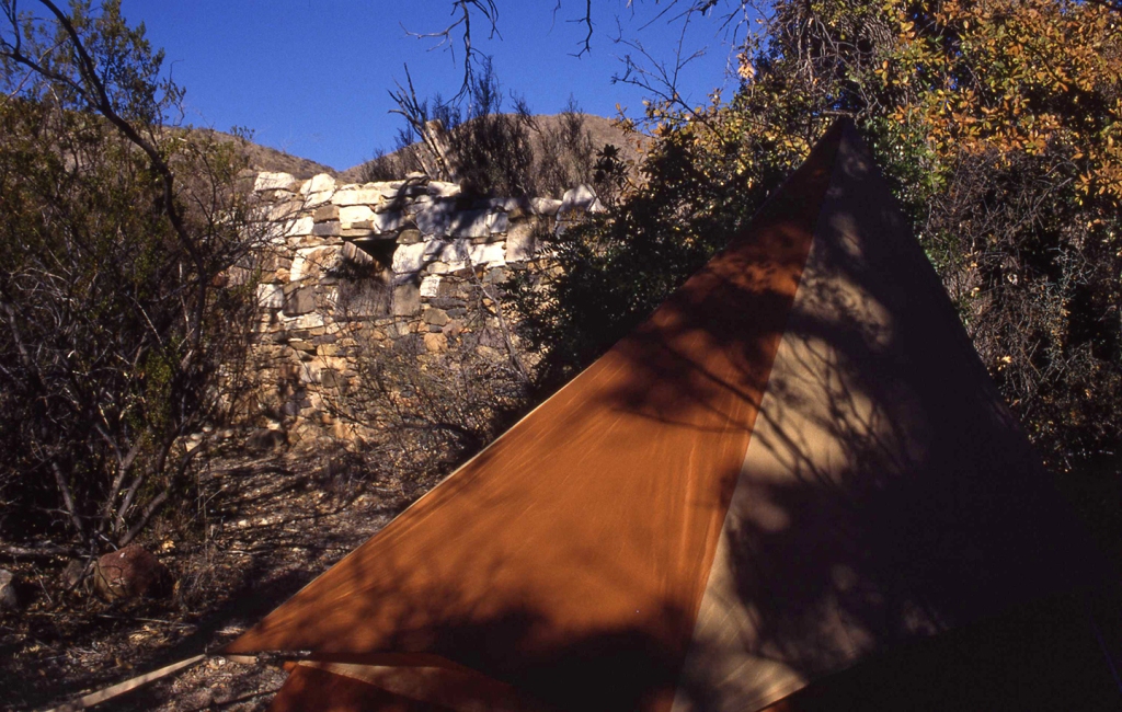
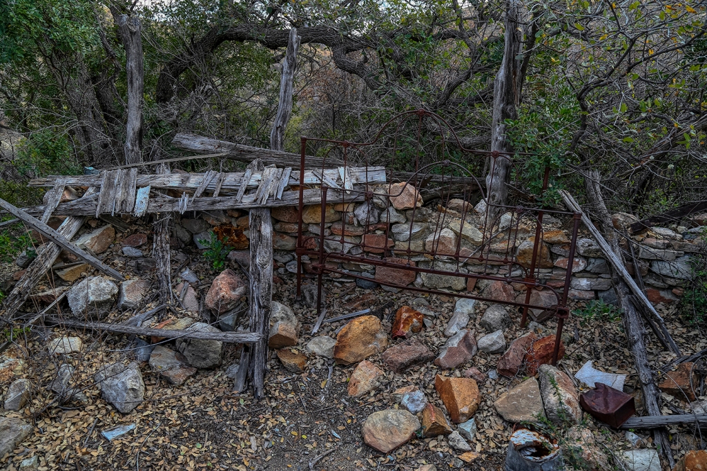
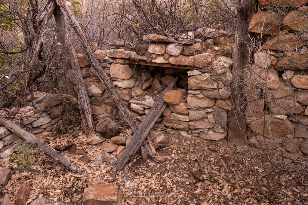
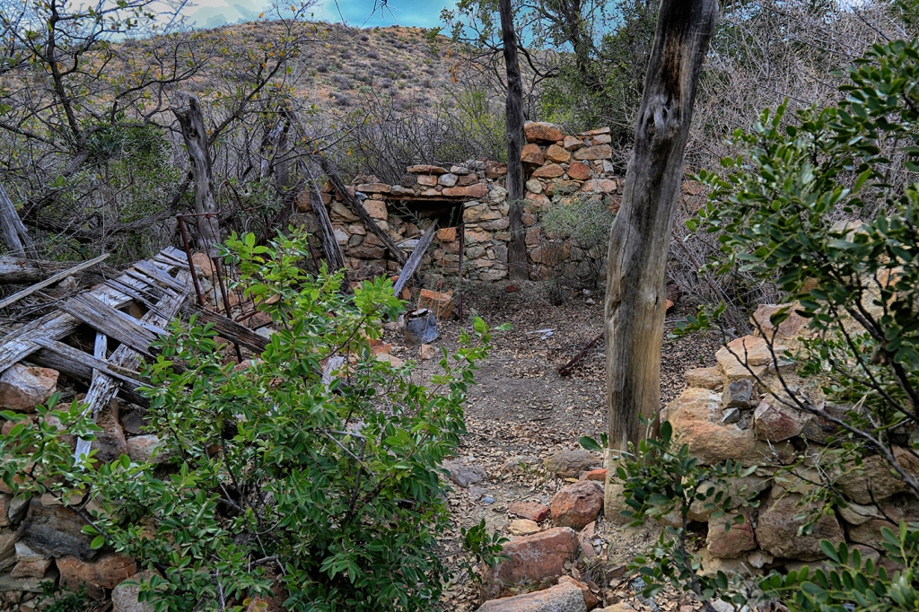
Recently the great-grandaughter of the original homesteaders at the Dodson Ranch made comment regarding my photograph of the Dodson Ranch House ruin along the Outer Mountain Loop. She said that she was unable to visit the site, but enjoyed seeing photographs of what was left of the ranch. In that spirit, I am adding this post of a collection of photographs that I have made on multiple trips out to the old ranch ruins, beginning in 1985:
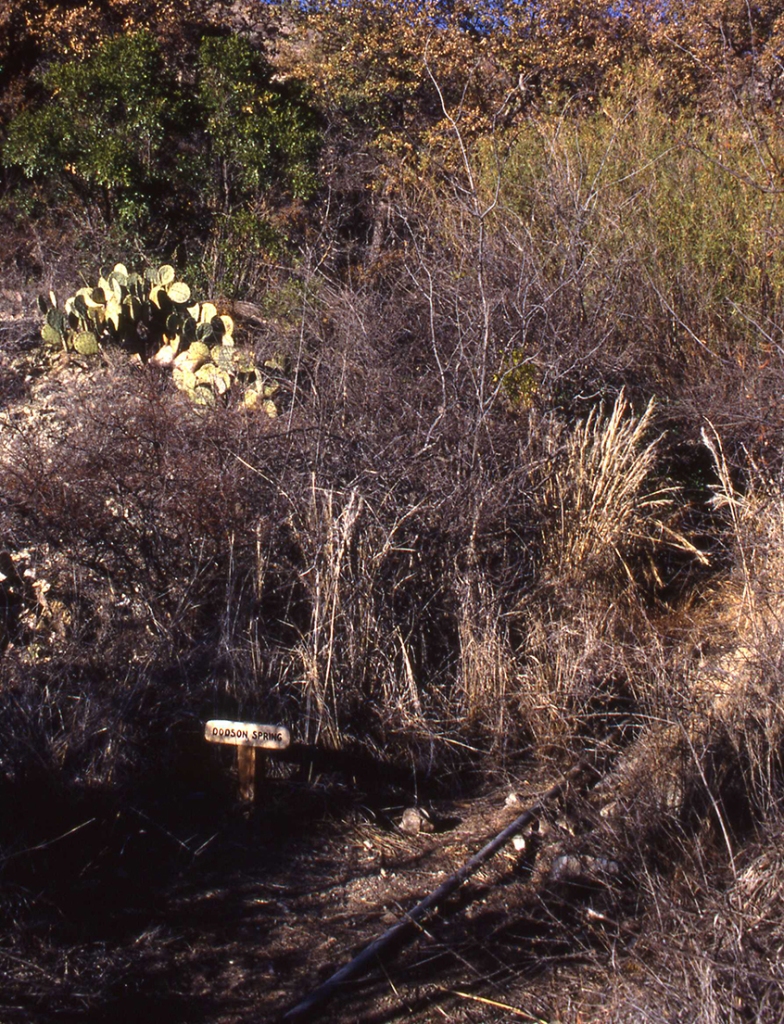
Remains of the ranch house located in the grove of trees created by a natural spring that drains the Chisos Mountains.Remains of the stone ranch house are hidden up in a grove of trees.In 1985 you could see the house from the trail. I camped close to the house site (red bear bag hanging in a tree).When I first found the site, the walls were still mostly intact and the window frames still in place. I camped near the house, in clear violation of NPS regulations about camping near historic structures.A brass bed frame remained in the house, along with utensils such as coffee pot and cups and food cans.Remains of the stone fireplace.Two tall center posts set into the walls supported a center beam that formed the roof support for the hip of the roof.NPS sign marking the Dodson Spring that supplied water for the family and livestock. (Sign is now gone).Remains of the house, with both center roof posts showing.Remains of the horse corral behind the ranch house.
Photography and Travel, specifically adventure travel and backpacking in remote North America, give me an excuse to stay outside. If kayaks, bikes, backpacks, Jeeps, archeology, geology and wildlife can be included, all the better. Having spent my life working in the fashion and photography industries, I love the unusual, the spectacular, and the beautiful. God has given us a wonderful world in which to live, and I try to open others’ eyes to its wonders. I have shared nearly 50 years of this indescribable wonder with my wife, Jodie, and we go everywhere together. I hope you will share some of our journey with us.
View more posts
10 thoughts on “Outer Mountain Loop – Big Bend NP”
As someone who at one time grew several dozen species of cacti, I am so envious of your being able to hike where they grow. We do have some Opuntias here but few and far between. Love to see them blooming in profusion.
I’ll bet you’re not quite so gloomy after seeing so many wonderful blooming plants. The cacti are glorious, but it was fun seeing the Century Plant, too. Are those orange flowers in the photo of your campside a different variety of prickly pear? I just posted about an errant Sotol that I found at the Brazoria refuge. It’s clearly not native here, but I’m sure there were plenty surrounding you in those mountains. I must say, I envy that sunshine, too. We’ve had at least two weeks of nothing but rain and cloudy skies. I’ll not whine (much) about not being able to work or get out with the camera, but it’s no fun being reduced to housework and organizing files.
Picking out a favorite photo’s an impossible task here, but the one of the Santa Elena canyon is compelling. It would be something to see.
Linda, by now you’re probably seen my post on your “Surprised by Sotol” blog post, about the black bear eating the sotol stalks. That was amazing.
The orange blooms at the campsite are of a blooming Engelmann’s Prickly Pear cactus. They bloom brilliant yellow, but when the sun begins to set, they begin to close up and turn orange.
And finally, PLEASE SEND US SOME OF YOUR RAIN!!! Oh, how I wish for a few rainy days.
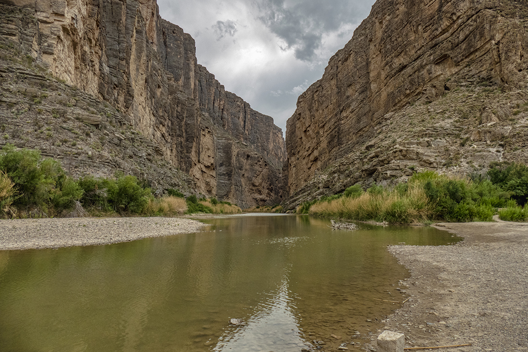
Santa Elena Canyon is a real treat. It’s amazing to paddle through the entire length of the canyon. The western end of the canyon is at river level. The canyon was formed along the Santa Elena fault when the entire slab was uplifted, so as you paddle through the canyon, the walls grow higher and higher, until they reach a height of 1500′ above the river at its outlet, which is the site of the photograph. The river usually flows at about 250 cfs (cubic feet per second), up to a high in flood of 25,000 cfs…right now it’s flowing at 11 cfs due to the year-long absence of rain. You can literally jump into Mexico without getting your feet wet.
Thanks for the comments, and for your post on the sotol.
Hi. Just happened across this today. Thanks for the photo of the Dodson Ranch ruins. The Dodson’s were my great-grandparents. I doubt I’ll ever be able to get to see it in person so I look for photos every once in a while. Keep up the good work.
Hi Debbie, Thanks so much for your comments. I first found the ranch ruins back in the 1980’s and the main house was in more complete condition than it is today. At that time, there was still an iron bed frame in the house. Do you happen to know how many people lived there at the time your great-grandparents homesteaded there? I can’t imagine what life was like there. Water was more dependable then, but the trip to trading posts along the river had to be an arduous journey.
If I can find a photo that I took on that first hike to the Dodson Ranch, I’ll add the post to this one for you to see.
Harve and Minnie Dodson had 12 children. The oldest was born about 1893 I think. My grandmother Della was the second youngest and born in 1911 in Glenn Springs. I imagine life was pretty hard for them but life is what it is. It seems like someone told me they had a wagon they used to go to “town” for things.
Thanks for posting the photos. I can’t wait to show them to my mother and son. She’s 93 and hanging in there. My son and his wife have been to Big Bend a couple of times for camping and hiking and they always bring lots of photos back. Thanks again.


As someone who at one time grew several dozen species of cacti, I am so envious of your being able to hike where they grow. We do have some Opuntias here but few and far between. Love to see them blooming in profusion.
We’ve been so dry, wasn’t sure we were going to get a good bloom this year. After one good rain, it all exploded!
I’ll bet you’re not quite so gloomy after seeing so many wonderful blooming plants. The cacti are glorious, but it was fun seeing the Century Plant, too. Are those orange flowers in the photo of your campside a different variety of prickly pear? I just posted about an errant Sotol that I found at the Brazoria refuge. It’s clearly not native here, but I’m sure there were plenty surrounding you in those mountains. I must say, I envy that sunshine, too. We’ve had at least two weeks of nothing but rain and cloudy skies. I’ll not whine (much) about not being able to work or get out with the camera, but it’s no fun being reduced to housework and organizing files.
Picking out a favorite photo’s an impossible task here, but the one of the Santa Elena canyon is compelling. It would be something to see.
Linda, by now you’re probably seen my post on your “Surprised by Sotol” blog post, about the black bear eating the sotol stalks. That was amazing.
The orange blooms at the campsite are of a blooming Engelmann’s Prickly Pear cactus. They bloom brilliant yellow, but when the sun begins to set, they begin to close up and turn orange.
And finally, PLEASE SEND US SOME OF YOUR RAIN!!! Oh, how I wish for a few rainy days.
Santa Elena Canyon is a real treat. It’s amazing to paddle through the entire length of the canyon. The western end of the canyon is at river level. The canyon was formed along the Santa Elena fault when the entire slab was uplifted, so as you paddle through the canyon, the walls grow higher and higher, until they reach a height of 1500′ above the river at its outlet, which is the site of the photograph. The river usually flows at about 250 cfs (cubic feet per second), up to a high in flood of 25,000 cfs…right now it’s flowing at 11 cfs due to the year-long absence of rain. You can literally jump into Mexico without getting your feet wet.
Thanks for the comments, and for your post on the sotol.
Hi. Just happened across this today. Thanks for the photo of the Dodson Ranch ruins. The Dodson’s were my great-grandparents. I doubt I’ll ever be able to get to see it in person so I look for photos every once in a while. Keep up the good work.
Hi Debbie, Thanks so much for your comments. I first found the ranch ruins back in the 1980’s and the main house was in more complete condition than it is today. At that time, there was still an iron bed frame in the house. Do you happen to know how many people lived there at the time your great-grandparents homesteaded there? I can’t imagine what life was like there. Water was more dependable then, but the trip to trading posts along the river had to be an arduous journey.
If I can find a photo that I took on that first hike to the Dodson Ranch, I’ll add the post to this one for you to see.
Harve and Minnie Dodson had 12 children. The oldest was born about 1893 I think. My grandmother Della was the second youngest and born in 1911 in Glenn Springs. I imagine life was pretty hard for them but life is what it is. It seems like someone told me they had a wagon they used to go to “town” for things.
Hi Debbie, I’m trying to get information on all of this for my family tree. I believe Harve and Minnie were my great great great great grandparents.
Debbie,
I just posted 10 more photos that I found of your family’s ranch site ruins. Enjoy.
Thanks for posting the photos. I can’t wait to show them to my mother and son. She’s 93 and hanging in there. My son and his wife have been to Big Bend a couple of times for camping and hiking and they always bring lots of photos back. Thanks again.