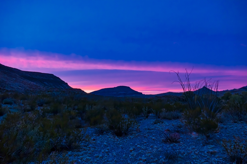
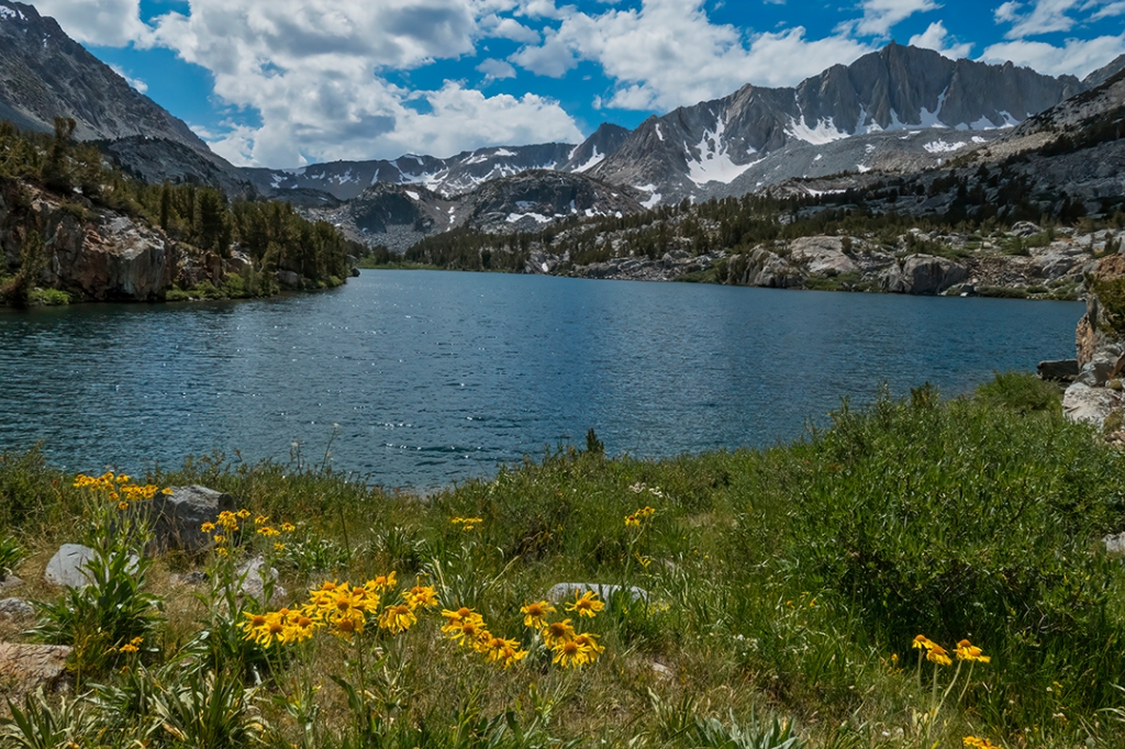
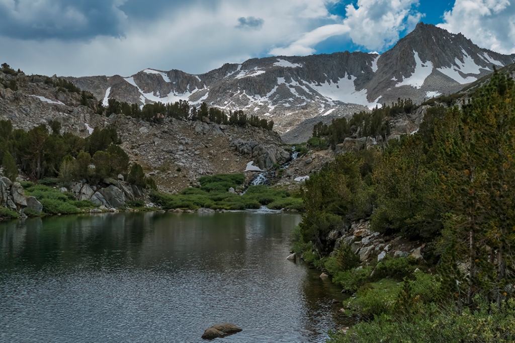
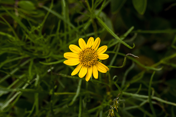
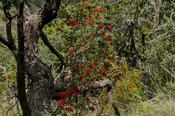
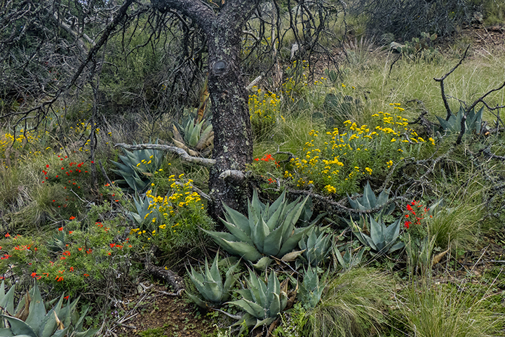
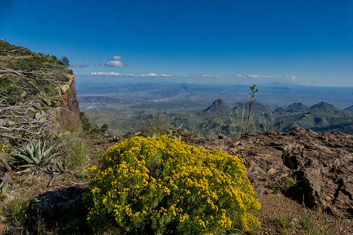
As we all continue to deal with indoor confinement, we’re still finding ways to get outside for exercise, and in our case, primarily by bicycle. Spring here in Big Bend doesn’t know that it’s under a “shelter at home” order, and so it follows its normal pattern of the seasons. This year the wildflowers are far less spectacular than in years past, but we’ve managed to capture a few signs of spring by taking a camera with us while riding through the surrounding desert. Here are a few images that made us smile this past week:
Ocotillo:
Dog Cholla:
Purple Prickly Pear:
Strawberry Pitaya:
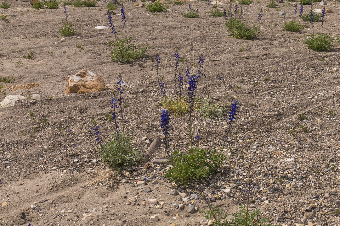
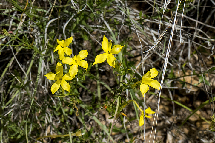
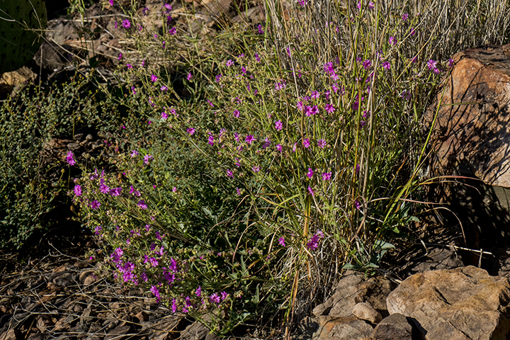
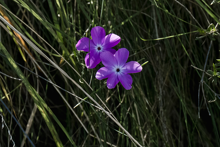
Bluebonnets:
Another sure sign of spring is the mating ritual of wild turkey. These gobblers were “struttin’ their stuff” just off the Post Road near town:
Not far away, pronghorn antelope had moved closer to town with fewer humans out and about to scare them away:
And finally, this roadrunner decided to play “tag” with my camera, staying just far enough ahead of me to elude posing for a decent photo:
It’s spring…get outside whenever you can for sun and exercise. It will brighten your spirits and get you away from that computer screen! Stay safe and well.
The April, 2020, issue of Texas Parks and Wildlife Magazine’s cover story spotlights The Big Bend 100, a new 100-mile-long through-hike across the largest national park and the largest state park in Texas…Big Bend National Park and Big Bend Ranch State Park. The route description is available at www.bigbend100.com.
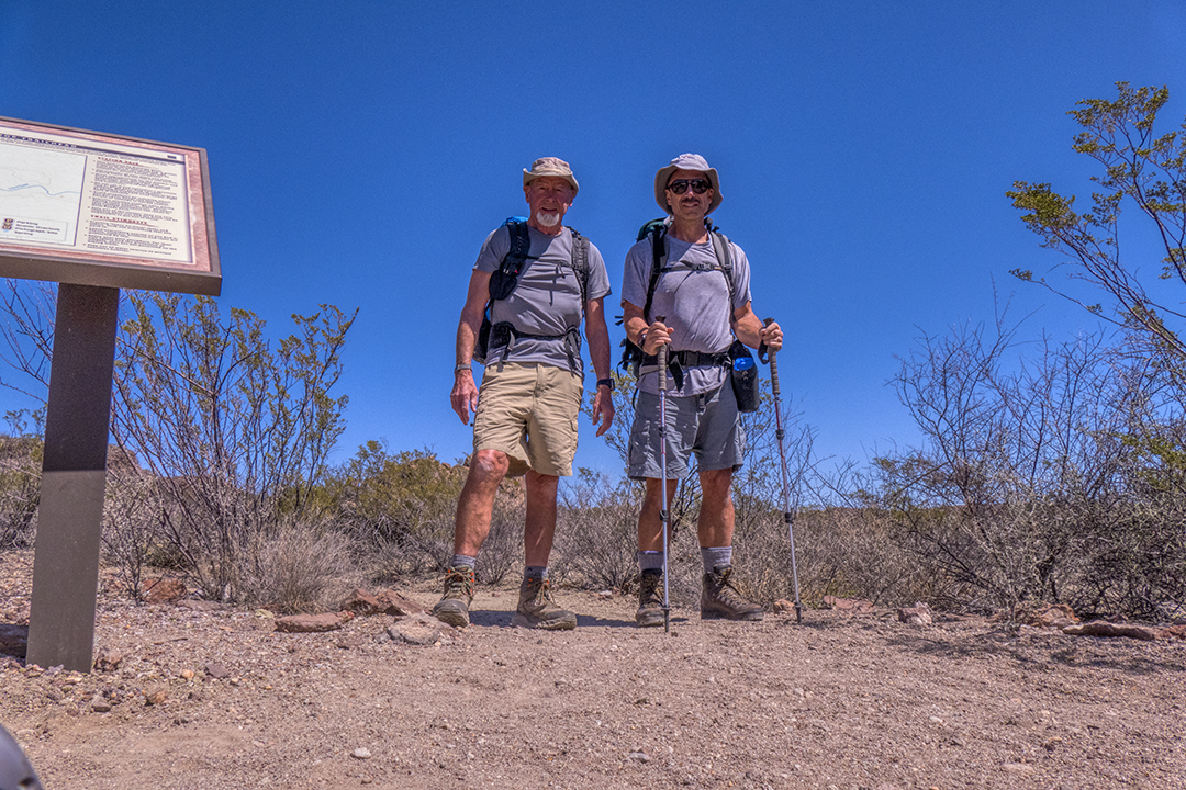
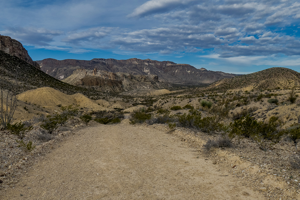
This month my good friend and longtime hiking buddy Joe joined me to hike several sections of the 50-mile route through the state park. Since both these parks cover hundreds of thousands of acres of the Chihuahua Desert, our main concerns were finding water where very little exists, and route-finding through an area of desert where no established trails exist…two factors that have the potential for disaster for the unprepared. In fact, just the day before we started out on the first leg of the route, there had been a search-and-rescue event to save lost hikers on the same trail we were attempting.
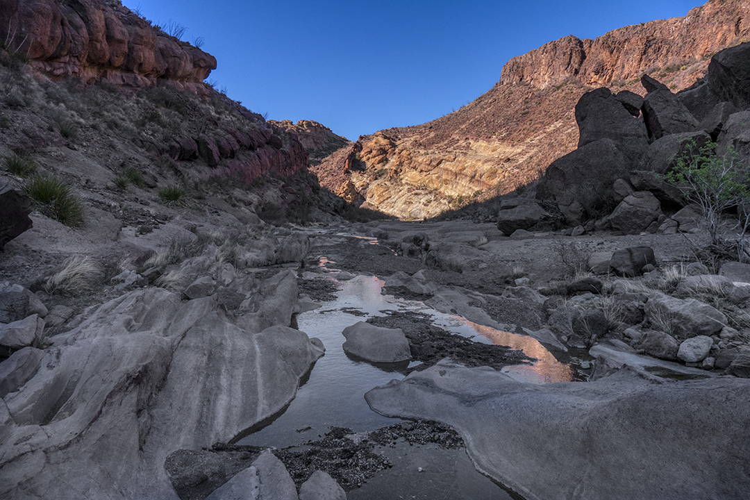
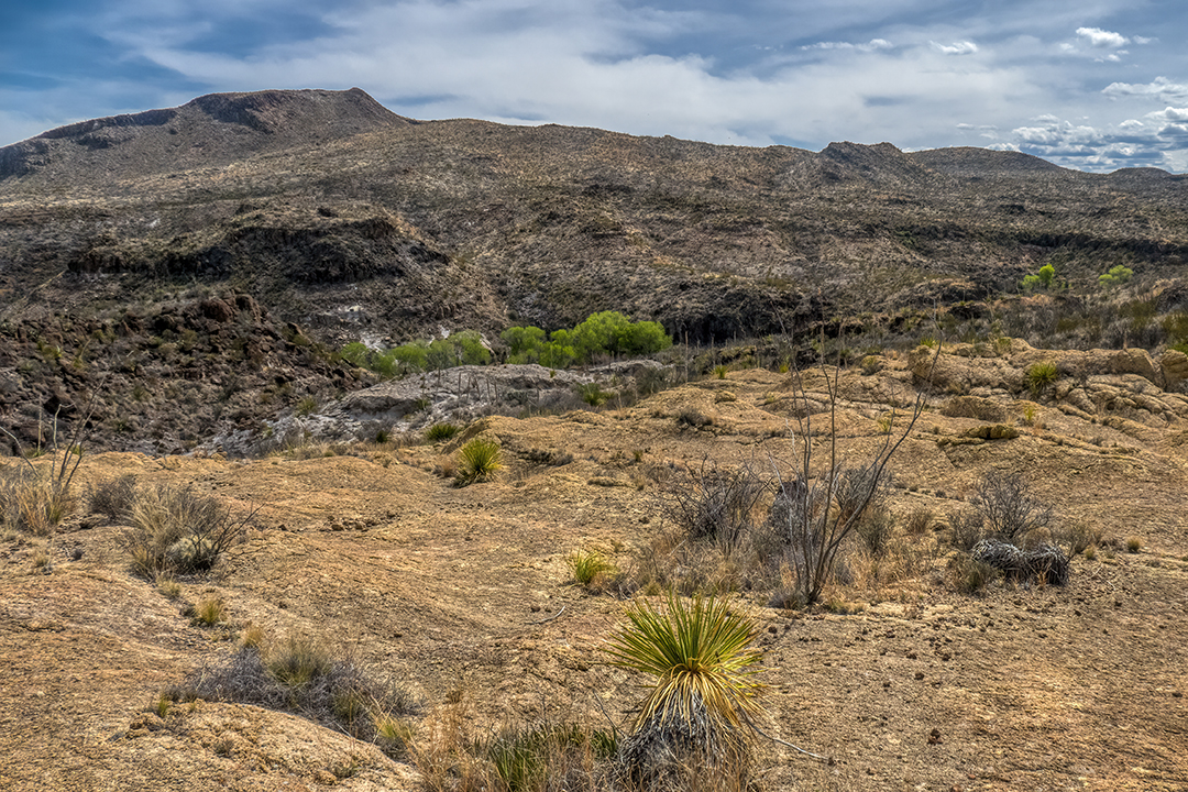
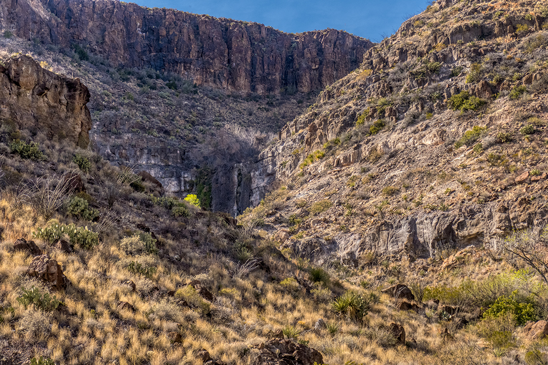
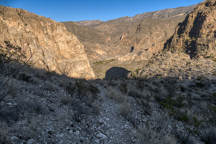
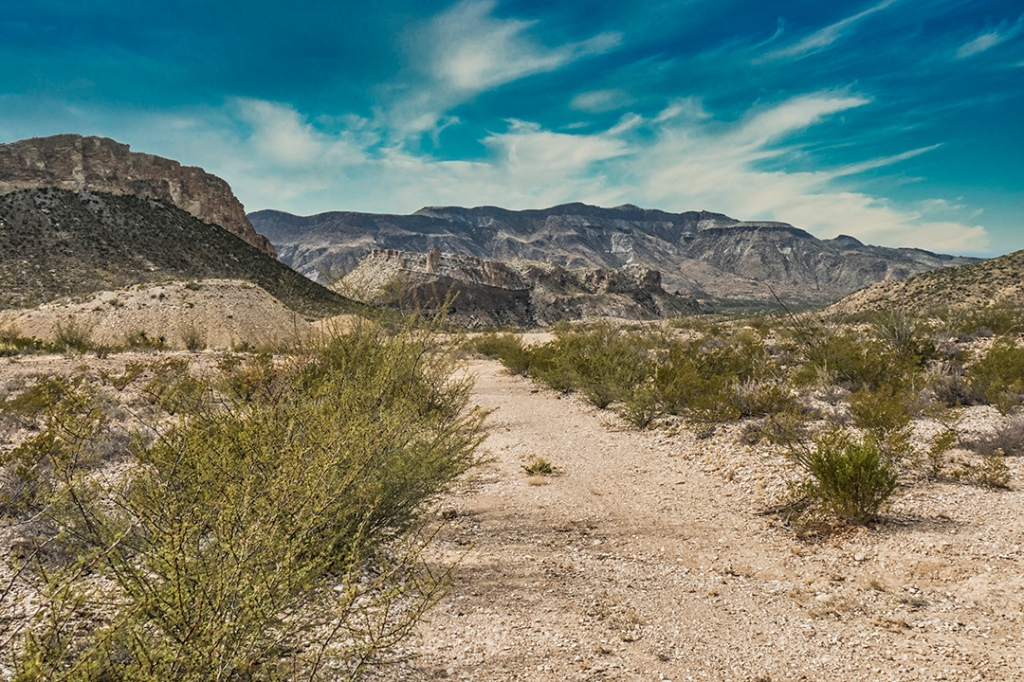
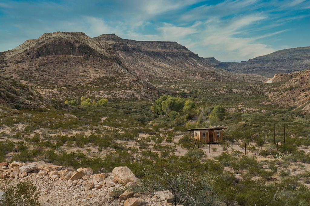
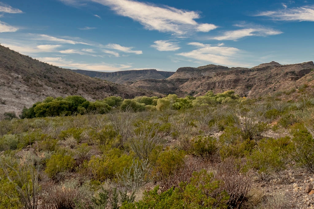
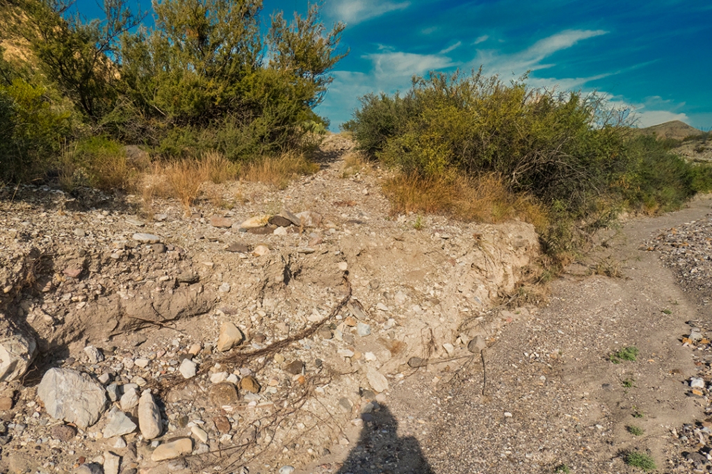
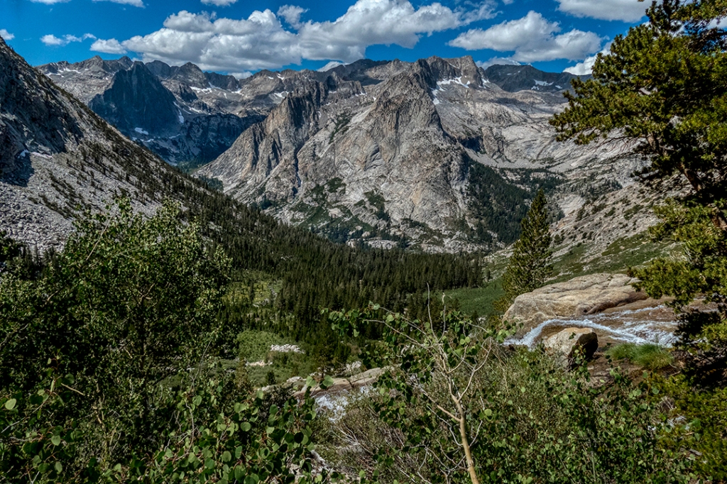
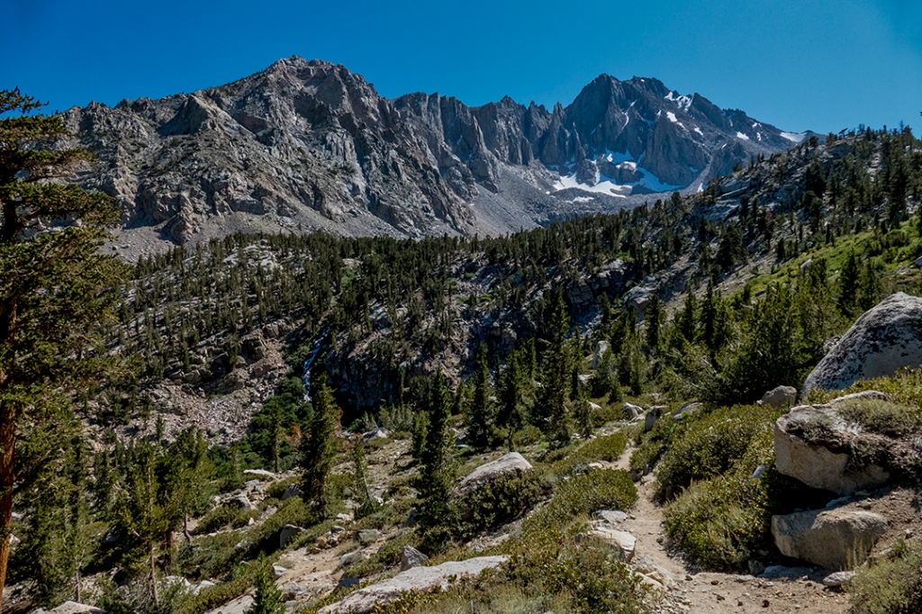
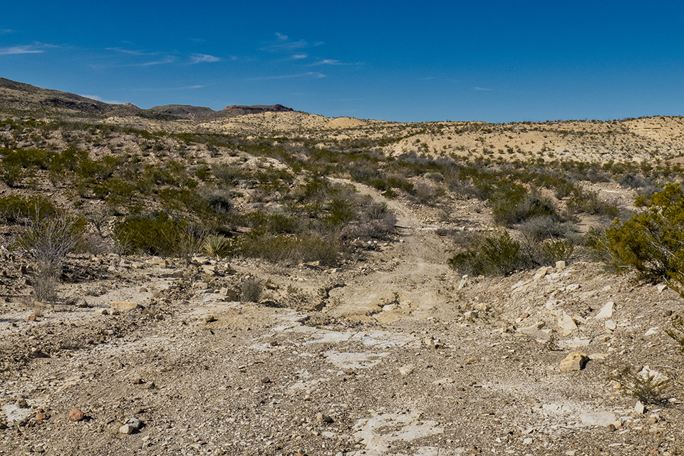
From the trailhead, the route crests a ridge and descends 200′ down into a drainage of Leyva Creek, a dry creek bed that drains this section of the mountains:
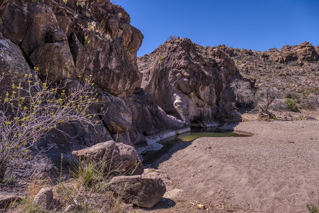
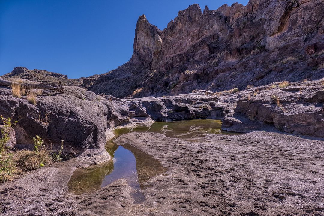
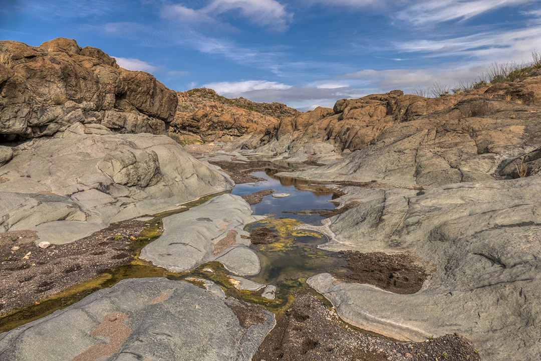
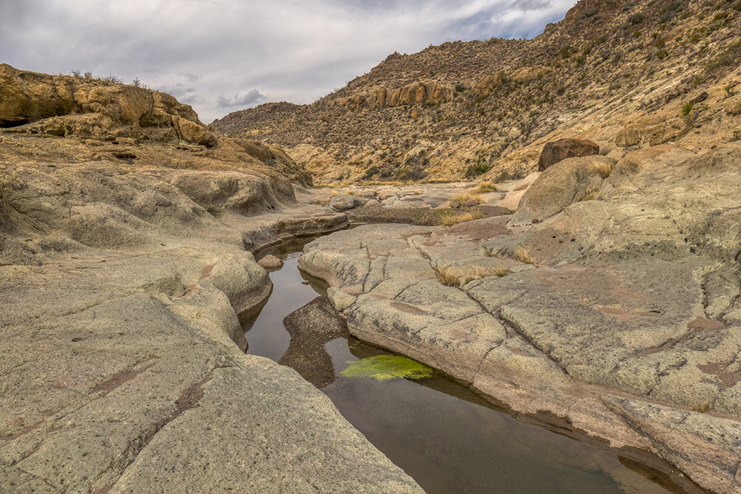
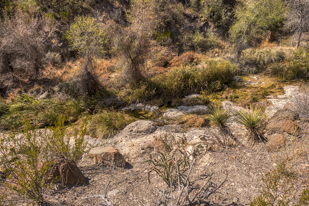
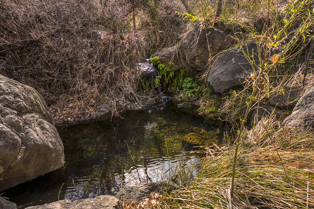
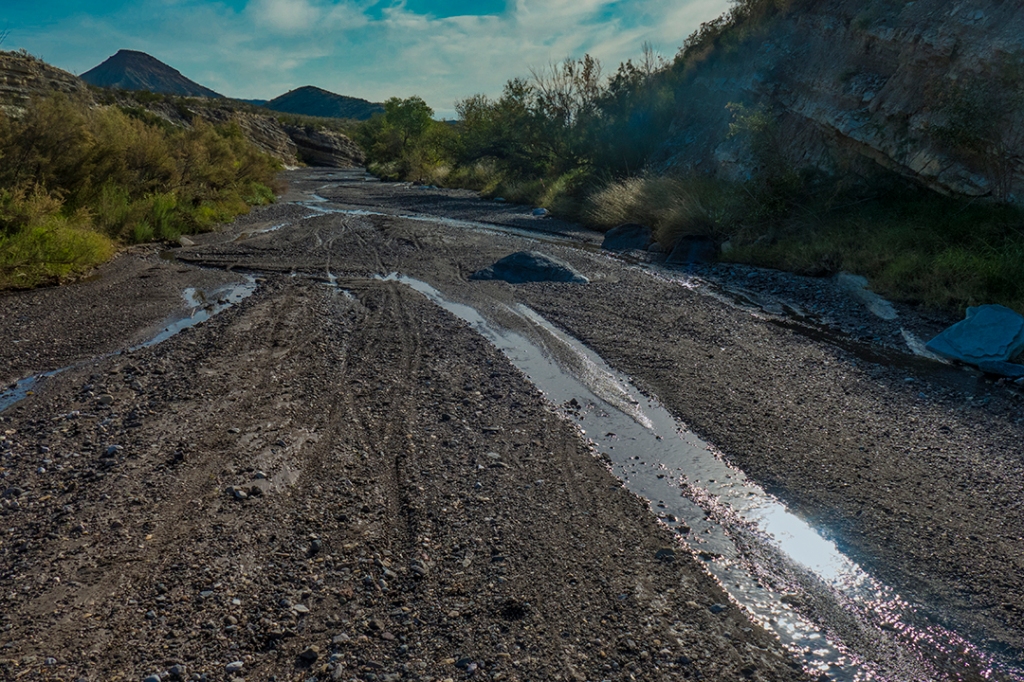
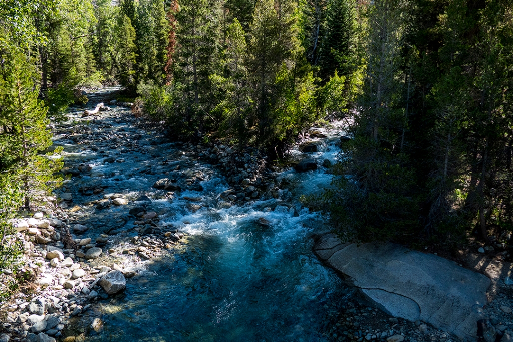
At about two miles, we find our first water, at a bedrock wall and pouroff across the creek:
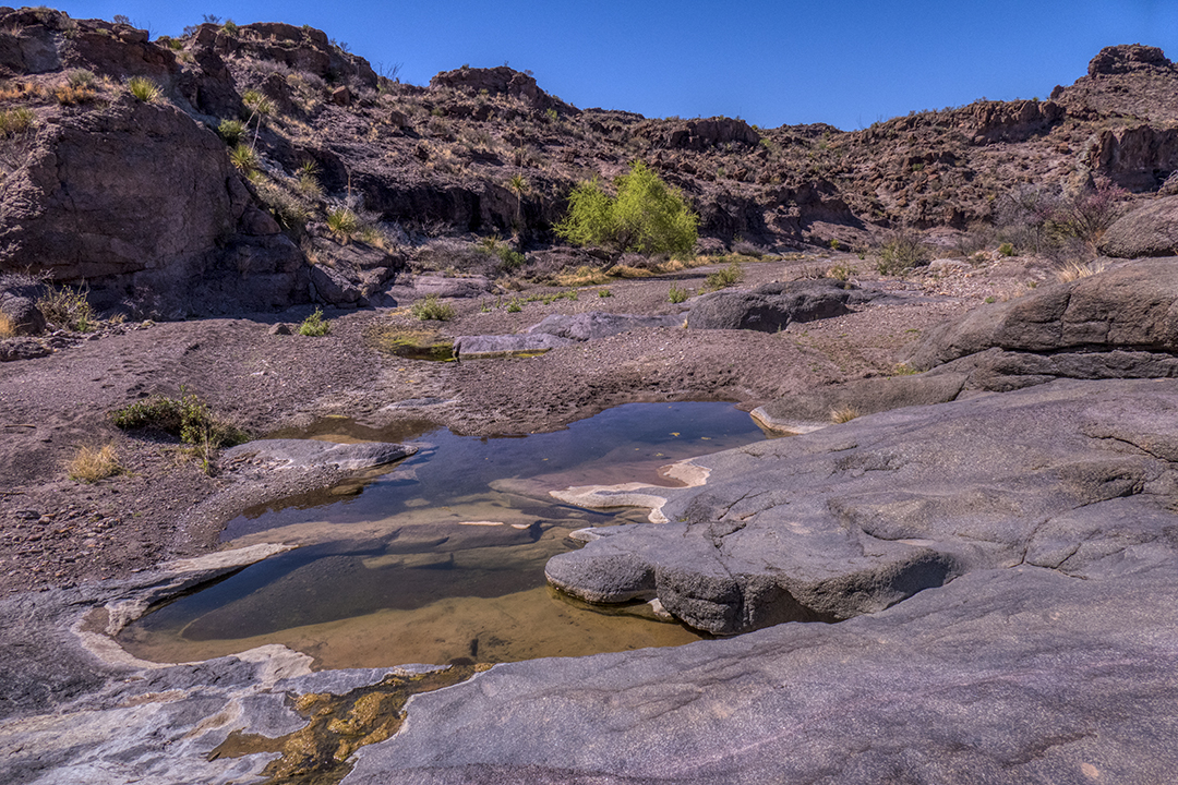
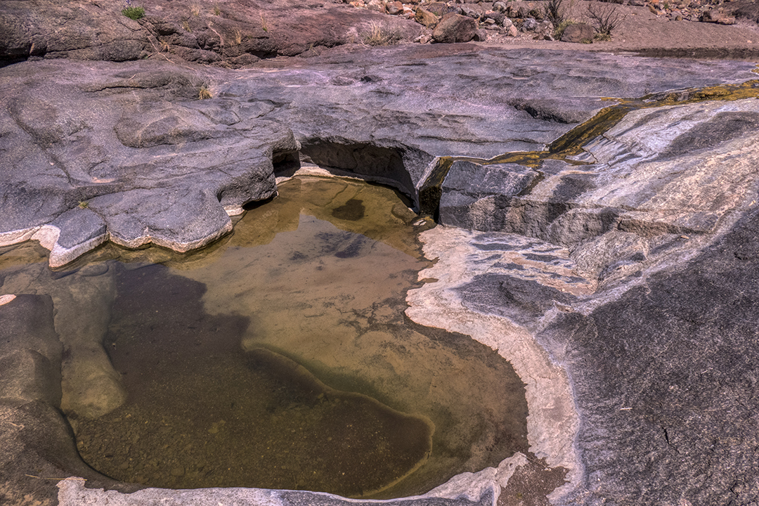
A short distance down the creek e come upon another water feature, beautiful deep pools cut into the bedrock by years of flow:
Further along this “dry wash” we spot an igneous “dike,” formed by lava forced up into cracks and fissures in the earth which cools, then is exposed by eons of erosion, with more water pushed to the surface by the bedrock. The many prints in the sand are from longhorn cattle, deer, elk, javelina, desert bighorn sheep, aodad sheep, and the occasional bear or mountain lion:
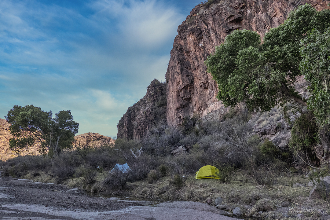
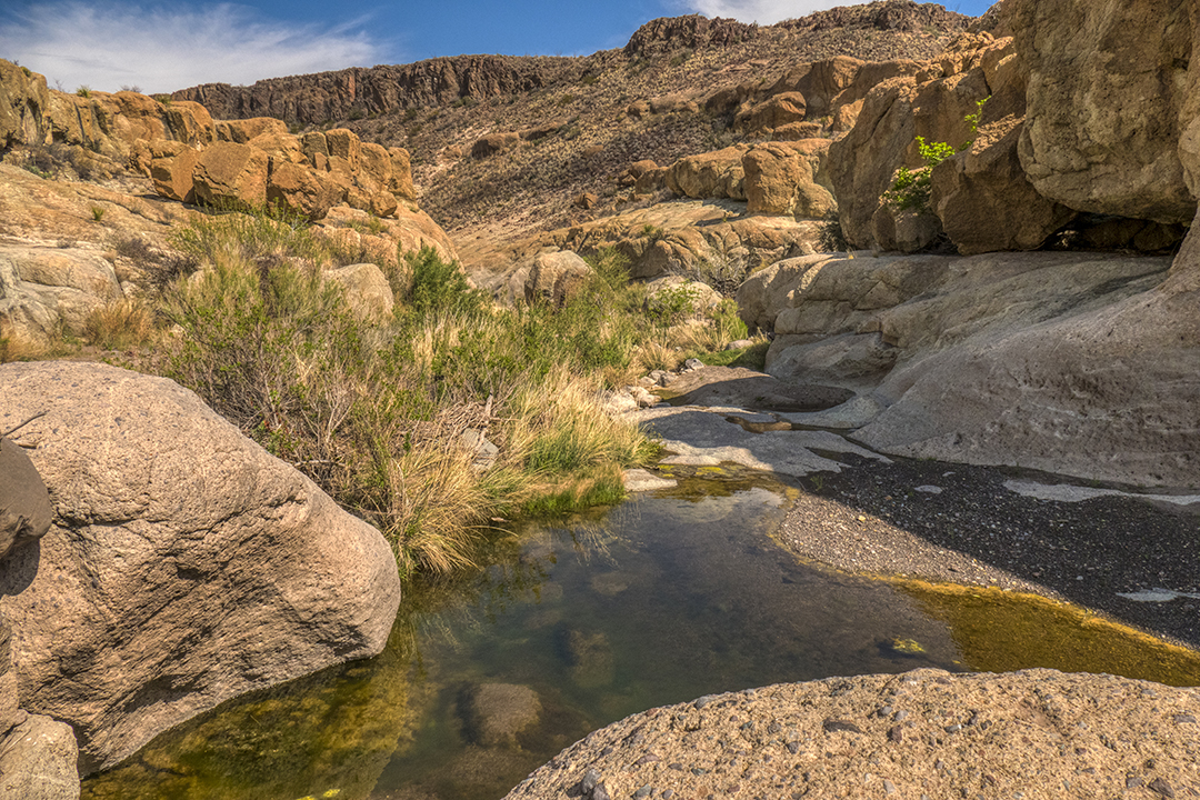
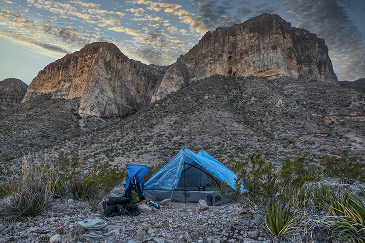
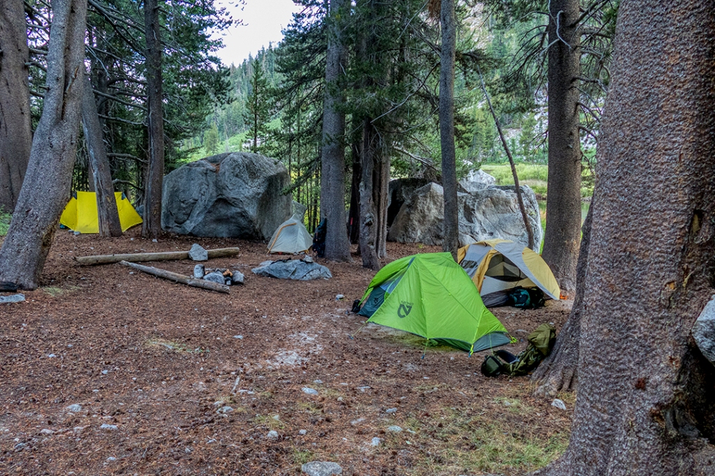
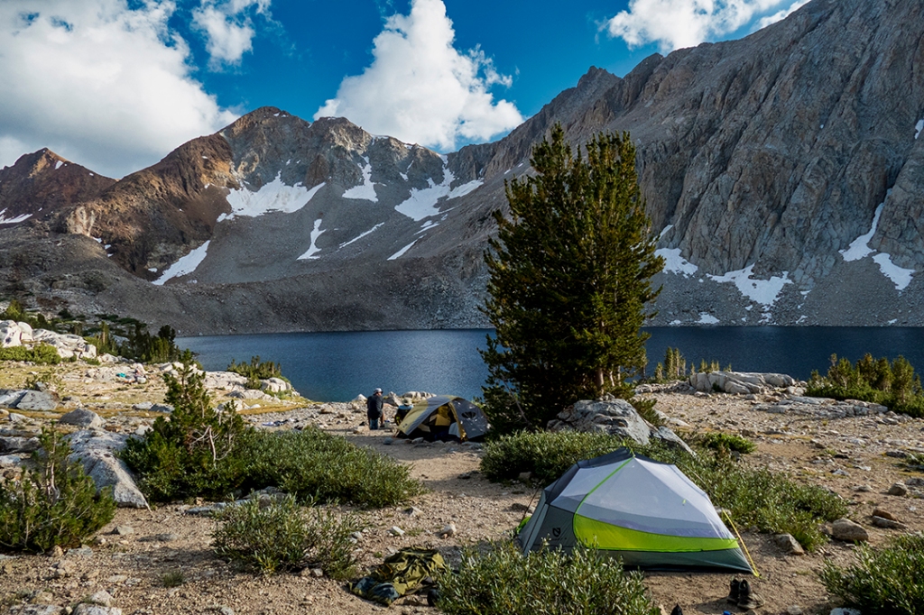
Our campsite the first night was at the base of a beautiful granite wall, complete with a stream of running water just out our front door:
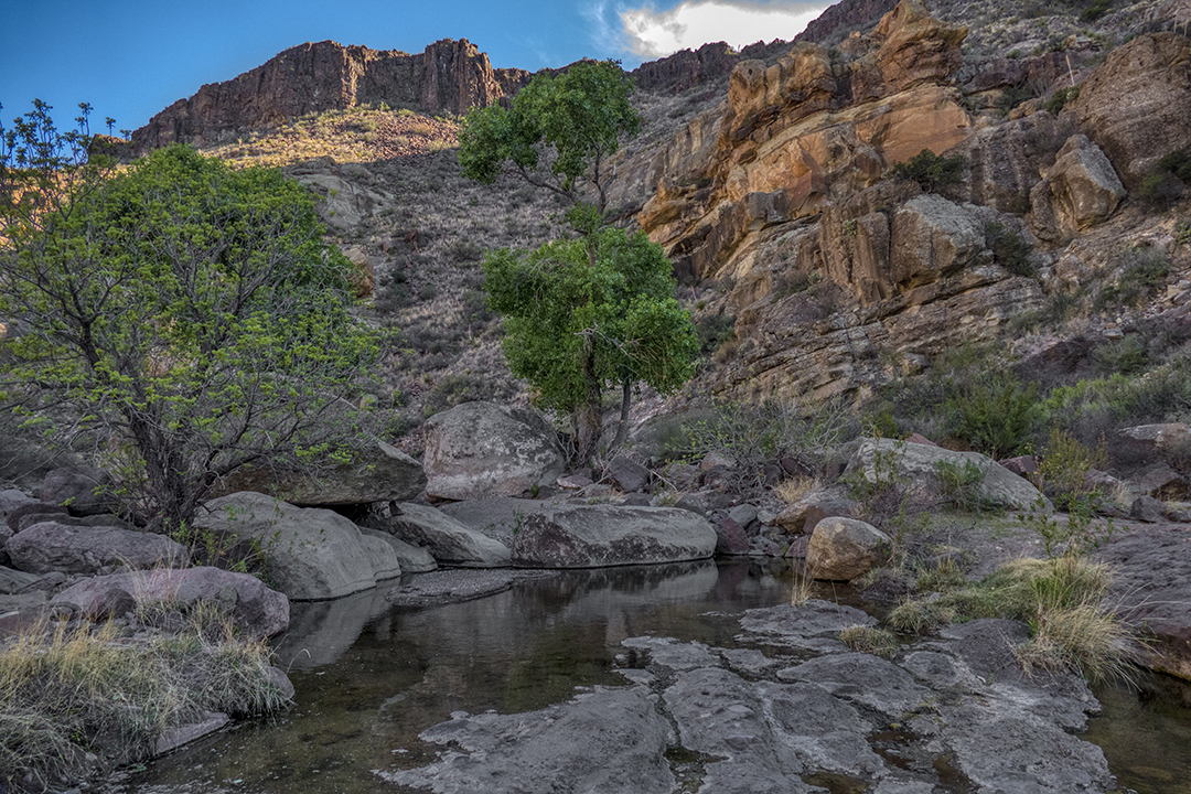
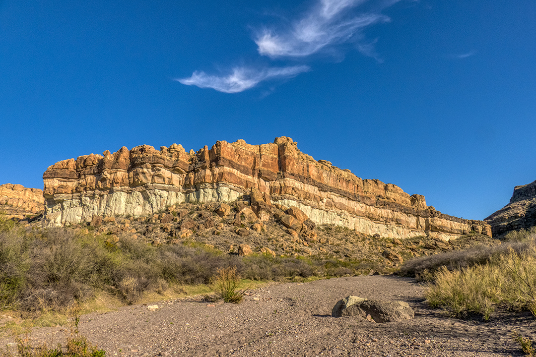
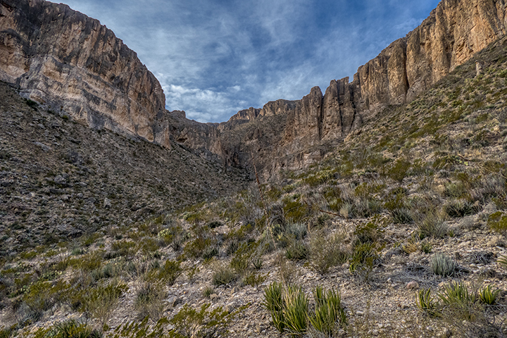
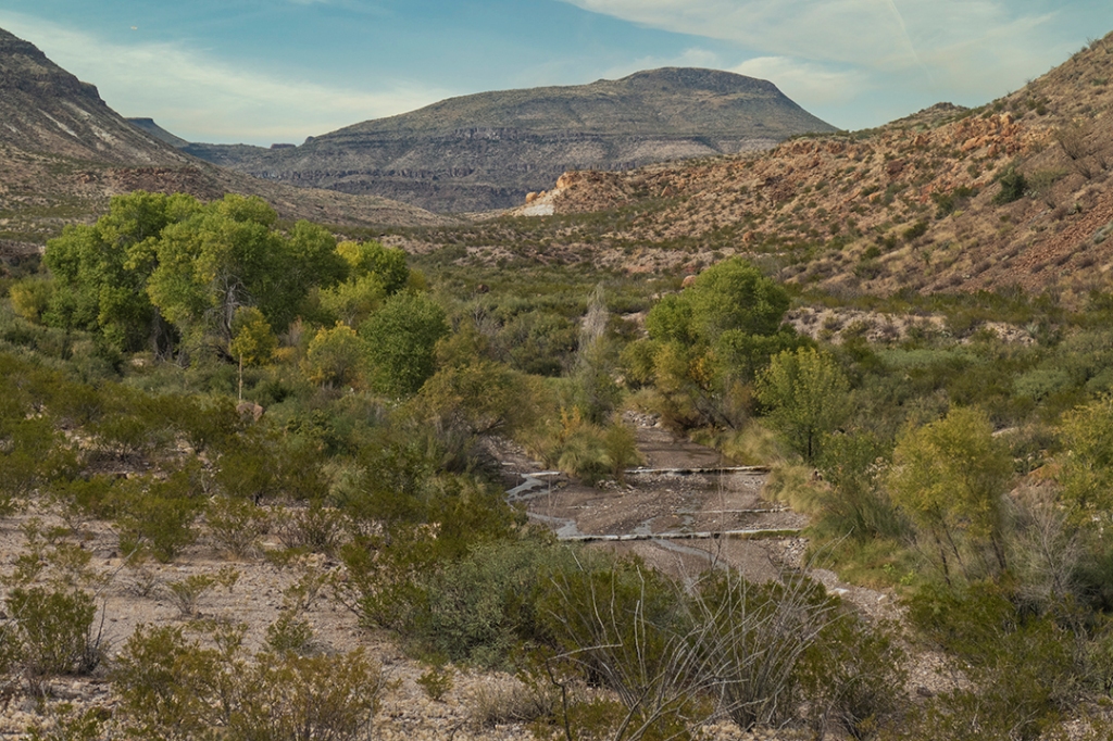
A short hike down canyon yields more water, not to mention fantastic views of the strata that makes up the interesting geology of this area:
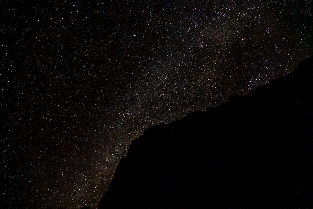
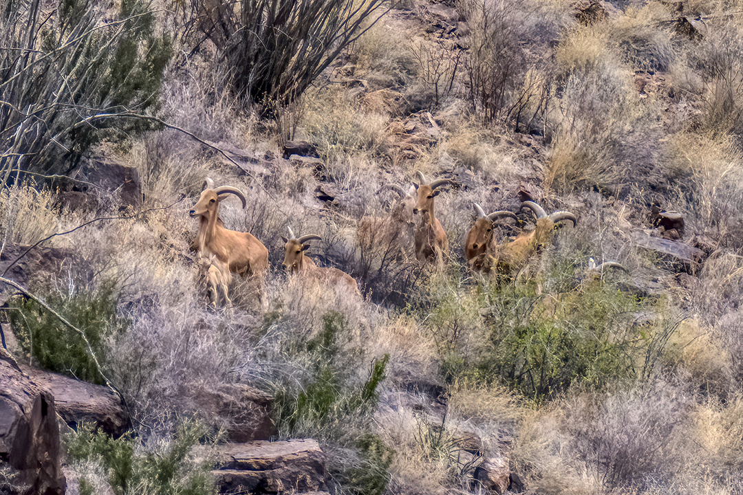
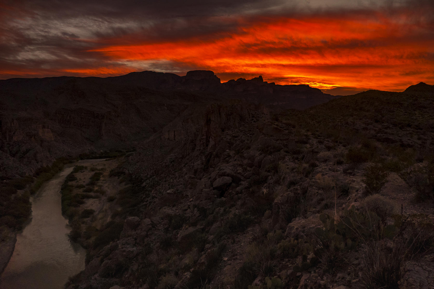
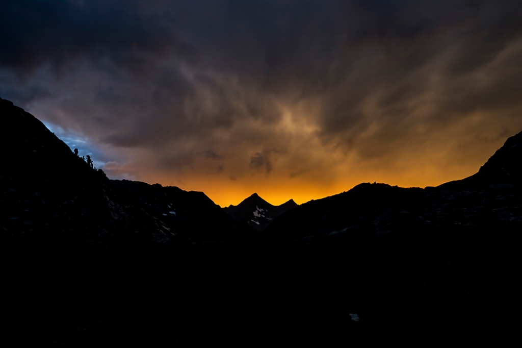
After a beautiful, clear, cool night filled with stars, satellites, constellations, a few meteors and the Milky Way, we awake to the clamoring of the hooves of a group (herd or flock, whichever you prefer) of aodad (barbary) sheep. These are non-domestics imported from Africa years ago for hunting by area ranches, and are now running wild across west Texas, competing for scant resources with native species, such as desert bighorn sheep:
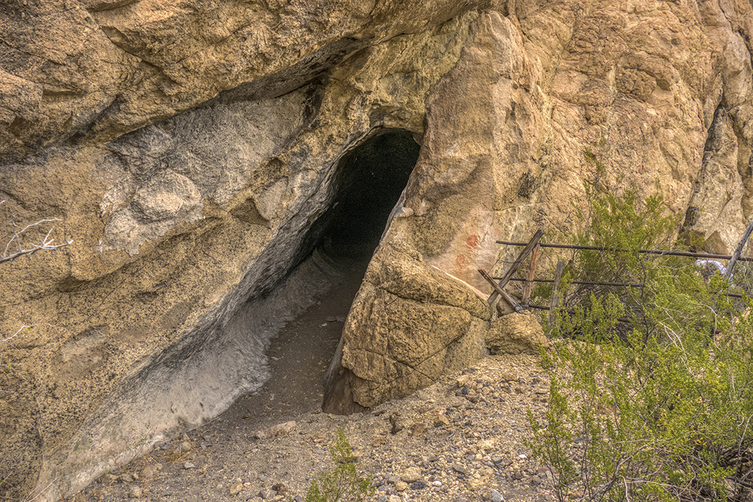
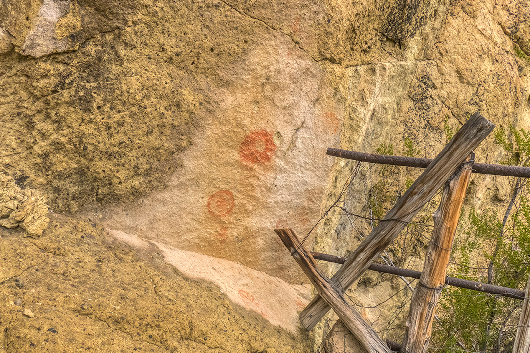
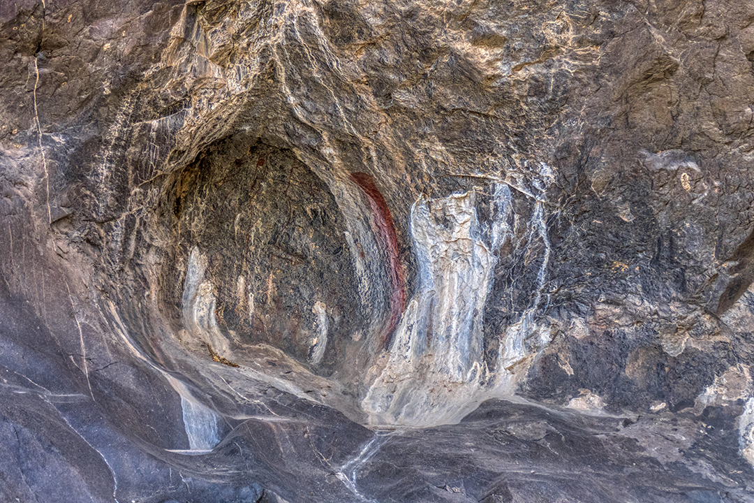
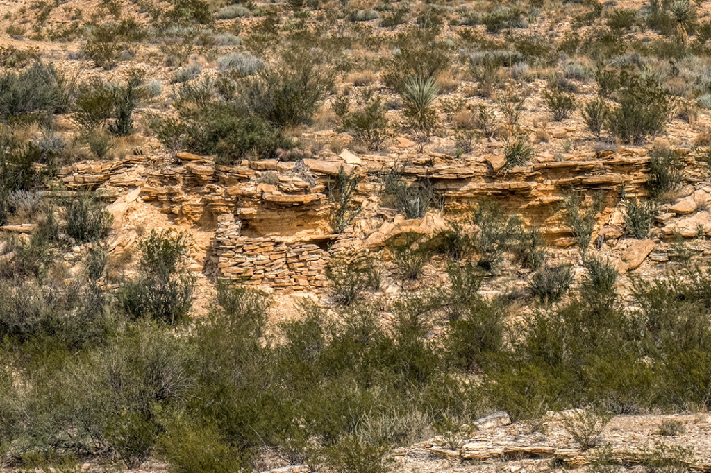
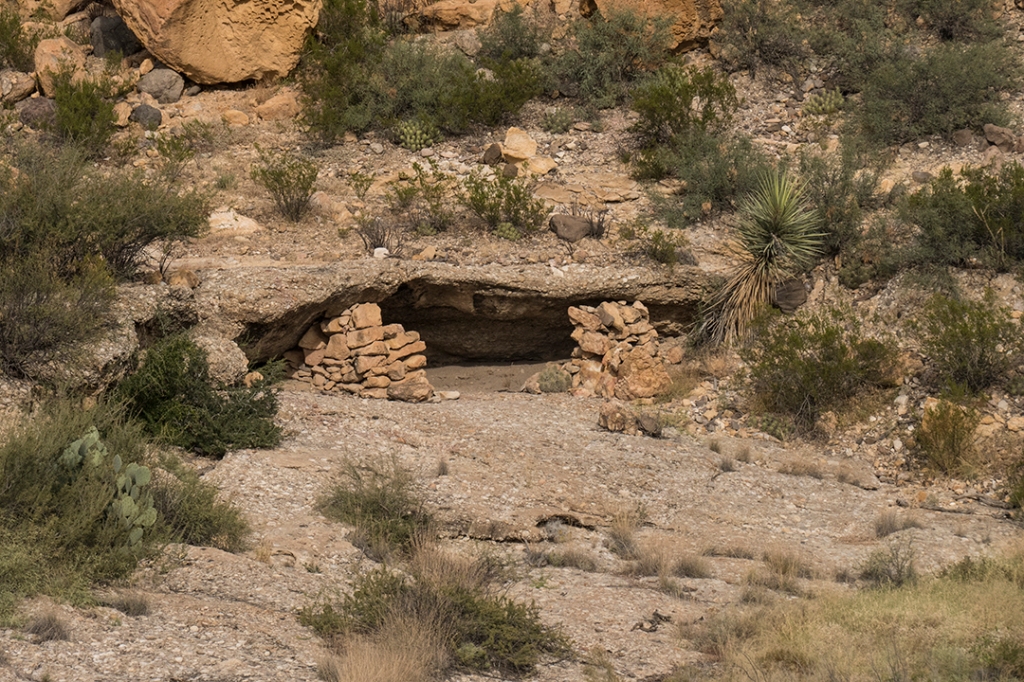
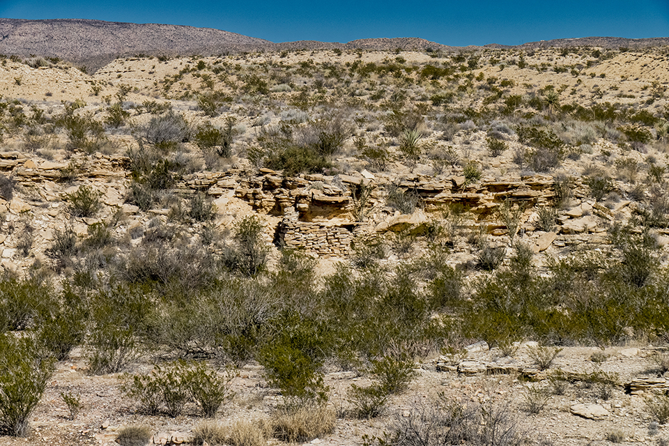
We headed north from camp for a day hike to find the trail that follows Terneros Creek to its intersection with Leyva Creek. Along the way we came upon a small cave that had obvious prehistorical use by native people, near a livestock pen that probably dates to the middle of the last century. We found rock art at the entrance, and the ceiling of the cave was blackened by years of fires burning for warmth and cooking:
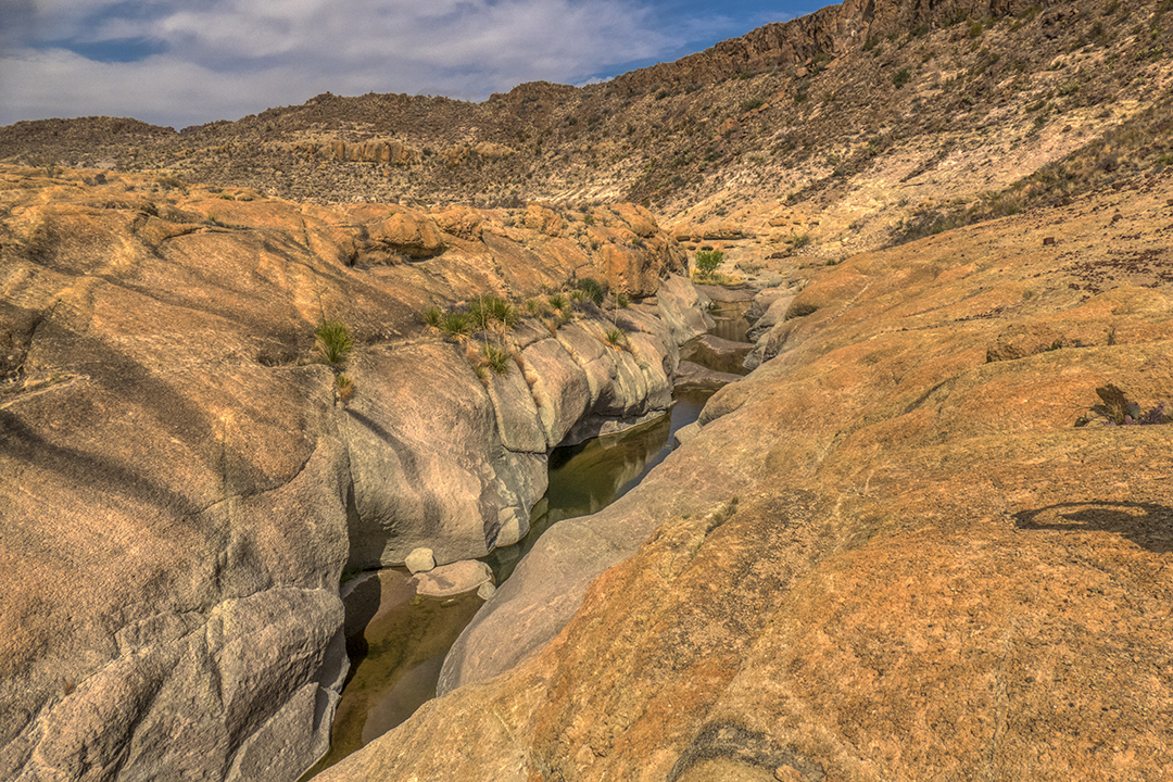
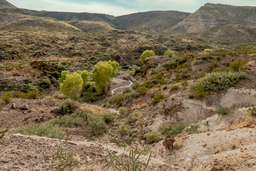
Instead of following the designated trail that follows an old ranch road due north, we diverted through a side canyon, an extension of Lava Canyon, that shows on our topo maps to contain water. In fact, it contained LOTS of water:
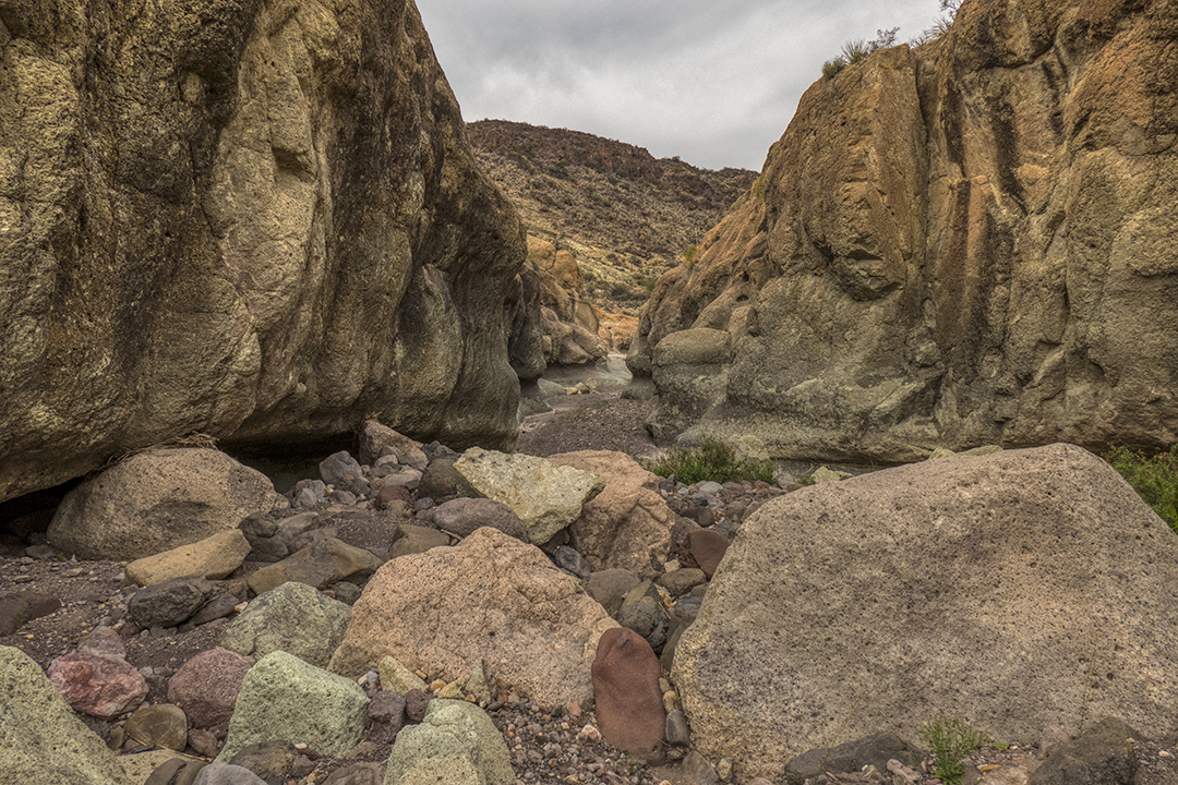
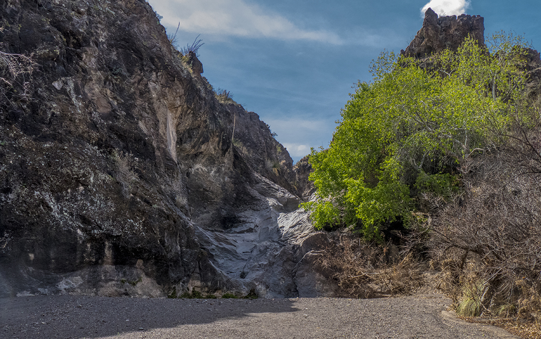
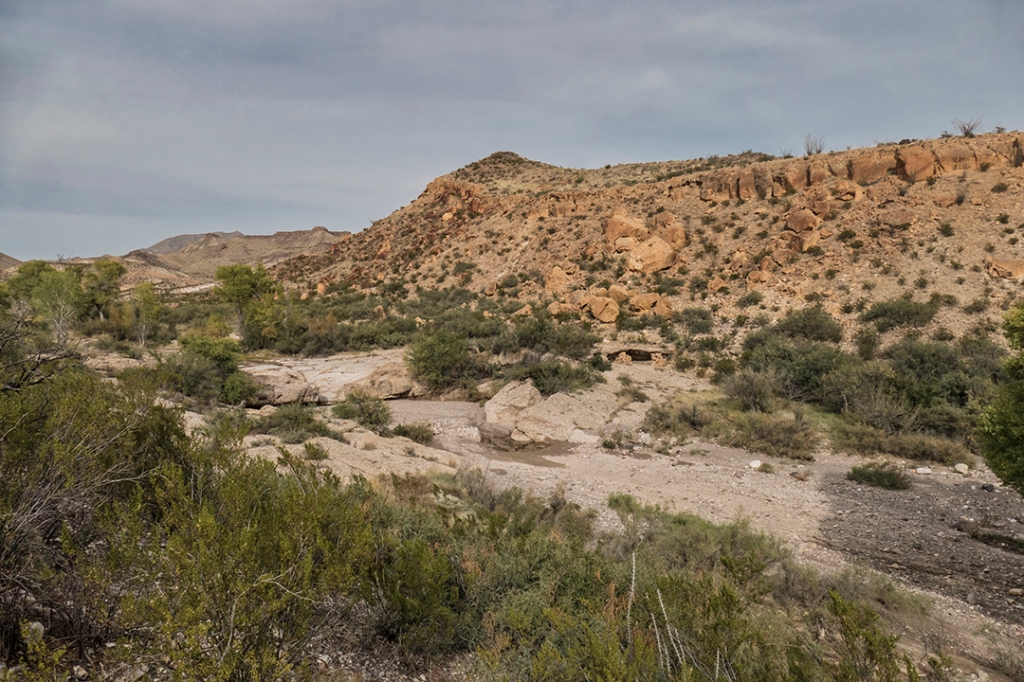
At the end of the canyon, it turns into a form of “slot canyon” before opening out into Terneros Creek:
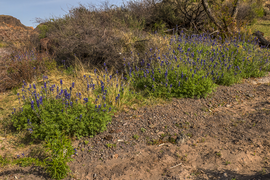
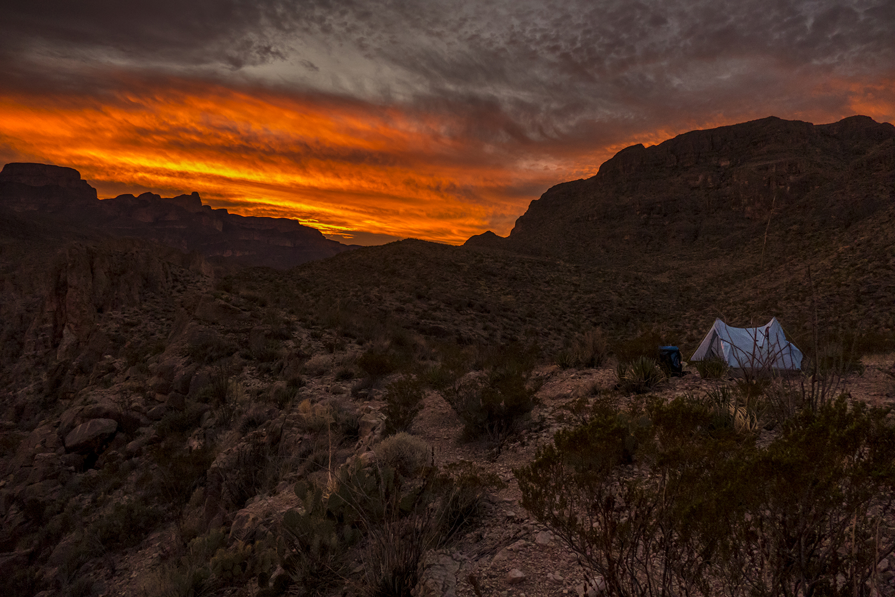
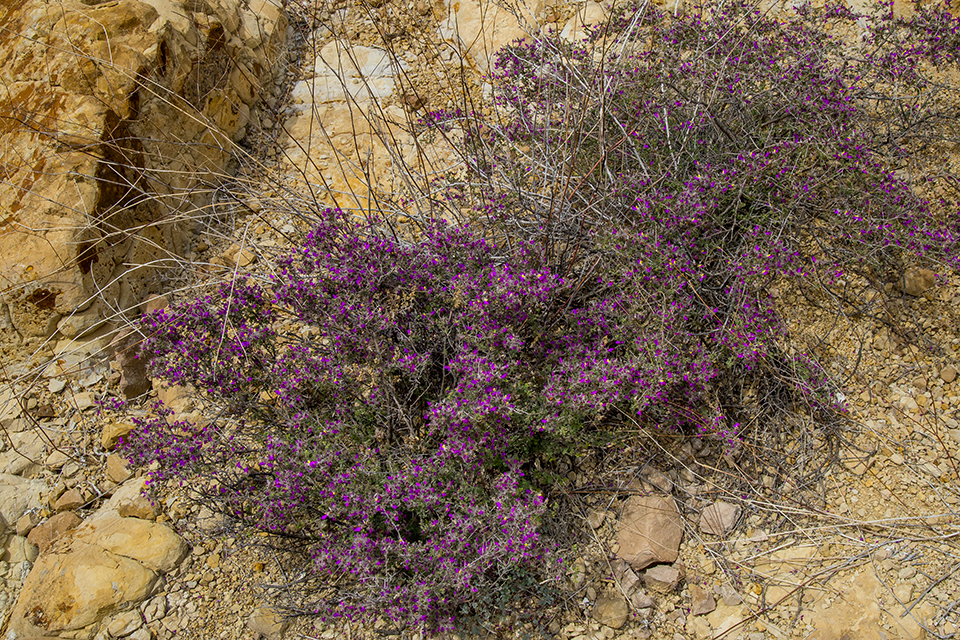
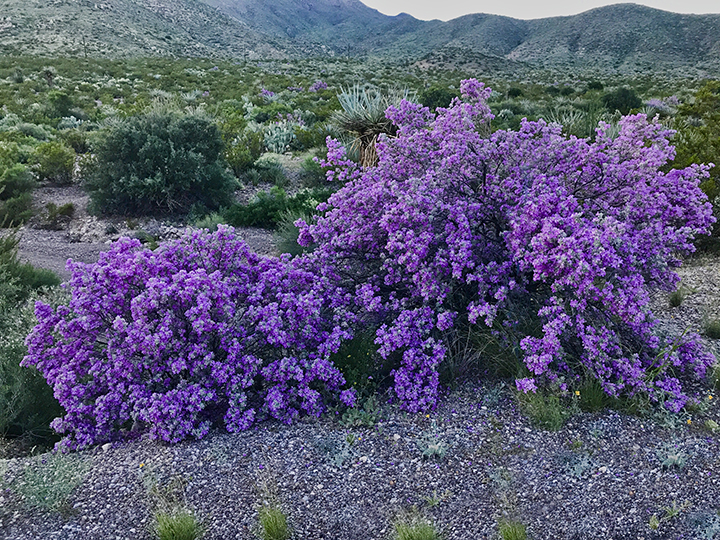
After returning to camp, the day hike ended with a cool night under the stars, and a 5.5 mile hike back to the trailhead on the third day. We passed many signs of spring in full bloom, such as these Big Bend Bluebonnets:
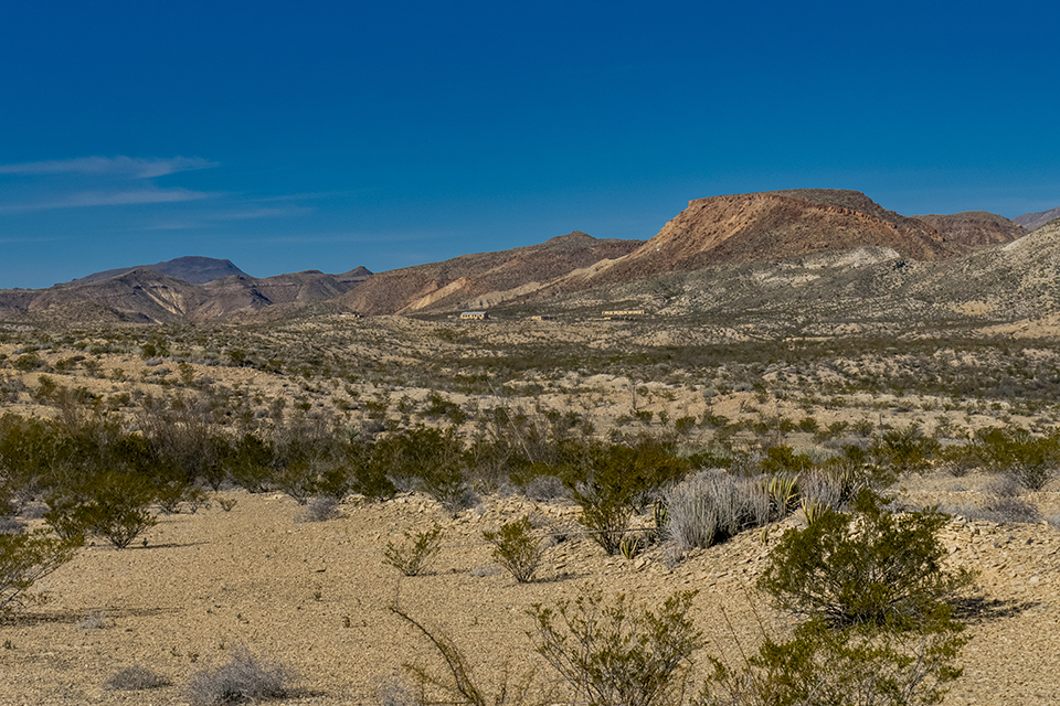
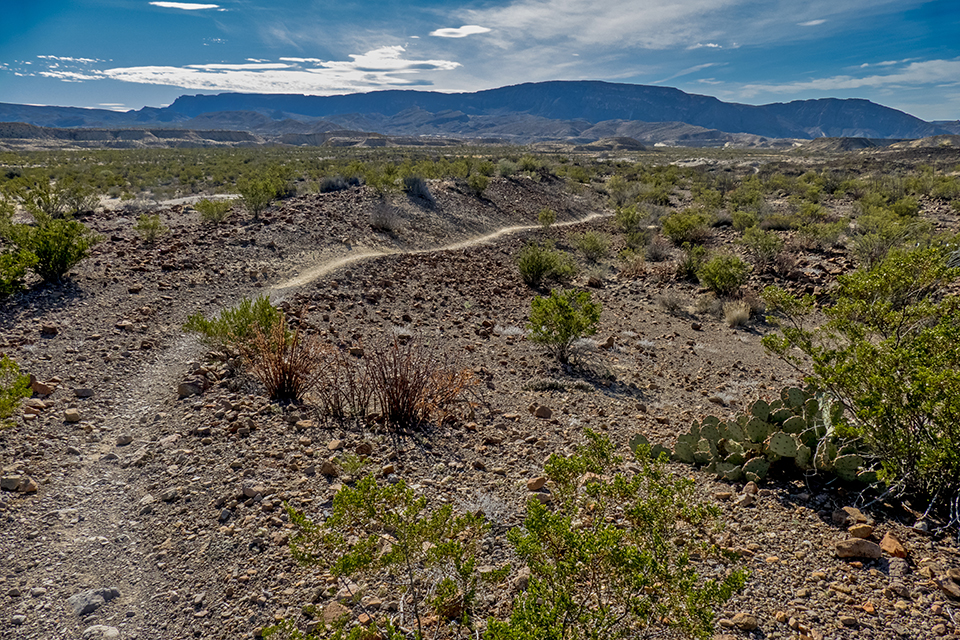
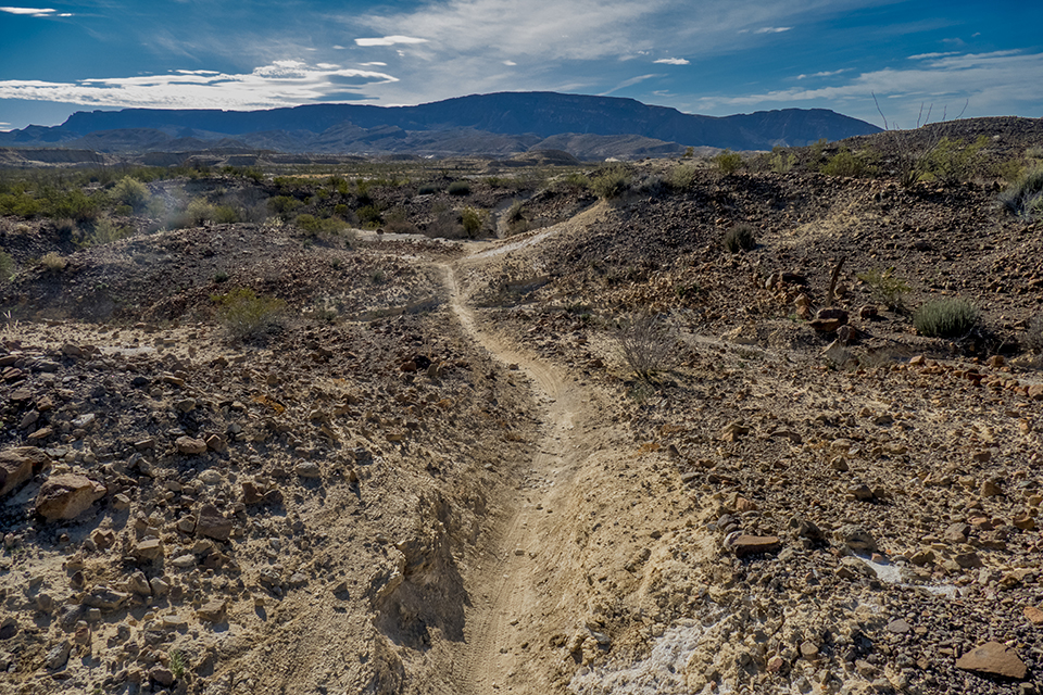
From the trailhead at Cinco Tinajas, the route passes the Sauceda Ranch House, now the location of the park interior headquarters, then follows the Leyva Loop ranch road to the Puerta Chilicote trailhead, and the start of the Mexicano Falls Trail which begins the second half of the route, and the remaining 25 miles of the Big Bend 100 through the state park. This section uses slightly more established trails, complete with cairns to aid in navigation:
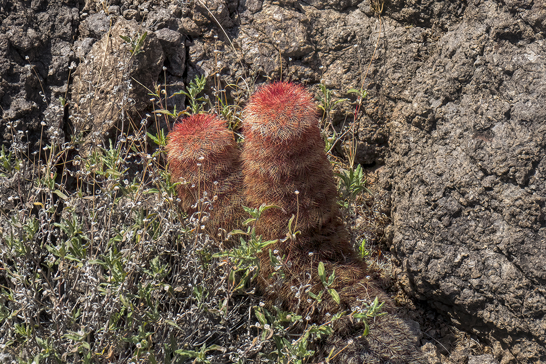
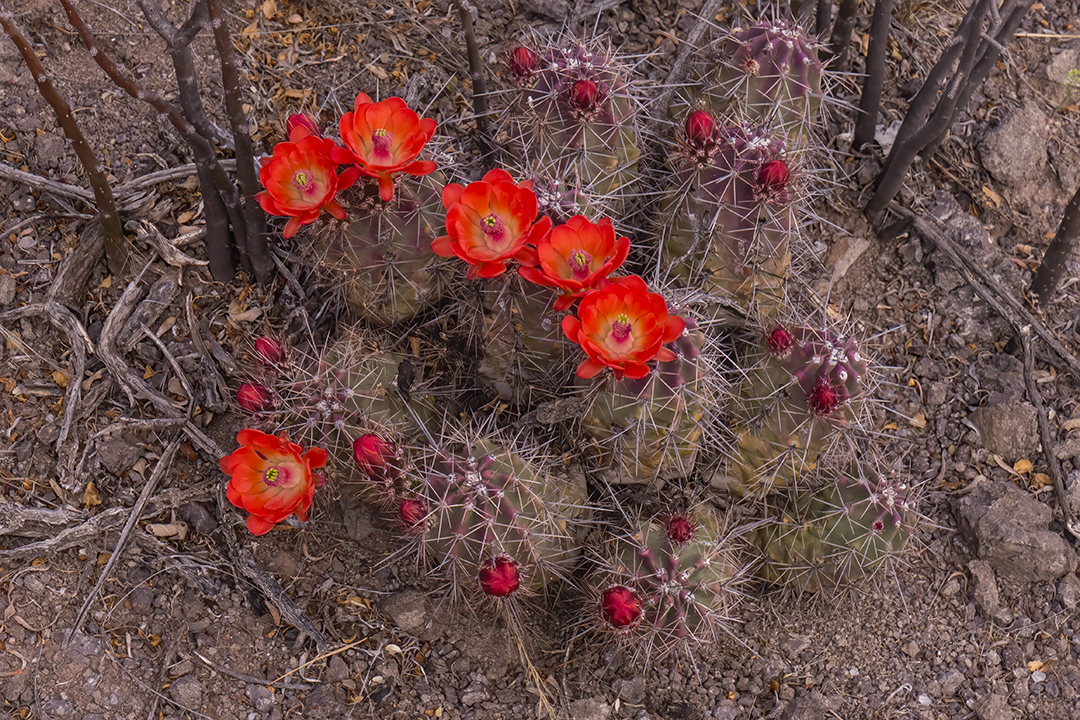
Some of the flowering cactus along the trail includes rainbow cactus as well as claret cup cactus in bloom:
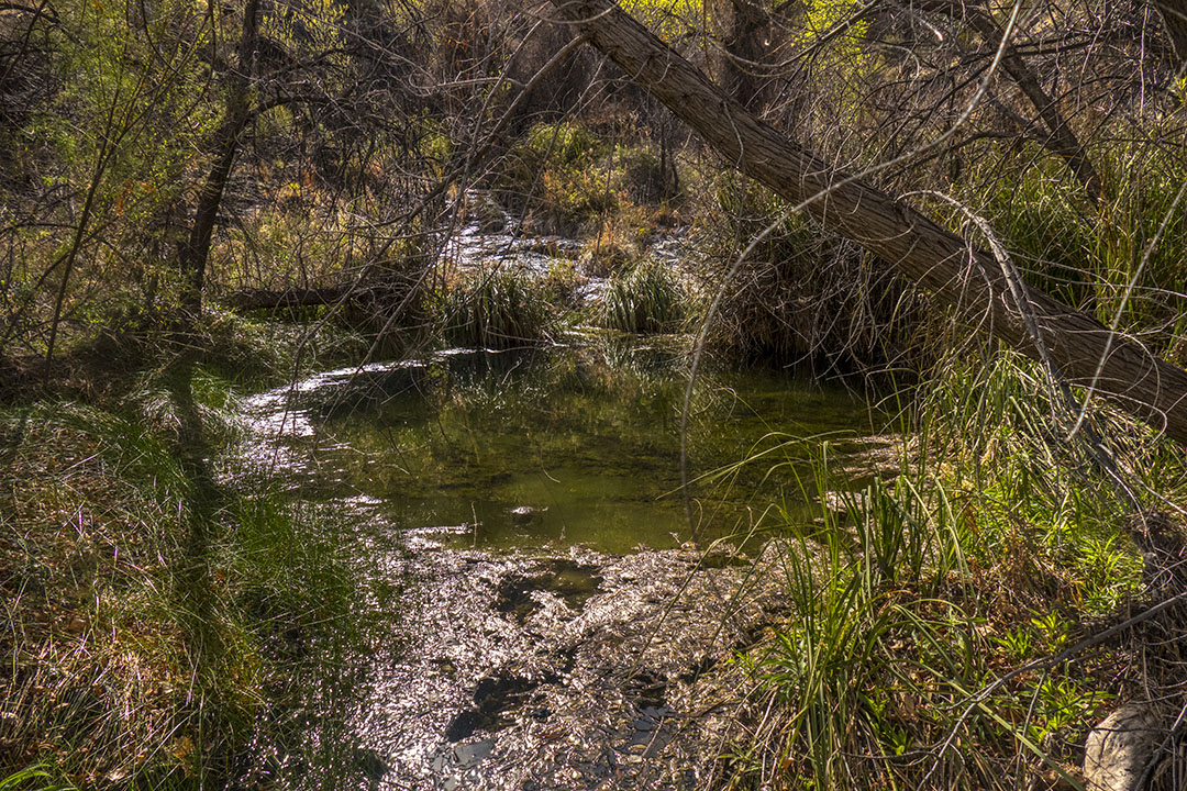
The trail follows cairns across solid rock until it drops down through a drainage to a spring indicated by telltale cottonwood trees:
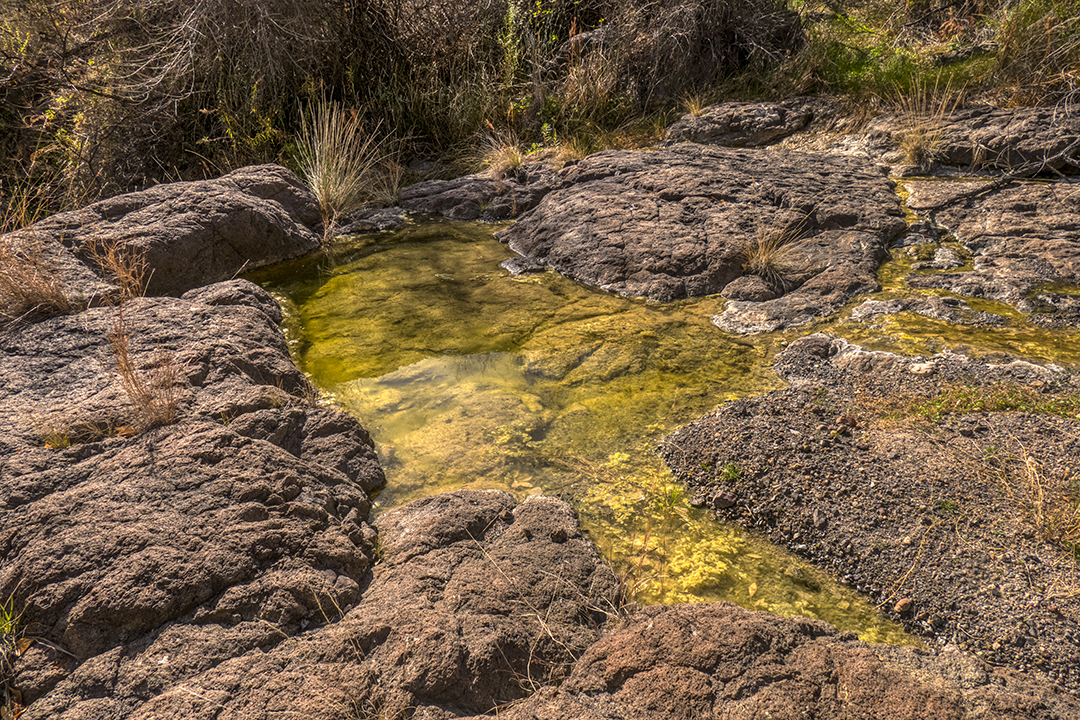
At the bottom, a pouroff holds water in small tinajas, which can be filtered to replenish water supplies. This series of tinajas (spanish for “earthen jar”) features a large panel of rock art above a pool:
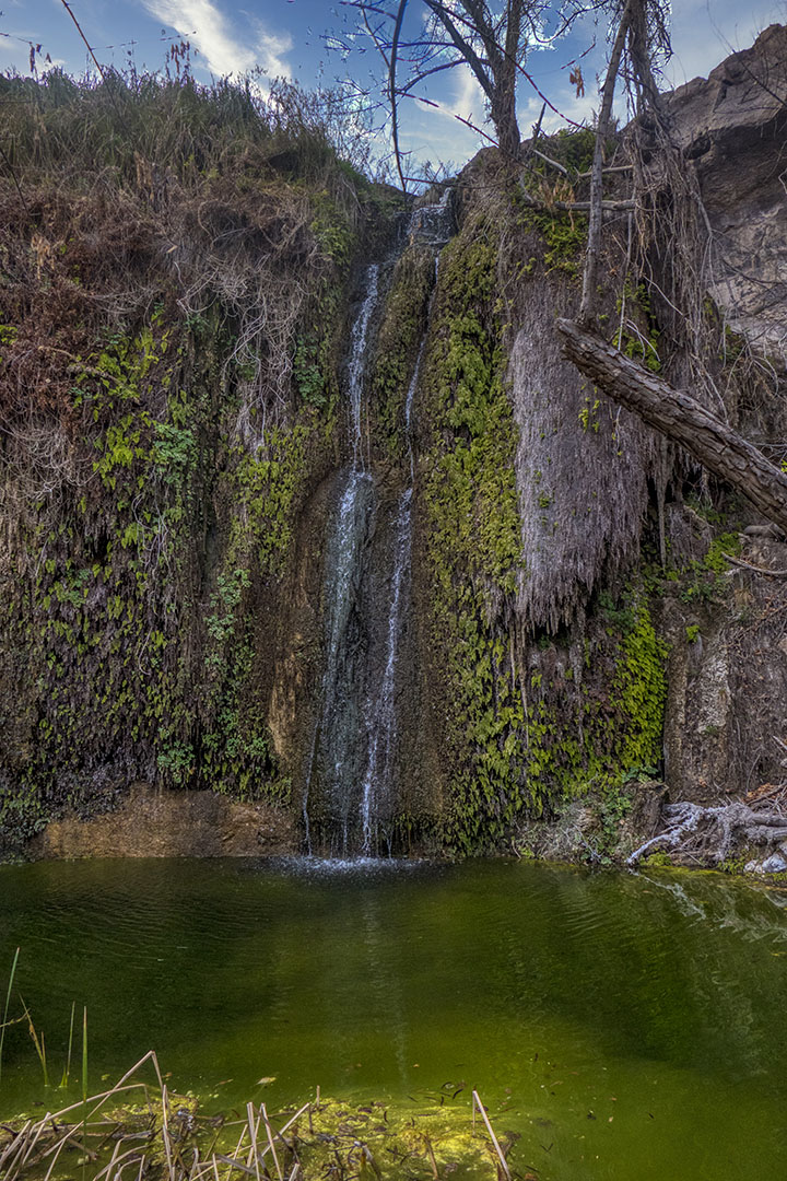
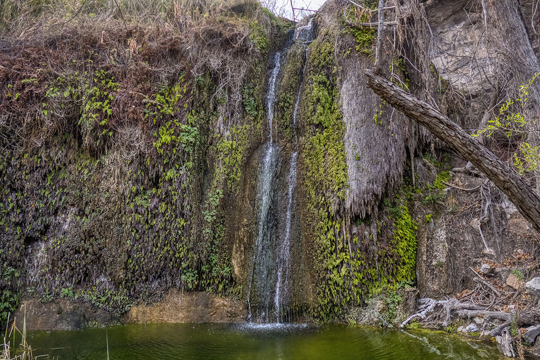
From here the trail climbs 200′ over a saddle and follows the trail of cairns to a spectacular overlook above Mexicano Falls. This is the second highest accessible waterfall in Texas, and unlike Madrid Falls (which I covered in the previous blog post), it is more intermittent in flow:
My campsite was on a high mesa just past Mexicano Falls, and I was treated to the warm glow of late light:
As if that wasn’t enough, the sunrise next morning was breathtaking:
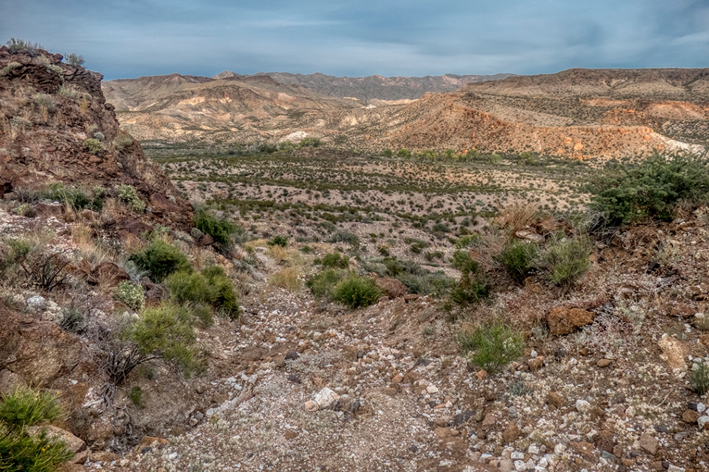
The views down Arroyo Mexicano, with the “Flatirons” of the Solitario (a round “lacolith” left from the volcanic activity of ancient times) in the distance:
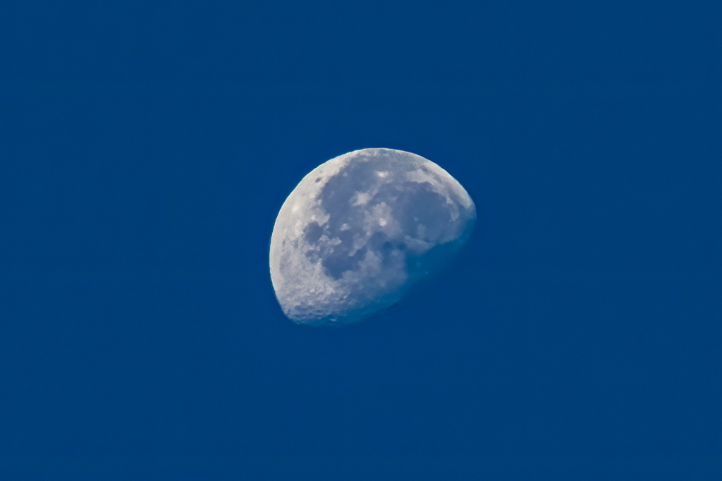
Moonrise over another adventure on the trail:
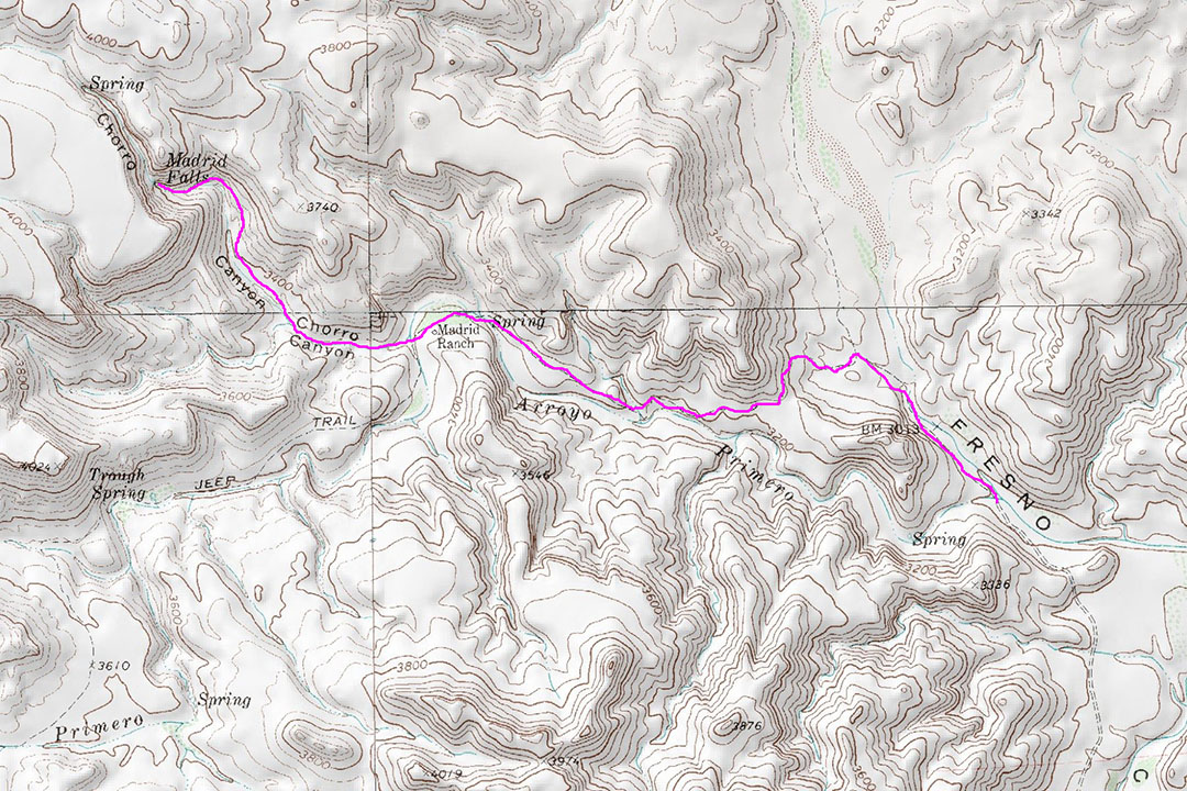
From Mexicano Falls, you can continue on southeast to the Mexicano Falls Trailhead, then down another half mile to Chorro Vista Camp, where you pick up Chorro Vista Trail which drops down to Madrid Falls. From Madrid Falls follow the Arroyo Primero Trail through Chorro Canyon, past the Madrid Ranch another mile and a half to Fresno Cascades, where you pick up the East Contrabando Trail which follows Fresno Creek for 11 miles to the end of the Big Bend 100 in Lajitas, at the East Contrabando Trailhead, all covered in previous posts.
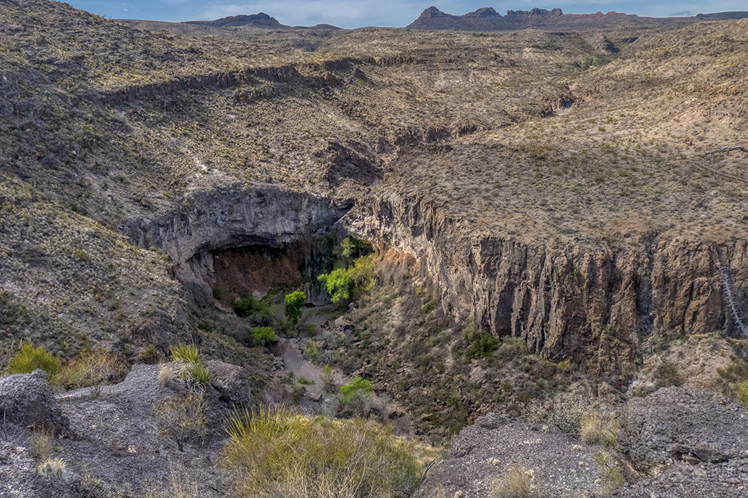
Little known to most, we have an aquatic wonder right here in the Big Bend, in the Chihuahuan Desert, the driest region in the state. At 100′, it is the highest waterfall in Texas accessible to the public (although not easily accessible). It lies deep in the heart of Big Bend Ranch State Park. I spent a full day riding my mountain bike the 11 miles up East Contrabando Trail to Fresno Cascades, then hiking with day pack the remaining 2.5 miles, with the last mile up Chorro Canyon off-trail up the dry creekbed, then bushwhacking through rock and trees and reeds to one of the most beautiful grottos I’ve ever seen:
After an 11-mile ride on mountain bike up the East Contrabando Trail, accessed from the Barton Warnock Center in Lajitas, TX, it’s time to hit the trail through Arroyo Primero for 2 1/2 miles, past the Madrid Ranch Homestead (covered in a previous post), then up Chorro Canyon mostly off-trail to the box canyon that features Madrid Falls and its accompanying pools and grotto:
Along the way, I pass the first Big Bend Bluebonnets of the season, growing in the dry creek bed of Fresno Creek. Officially lupinus havardii, this is the tallest of the lupines:
After passing the Madrid Homestead, you will cross a wide dry creek and continue up a well-defined trail to the sign “Primero Trailhead” that marks a hard southerly left turn. Continue on due west up Chorro Canyon:
The trail is faint, then when it disappears, just follow the path of least resistance up the dry creek bed, until you see the first signs of water, flowing from the falls and its pools:
The canyon makes a hard left, up into a box canyon where you get the first glimpse of the top of the falls:
From this point, stay out of the deep drainage and follow a fairly well-defined trail around the right side of the canyon until you begin to hit the lower pools:
From here it’s a matter of bushwhacking your way through reeds, rocks, and the growth that accompanies water until you finally reach the pool at the base of the falls. There is a small upper falls (not visible in this photo, that drops into a small upper pool, then continues over the main falls:
It’s hard to describe how this lush grotto feels when you encounter it in the middle of the Chihuahuan Desert after a long, warm, dry 13-mile hike/bike. It’s a true slice of heaven:
After spending lunch here, and re-hydrating from the hike (don’t drink this water unfiltered…animals use this as a water source and it contains bacteria such as giardia), it’s time to enjoy the lower pools on the way back out of the canyon:
It’s been several years since I backpacked one of my most favorite trails in all of the Big Bend region, the Marufo Vega Trail, located at the far eastern end of Big Bend National Park on the southern border of Texas with Mexico.
This is a strenuous 14+ mile long trail that crosses the southern end of the Dead Horse Mountains, then drops down nearly a thousand feet to the Rio Grande River and traverses the slopes that drop down another hundred feet or more to the river, southward some two miles, then climbs the thousand feet back up to the Dead Horse Plateau.
The Marufo Vega Trail probably is the scene of more “search and rescue” events than any other in the national park, mostly due to its remoteness, the total lack of water, and the extreme heat in these canyons during late spring, summer and early fall. This is definitely a winter hike, and I cannot emphasize enough how important it is to carry at least a gallon of water per person for this hike.
The trailhead lies on the paved road to Boquillas Canyon. There is a dirt parking area across the road from the trailhead. The trail follows a dry creekbed up Telephone Canyon, passing some of the remains of old ore tram towers that carried ore buckets on large 1″ cables from the Rio Grande River to an ore terminal up-canyon, where the ore was loaded on wagons and hauled by mule to a processing plant in Marathon, TX, some 40 miles north of the current national park.
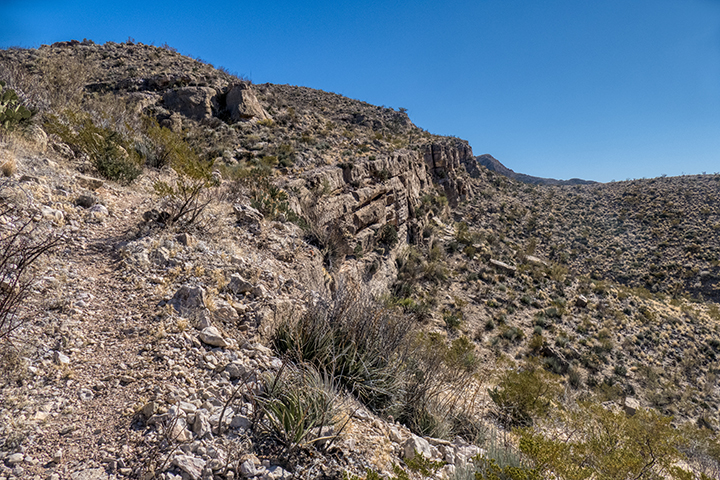
At 1.5 miles there is a trail junction where the Marufo Vega Trail turns right and climbs a steep gully of rocky scree, up to the Dead Horse Plateau. You can also continue on .7 mile up the Strawhouse Trail to the point where another trail junction marked “Marufo Vega” splits to the right and climbs out of the Strawhouse drainage up onto the plateau for another .7 mile to join the Marufo Vega Trail.
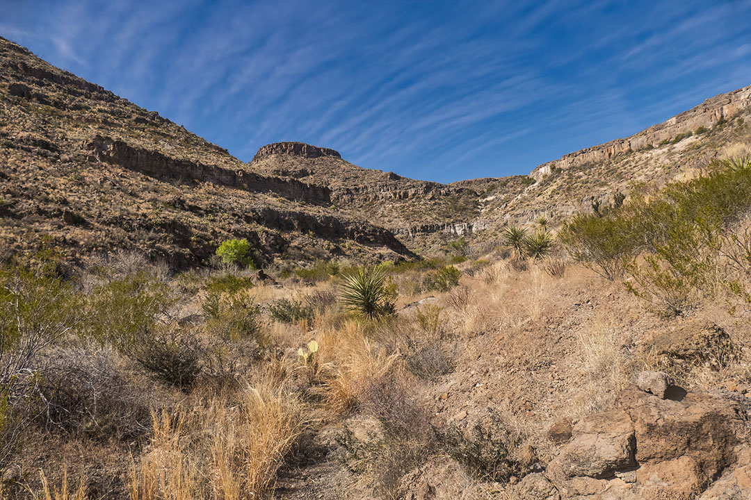
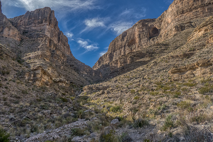
The trail flattens out and follows dry creek drainages, winding through the ravines and cliffs of the Dead Horse Mountains for another three miles.
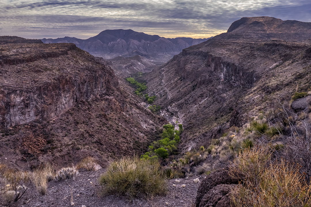
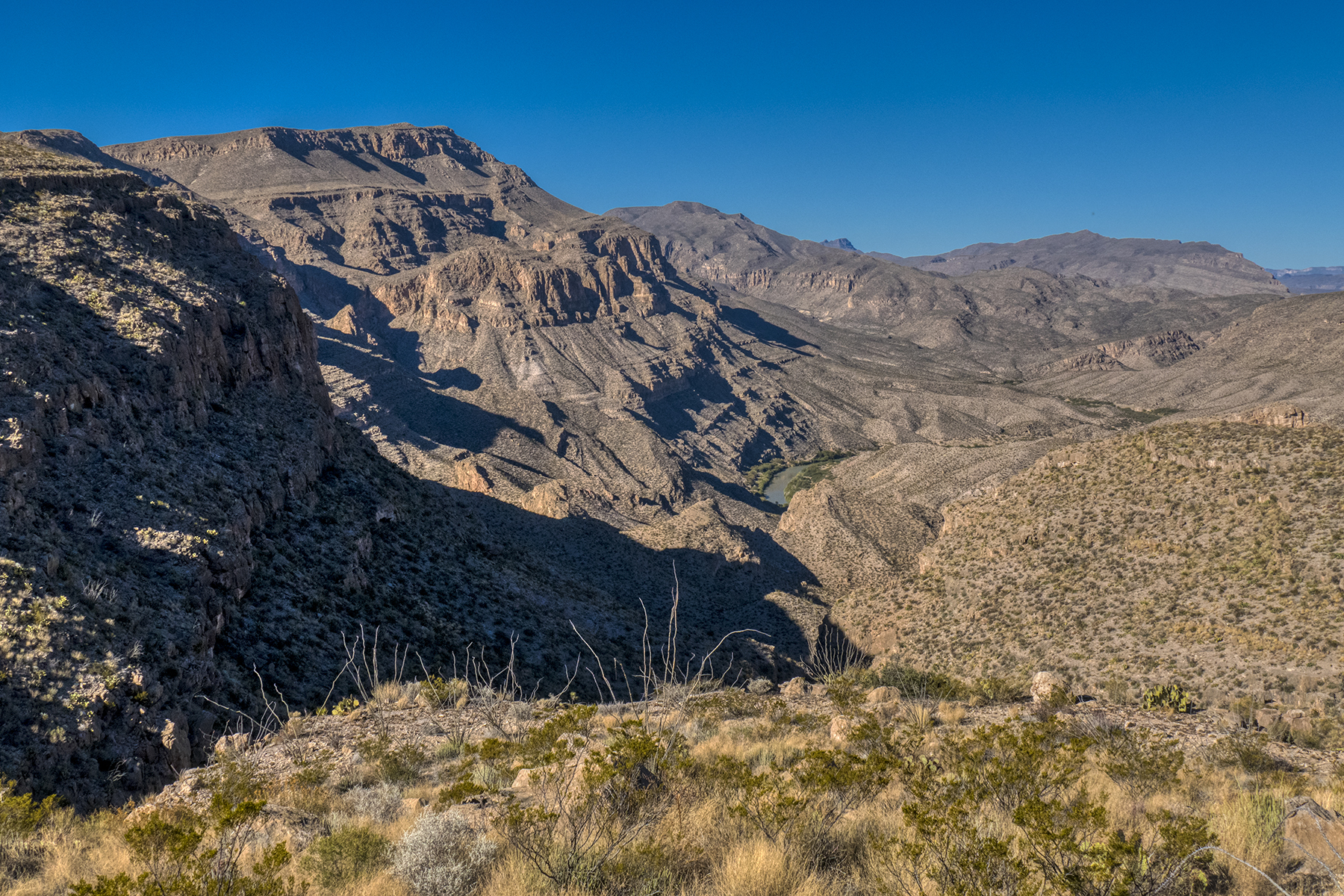
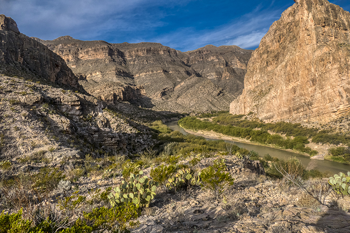
Suddenly, as you round the corner of a bluff, the lower canyons of the Rio Grande River open out before you with startling grandeur.
At this point you are also struck by the fact that the trail has to descend down to that river so far below and traverse the slopes just above the river for 2 miles before you can climb out and up again.
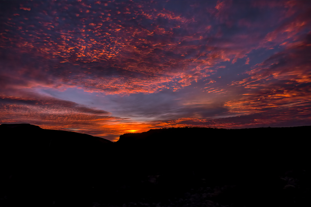
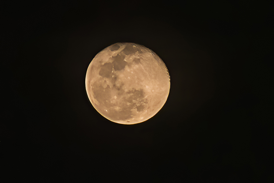
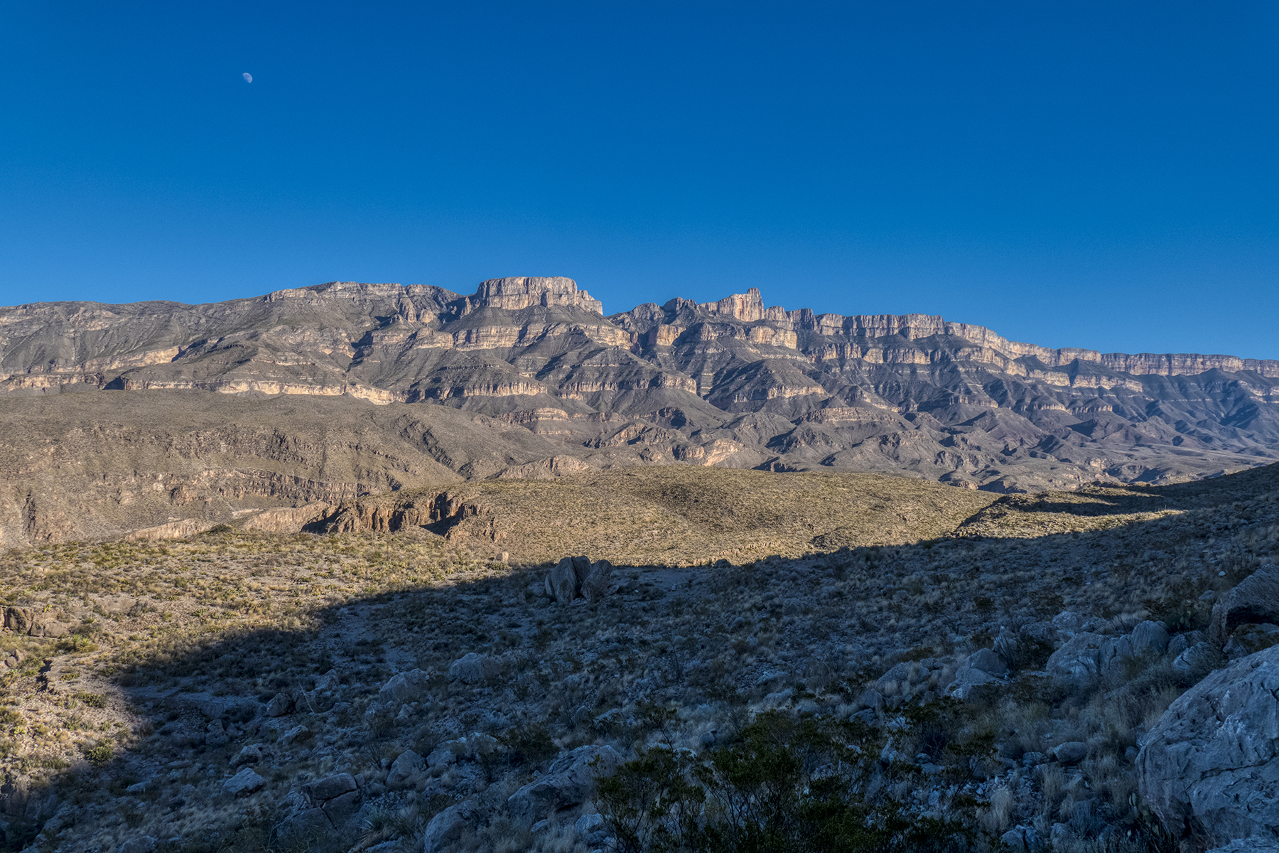
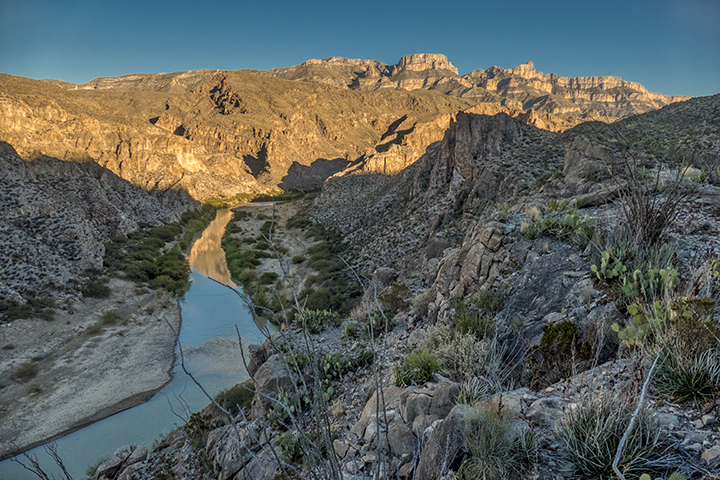
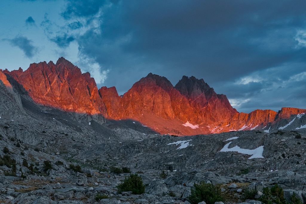
The southeastern end of the Dead Horse Mountains collides head-on into the uplifting fault which is the Sierra del Carmen Mountains in Mexico. The Rio Grande River cuts a dividing swath between these two ranges. Here, a nearly full moon rises over the 8000′ high peaks of the Sierra del Carmens. It is here that the trail begins its descent of over 800 feet down to the Rio Grande, seen below as a green oasis at the bottom of the canyon:
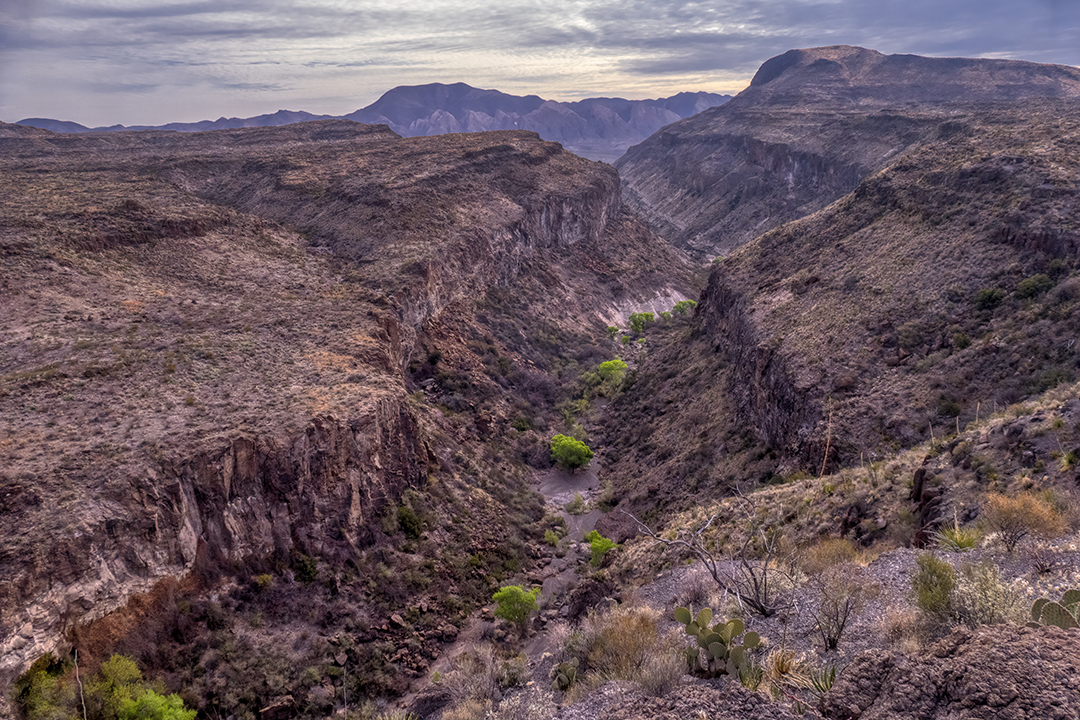
Another mile later, following the descent from the plateau, the trail skirts along the cliffs that drop another 150 feet or so down to the river:
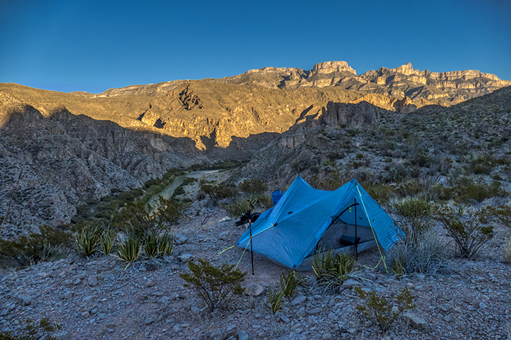
At this point I set up camp at one of the most scenic, and secluded, spots I’ve ever found in Big Bend National Park:
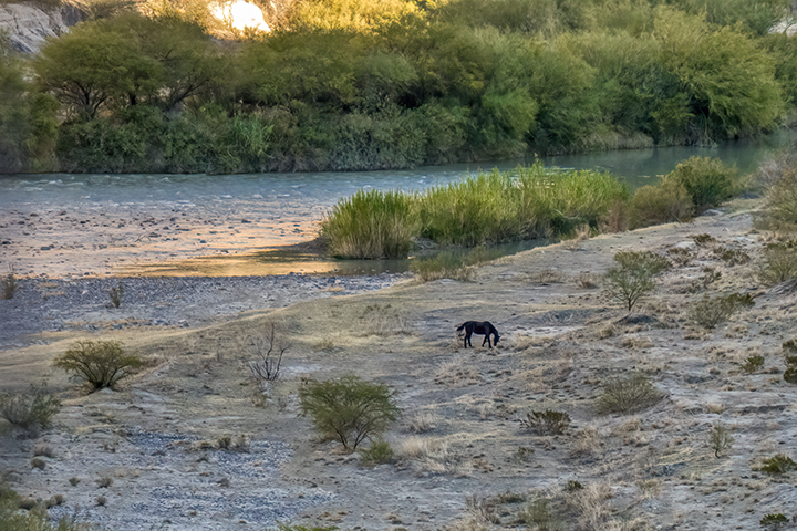
Down on a sandbar along the river a wild mustang, probably from Mexico, grazes on the lush vegetation that water provides:
The cliffs that mark the end of the Dead Horse Mountains, and the plateau from which the trail descends:
Sunrise over the Sierra del Carmen Mountains:
Exploring the side canyons requires a lot more time and days, which I will save for another trip:
The trail continues downriver with astonishing vistas everywhere you look. The extreme tilting of the fault line can be seen in the massive cliff face on the Mexican side of the river (the tan cliffs on the right):
Soon it’s time to begin the 1000′ climb back up through a side canyon, following the Marufo Vega Trail markers back to the top of the plateau:
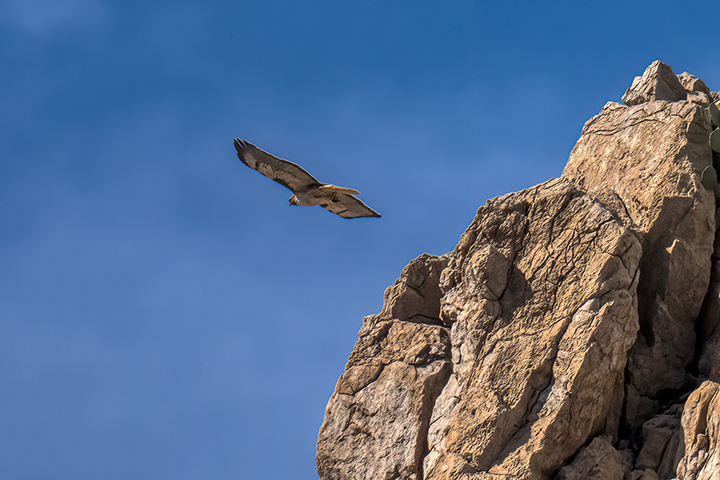
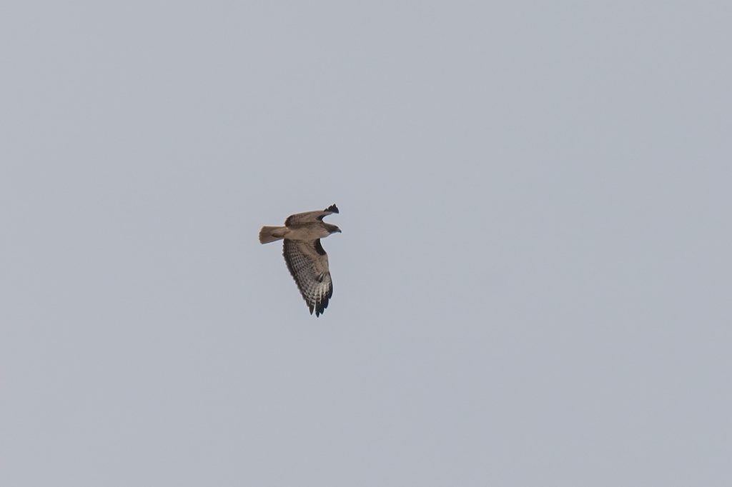
A beautiful redtail hawk kept watch on me as I neared the top of the trail, then effortlessly sailed off his perch and was two canyons over before I had a chance to get a drink of water.
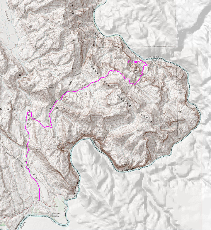
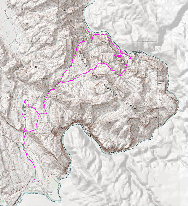
Overview of the 14.5 mile long Marufo Vega Trail. The light area of the map without map gradients is Mexico:
If you are fit, and in the national park in the winter when temps allow, this is not a trail to be missed. If you continue on up Strawhouse Canyon with a little more time, there is some beautiful native American rock art (pictographs) at the entrance to a box canyon at the end of that trail…but that’s for another trip.
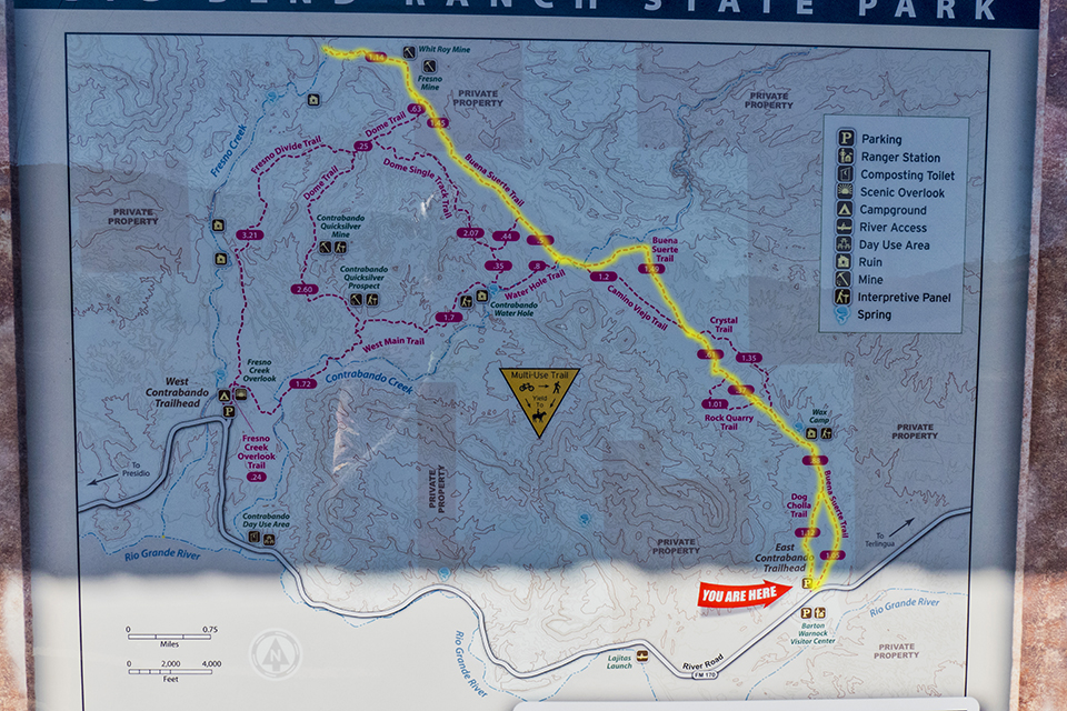
Time to hit the trail…and what better trail than the Contrabando Trail in Big Bend Ranch State Park. This is a hike/bike trail, so I opted to “Bikepack” so I could cover the miles more quickly. You pick up this trail from the park headquarters at the Barton Warnock Center in Lajitas, Texas, and follow it northward until it intersects with Fresno Creekand follows the creek northward through Fresno Canyon.
For this trip I’ll be camping overnight in the area of Fresno Cascades, a dependable water source in the heart of Fresno Canyon, and doing a day hike up a side canyon to the Madrid House, and possibly up to Madrid Falls, a seasonal waterfall in a remote area of the park.
Round trip is about 26 miles, which can easily be done as a day ride/hike, but I want to not be rushed and explore, since I’ve not been on parts of this route before.
Map of the route, with numbers for reference to points of interest I describe along the way:
My bike, ready to roll. It’s a Motobecane full-suspension 27.5+ with 2.8 tires, outfitted with RockBros handlebar bag and seat bag to hold a sleeping bag, tent, air mattress, clothing and other miscellaneous gear.Location #1: A plant called candelilla grows in the area. It was used to make candles and other paraffin substitutes in the early part of the last century. The remnants of a candelilla processing operation are still found along the banks of a dry arroyo:
Candelilla
Wax Factory
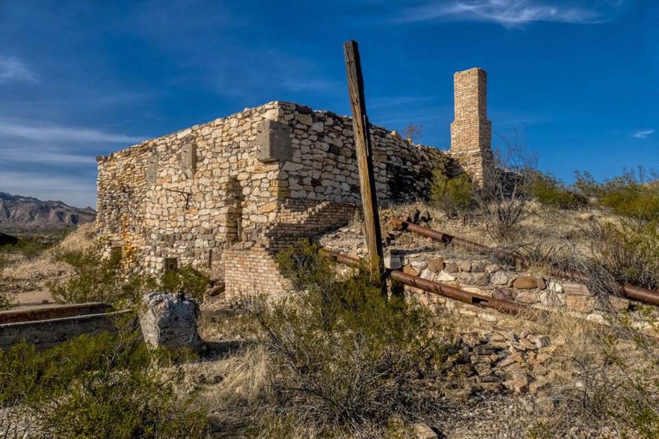
Location #2: At about 7 miles the trail passes an abandoned mercury mining operation, the Fresno Mine, which operated off-and-on from 1935 – 1956. From here the trail turns westward toward Fresno Creek:
Fresno Mine
Location #3: The trail crosses Fresno Creek and climbs gradually through Fresno Canyon. Along the way you can find remnants of the Old Government Road, a roadway constructed in the 1910’s by the Army to move troops to protect the border during the Mexican Revolution. An old line cabin used by early ranchers near Fresno Creek, and cottonwoods line the banks of Fresno Creek, near Fresno Cascades, where the water is forced to the surface by limestone deposits:
Old Government Road
Fresno Creek
Location #4: Fresno Cascades…a dependable water source in the Chihuahuan Desert, historically used by paleo-indians and cowboys. Water is forced to the surface and flows into tinajas (water holes in the rocks), then goes underground to resurface downstream. The remains of what might have been a grain storage cache, or perhaps a temporary sheep corral…park authorities are not sure. From there the trail climbs up an old ranch road over a low pass and continues on to the old Madrid Ranch:
Fresno Cascades
Grainery
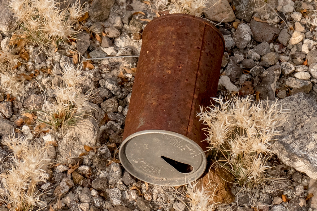
After dropping my bike, I set out on foot, up and over the saddle separating the Fresno Creek and Ojo Blanco Creek drainages. Along the way I am scolded disapprovingly by a red tail hawk. Below, the Ojo Blanco drainage is an oasis in the desert, the telltale cottonwood trees appearing everywhere a spring reaches the surface. An old beverage can, circa 1950’s-60’s vintage, carries an ignored message, “Dispose of Properly…Please don’t Litter.”
Red tail hawk
Ojo Blanco Creek
Please don’t litter
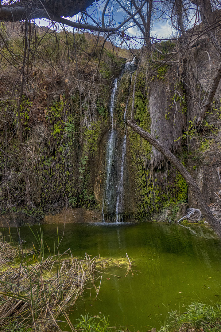
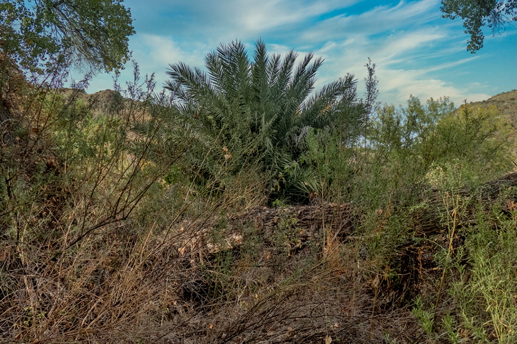
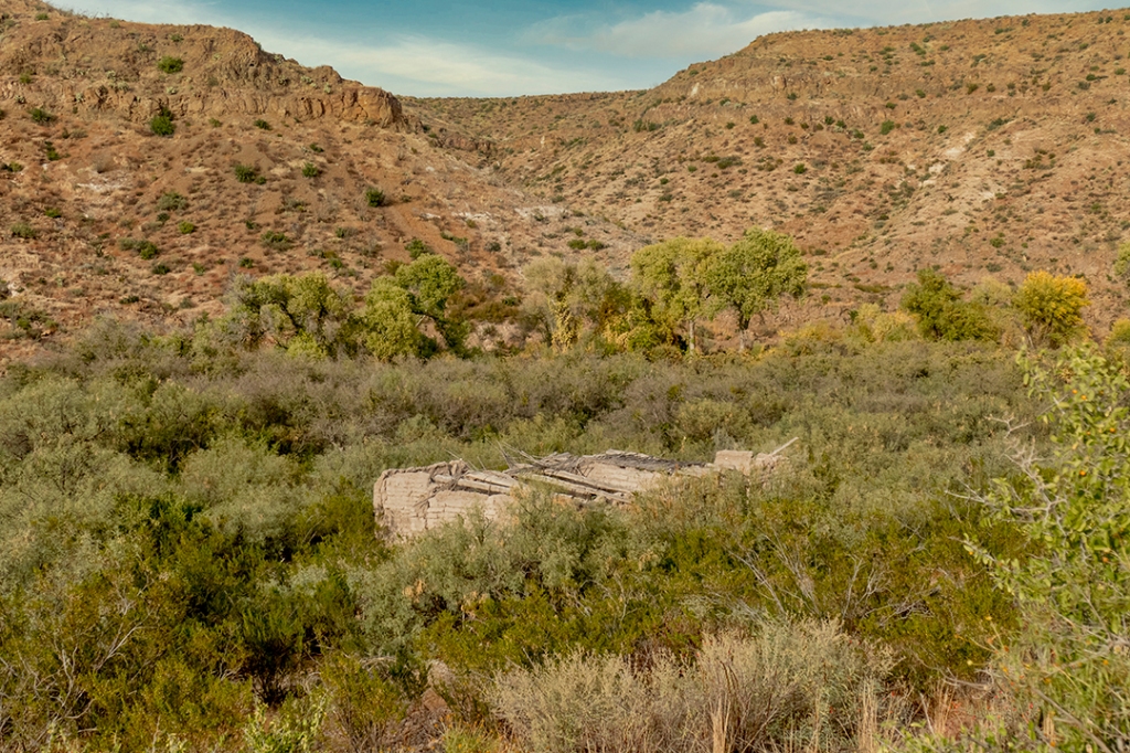
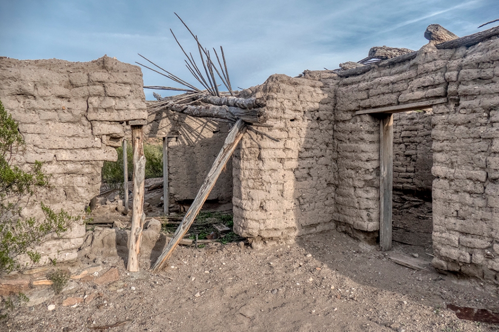
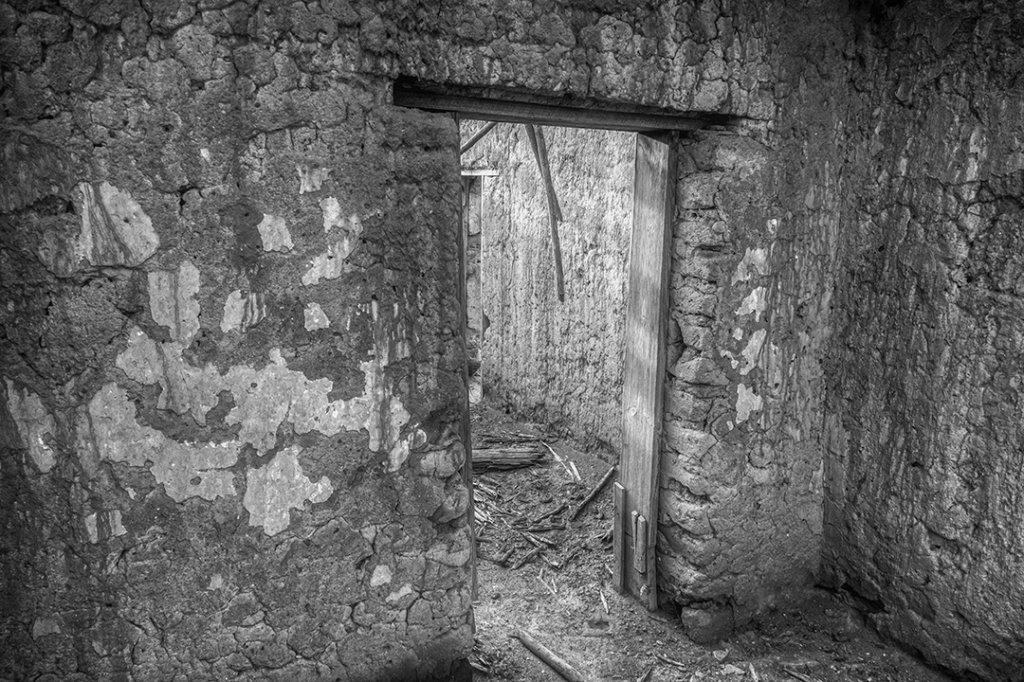
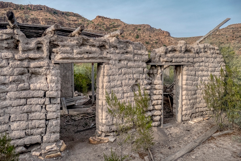
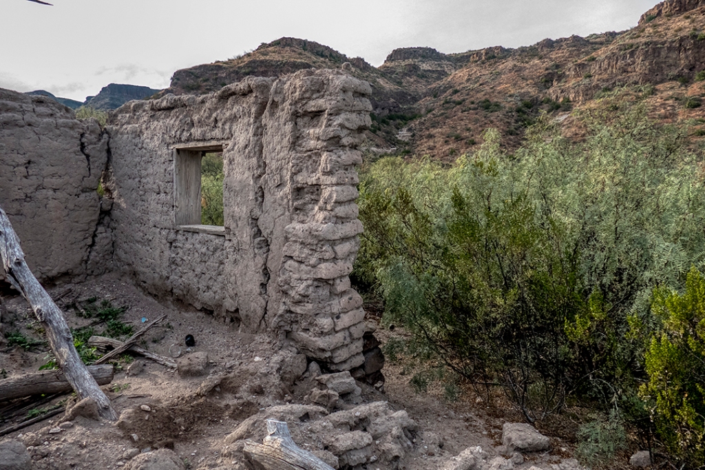
Location #5: Madrid Ranch – following the old ranch road trail for about 1.5 miles beyond Fresno Cascades you approach a very large grove of very tall cottonwood trees. This marks the location of Trough Spring, and the Madrid House, where the Madrid family homesteaded in the early part of the 20th. century. Nearby, a tall waterfall (Madrid Falls) derives its name from this family. A date palm grows around the spring. A friend familiar with this area speculates that the date palm, not indigenous to the Chihuahuan Desert, grew from discarded dates carried by cowboys as trail snacks. These occur in several places around springs in BBRSP. The Madrid House was actually a very well built, large adobe house, where you see remains of beautifully plastered interior walls, plus an obvious addition…a bedroom added as the family grew, showing occupation for a number of years. Madrid Falls lies out of view up a side canyon:
Cottonwoods
Trough Spring
Date Palm
Madrid House/Canyon
Madrid House Front
Plastered walls
Rear/added on room
Madrid Falls
Location #4: Fresno Cascades Camp…the day was getting late, so I passed on trying to hike back to Madrid Falls. I’ll save that for another trip. My campsite was just above the cascades, near enough to water that I was serenaded all night by the water dropping over the cascade into a pool that never filled, but went underground as fast as the water flowed into it. Sunset was wonderful, and the nearly full moon shone all night:
Fresno Creek from saddle
Campsite
Fresno Cascades
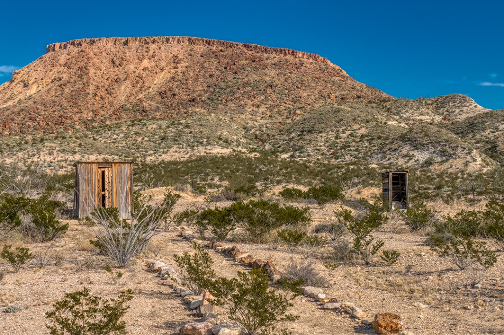
Location #2: Fresno Creek to the Fresno Mine, and home…a lot of the creek crossings have been washed out by summer rains. Dropping down off the bank into the creek bed and back up the other side can be hazardous, and sometimes require dismounting. The trail, normally a dry creek bed, requires a little extra peddling effort due to the soft, water-soaked surface. I stopped at the Fresno Mine and hitched my trusty steed to an old hitching post for a rest. I’d like to know the story about the dual outhouses:
Trail washout
Fresno Creek Trail
Hitching post
His and Hers???
I rode/hiked for two days and saw no one. The trail is both beautiful and historic, with grand vistas. Take PLENTY OF WATER. Yes, there is usually water along this route (be sure to filter), but it cannot be guaranteed year round. Be sure to put this one on your “Bucket List.”
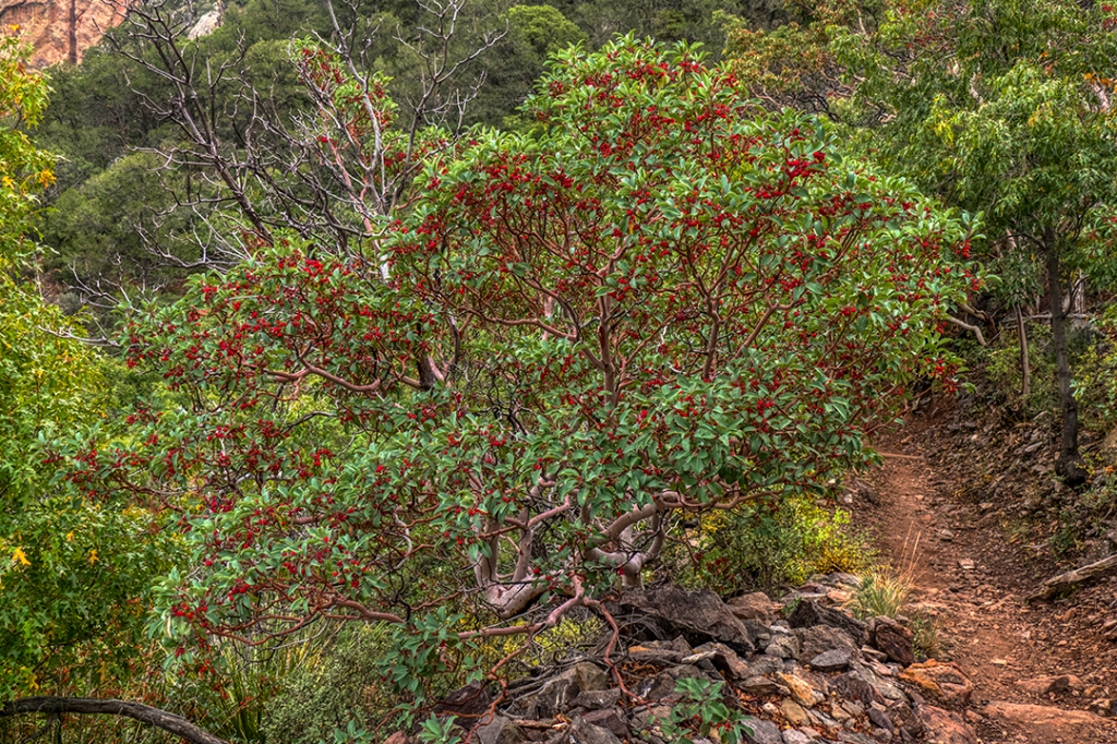
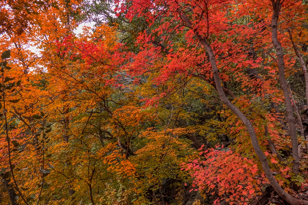
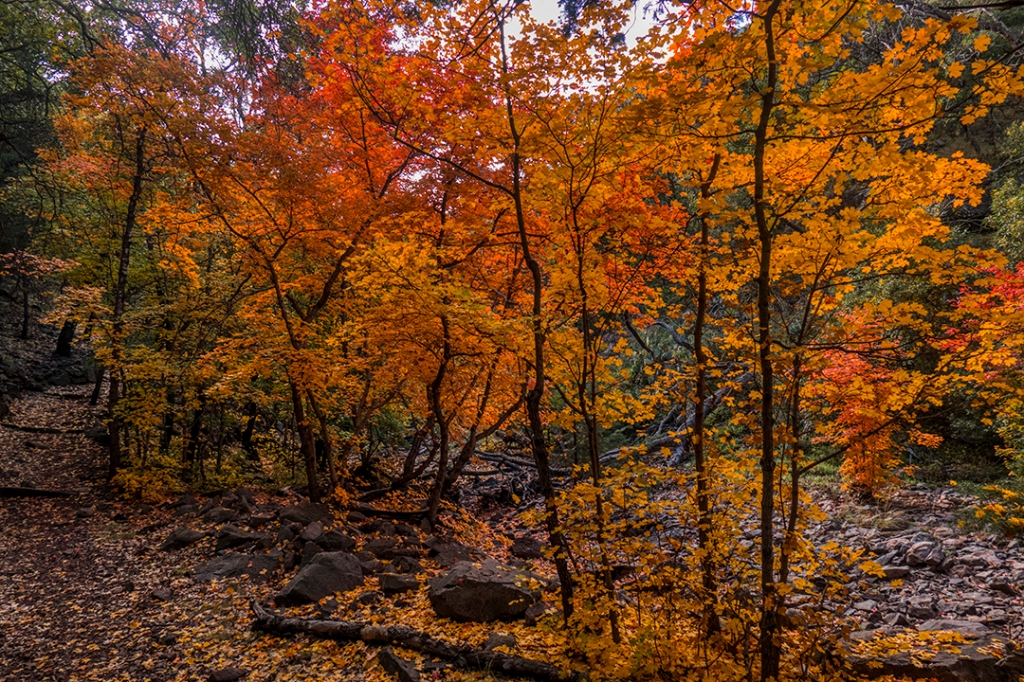
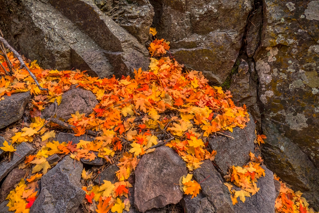
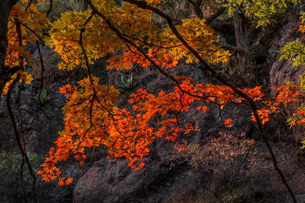
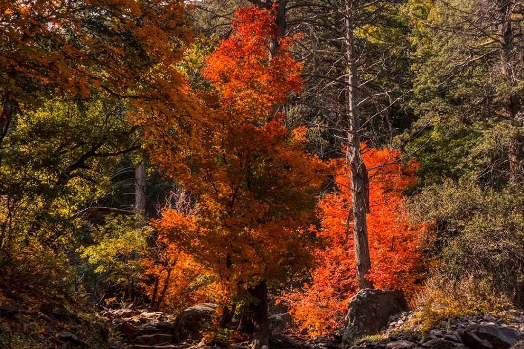
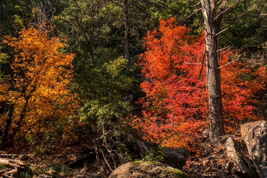
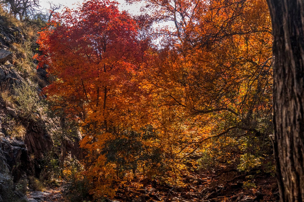
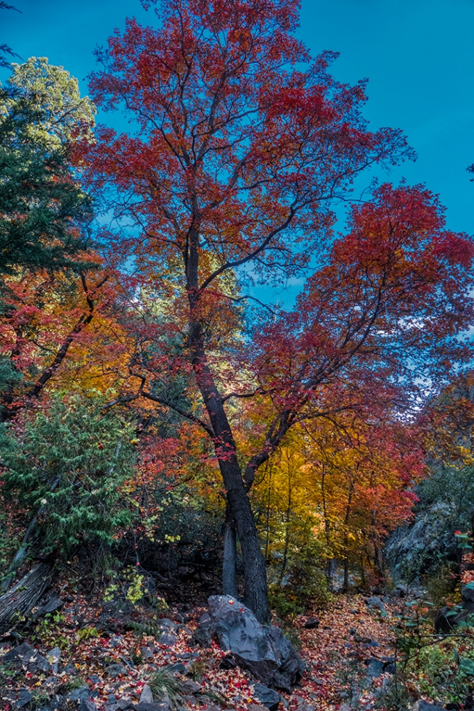
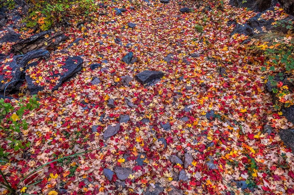
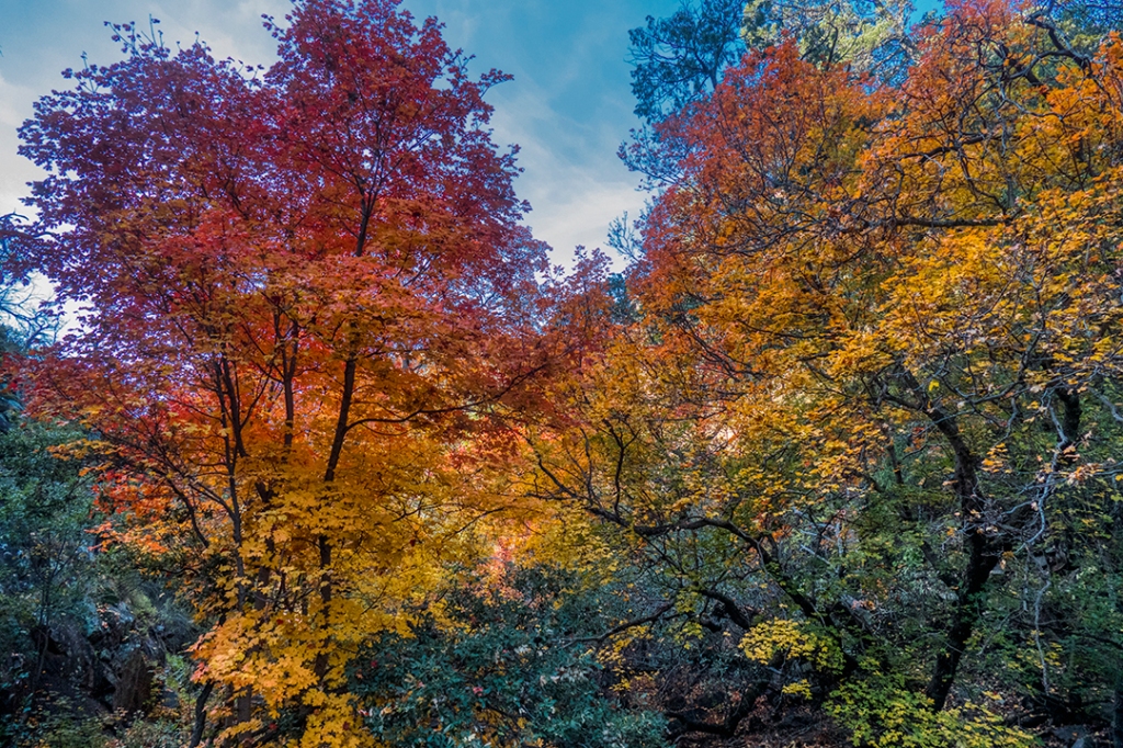
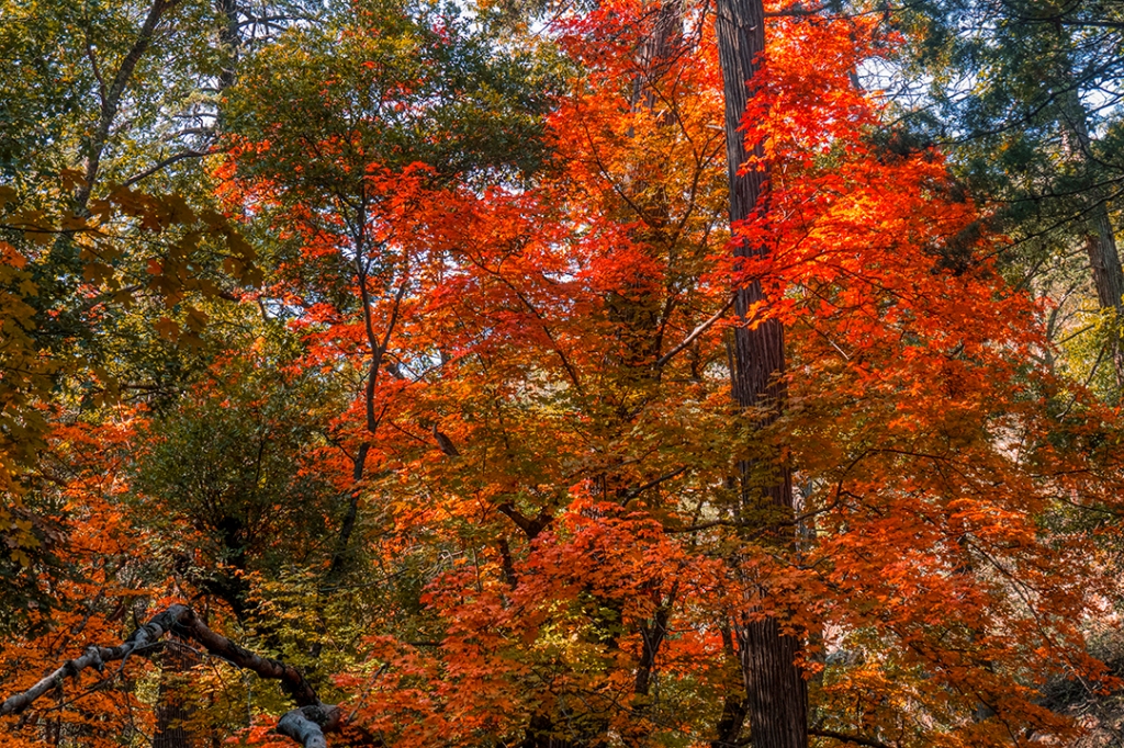
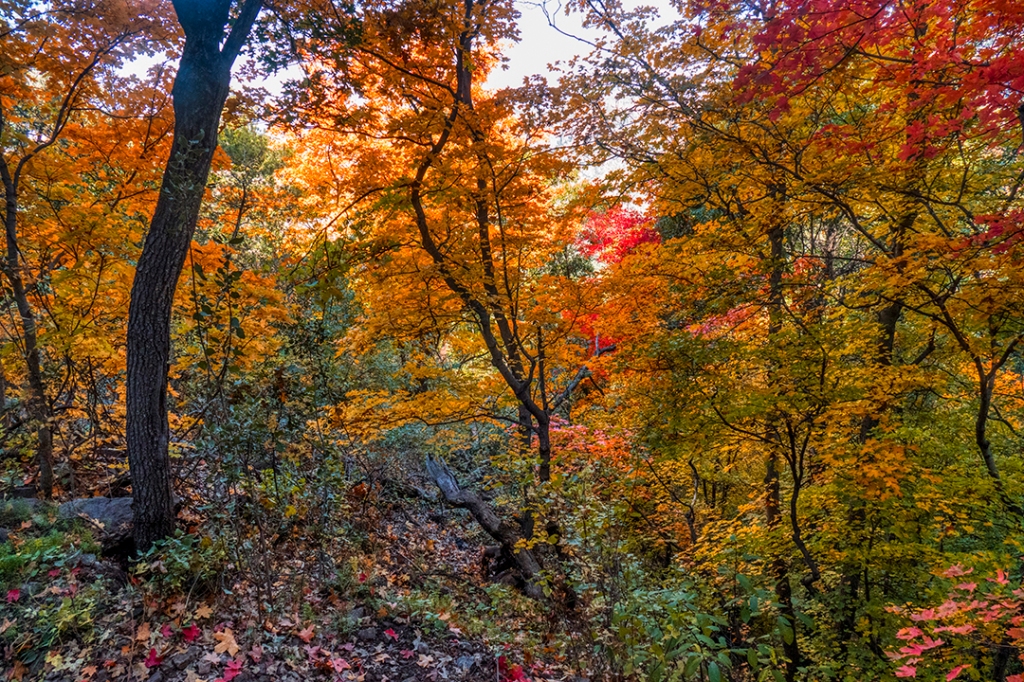
It is generally assumed that the desert of the southwest has two colors: green and brown. The green would be the desert during the rainy season and brown would be the rest of the year. However, there are “islands” that rise above the desert floor that reach up into other climate zones by the nature of their altitude. One such island is the Chisos Mountains, located centrally within Big Bend National Park. This past weekend I went on a quest to photograph the magnificent fall foliage of the bigtooth maple trees, found mostly in upper Boot Canyon above Boot Spring at an elevation of just under 7000′. My timing was perfect, the maple leaves having just turned to their magnificent technicolor shades of red, orange and yellow.
The spires rising above the Pinnacles Trail, access to the high canyons of the Chisos Mountains.Brilliant red berries of the Texas Madrone tree, along the Pinnacles Trail.A small grove of bigtooth maples along the Pinnacles Trail at an elevation of about 6700′.Just after crossing Boot Creek, entering upper Boot Canyon with its stand of bigtooth maples.The trail follows the creek upwards through the maples.One of the taller examples along the trail.The trail is carpeted with a mosaic of reds, oranges and yellows, having been just recently blown down by an overnight wind.
So, if you thought you had to go to Maine, or the Smokey Mountains for fall color, look closer to home. You just might find what you seek out in the desert.
There are three hiking trails that transect our country from north to south, one in the east, the Appalachian Trail, one in the central Rockies, the Continental Divide Trail, and one in the west, the Pacific Crest Trail. In addition, there are a number of shorter “thru-hikes” on shorter point-to-point trails, the most famous, and arguably the most scenic, being the John Muir Trail of the high Sierra Nevada mountains of California. It runs from Yosemite National Park to Mount Whitney, the highest peak in the lower 48 United States. It runs for 210.5 miles up and down the passes and basins of the Sierras.
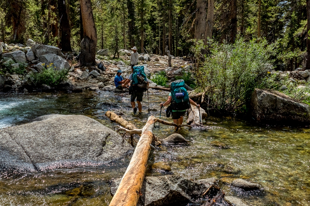
My good friend, Joe, his wife Sara, and I spent 9 days backpacking the most scenic (and I must add the most vertical) 65 miles of this trail during the first two weeks of September.
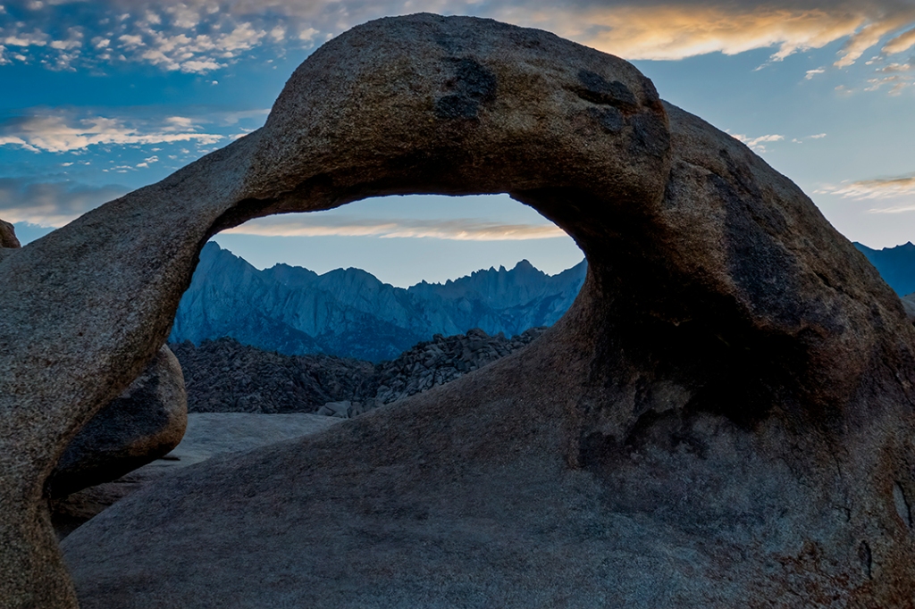
Looking west through an arch in the Alabama Hills toward Mt. Whitney, the highest peak in the lower 48 states at over 14,500 feet.
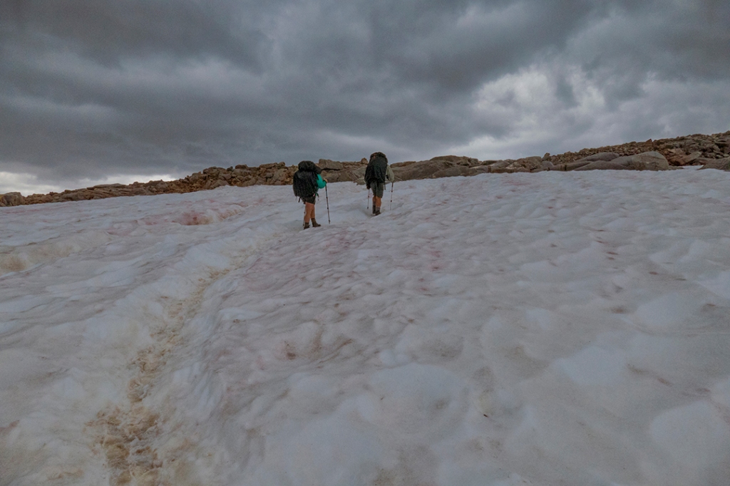
Day 1 started west of the town of Bishop, CA, at the trailhead at 9800 feet elevation, then climbed up past Long Lake, Sadderock Lake, and up over Bishop Pass at 11,980 feet in a driving rain and sleet, hands frozen to our hiking poles, plodding through a river flowing down the trail with lightning dancing off the adjacent 14,000+ foot high peaks. A nice way to start the trip.
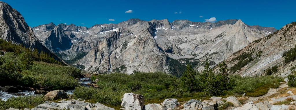
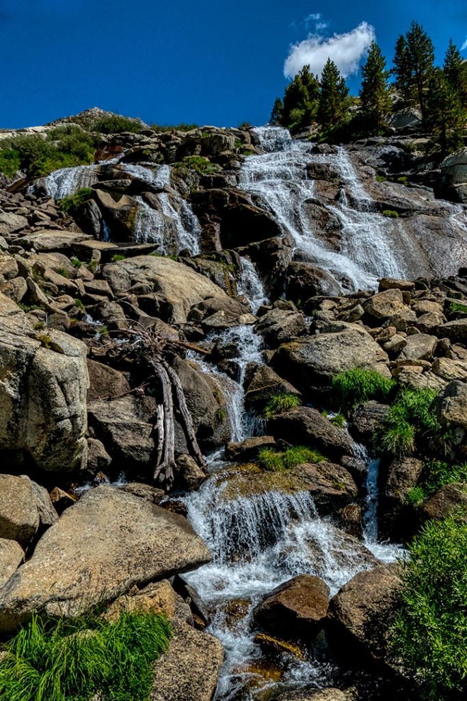
My first look at the jagged peaks of the Sierra Nevada front range from the upper end of South Lake on the climb up to Bishop Pass on day 1.A waterfall drains the remaining snow fields of the High Sierra, left from a very high snow year with an estimated snowpack of 150%.My companions, Sara and Joe, plod upwards through snowfields in a cold sleet and rain storm, struggling to gain the top of Bishop Pass at an elevation of 11,980 feet.
We made camp below the pass in the upper Dusy Basin at about 11,300 feet elevation. The rain and sleet cleared just before we made camp, and the aspenglow on the peaks was magical. Overnight temps held at about freezing, not too bad for this elevation.
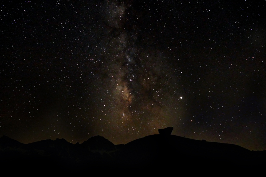
Camp 1 in Dusy Basin, just below Bishop Pass.Aspenglow against the wall of 14,000+ peaks that rise at the eastern end of Dusy Basin.The Milky Way in all its glory after the storm clears and the stars appear.
On day 2 we drop down through the Dusy Basin drainage, headed for LeConte Canyon and the Middle Fork of the Kings River.We have a total descent of 3140 feet to our low elevation of 8700 feet at Grouse Meadows.
Sunrise just making its way onto the peak above a nameless lake in Dusy Basin.The far walls and spires of LeConte Canyon.A falls on Dusy Creek.The peaks of LeConte Canyon.We surprise two whitetail deer in Grouse Meadows, site of our camp for night 2.
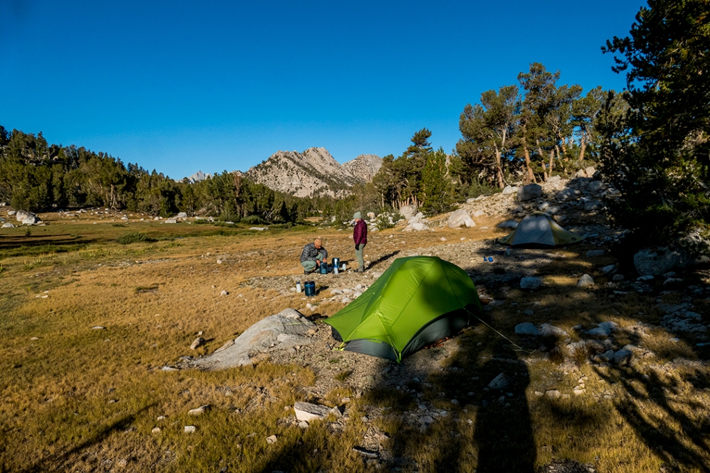
After we set up camp at a campsite in Grouse Meadows, we are joined by two “thru-hikers,” a man from Akron, OH, with the trail name “Just Jeff,” who is finishing up the final 200 miles of his 2400 mile journey on the Pacific Crest Trail from Mexico to Canada. His partner was Christina, a solo girl from Belgium doing a thru-hike of the John Muir Trail from south to north. Thru-hikers are characterized by light packs and no unnecessary gear, including food. They are always hungry and always ready to eat any and all extra leftovers.
Campsite in Grouse Meadows, with Just Jeff and Christina.Afterflow of sunset below the parting storm clouds at Lower Palisade Lake.
Day 4 we climbed 1500 feet up and over Mather Pass from Lower Palisade Lake in a cold rain, then down 1100 feet into the upper basin below Mather Pass.
Cresting the top of Mather Pass at 12,100 feet, looking back down through rain clouds to the basin below.
Day 5 we break camp and head down the wide, beautiful basin, down about 1000 feet to the trail junction at the Middle Fork of the King’s River, then climb back up 1000 feet to Lake Marjorie for the next night.
Morning, looking back at Mather Pass from the upper basin campsite.Hiking along the headwaters of the King’s River that drain the upper basin.It’s Crocs only for crossing the Middle Fork of the Kings River. There was a fatality at this crossing last year involving a girl who did not cross with her backpack unbuckled and was swept away when she fell into the fast waters.Campsite on Lake Marjorie at 11,050 feet altitude.
Day 6 we leave Lake Marjorie and climb 1080 feet up and over Pinchot Pass, then drop down 3670 feet to the beautiful Woods Creek Suspension Bridge for camp.
Yours Truly atop a spire at the crest of Pinchot Pass at 12,130 feet altitude.Woods Creek Suspension Bridge (one hiker at a time, please).
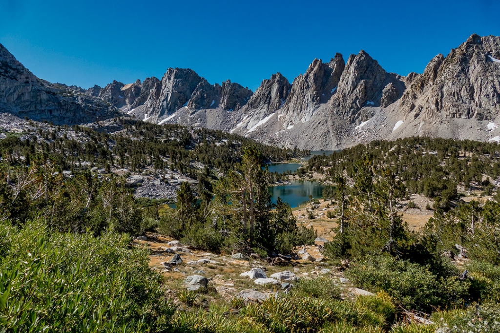
Day 7 starts cold and early, leaving the low point of 8510 feet elevation and heading up over 2000 feet to the Rae Lakes at an elevation of 10,550 feet.
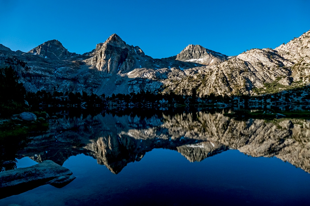
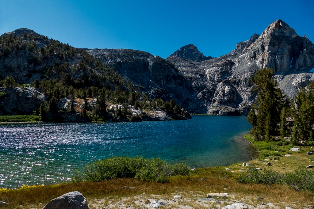
Confluence, Woods Creek & S. Baxter Creek.One of the Rae Lakes, one of the most picturesque (and popular) lakes in the region.
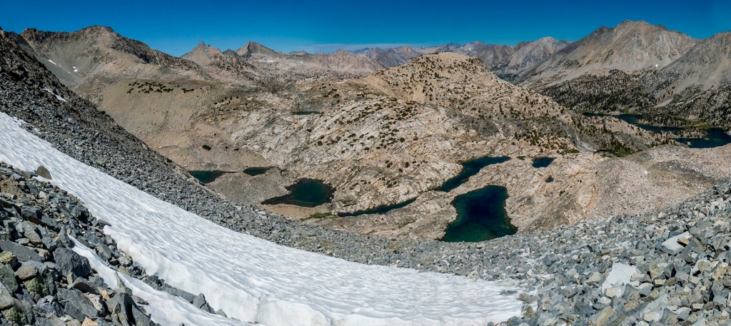
Day 8 greets us with a beautiful reflection on upper Rae Lake, then it’s to work, climbing up 1430 feet to the summit of Glen Pass, then down over 1400 feet to the Kearsarge Pass trail junction, and back up past Bullfrog Lake to make camp.
Sunrise reflection on upper Rae Lakes.A look back down from the 11,970 elevation of Glen Pass.Campsite above Bullfrog Lake our final night on the trail.
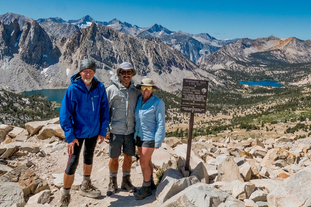
The final climb: up and over Kearsarge Pass (11,835 feet) and down to the trailhead and the end of the trail.
A look back at the Kearsarge Lakes and the awesome spires of the Sierra, on the way up the switchbacks to the summit of Kearsarge Pass.Joe, Sara and I having a “pass party” at the top of Kearsarge Pass 11,835 feet.Farewell to the Sierras and the John Muir Trail.
This was a backpack trip I’ve always had on my “bucket list,” and it was definitely everything I expected, and more. There are many guide books available on the trail which include advice on access points, permits required, and all the other pertinent info you need to know in planning a hike on the John Muir Trail. Happy Trails.
It’s still only mid-February here in the Big Bend, but you would never know it by the weather. So far, this is the second consecutive mild winter in a row, and I was fearing a lack of wildflowers again this year, after a total bust last spring. However, my wife and I took a backroads trip through Big Bend National Park on Valentine’s Day, and the profusion of early wildflowers was astonishing. Here is a sample of our day out:
We’re also looking forward to a spectacular blooming of the cactus as we get later into spring, but for now the “hills are alive” with the perfume that is the signature of wildflowers in the Big Bend.
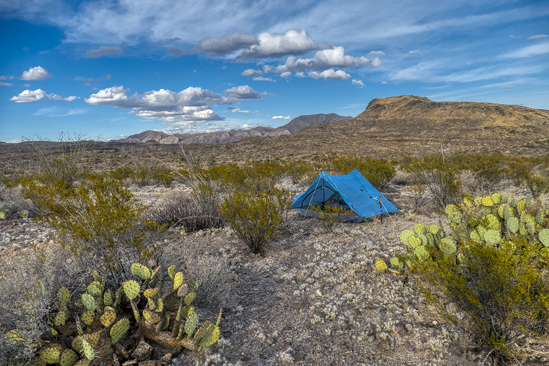
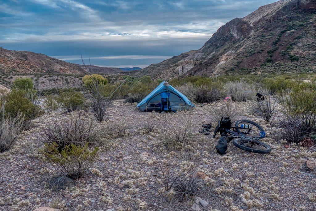
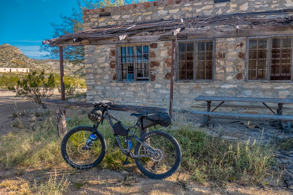
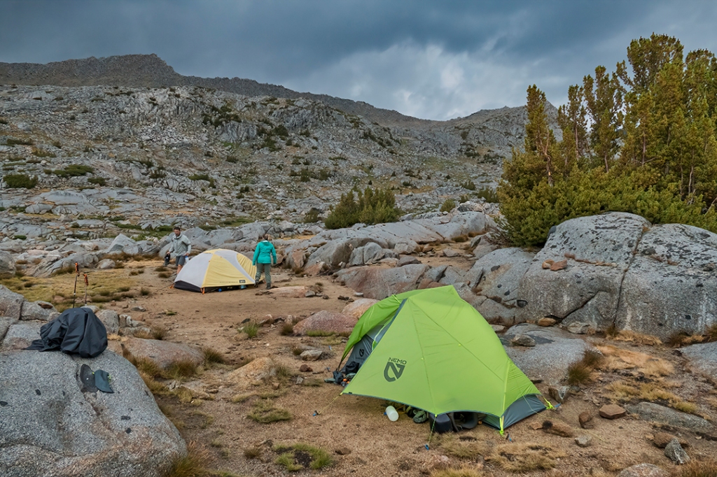
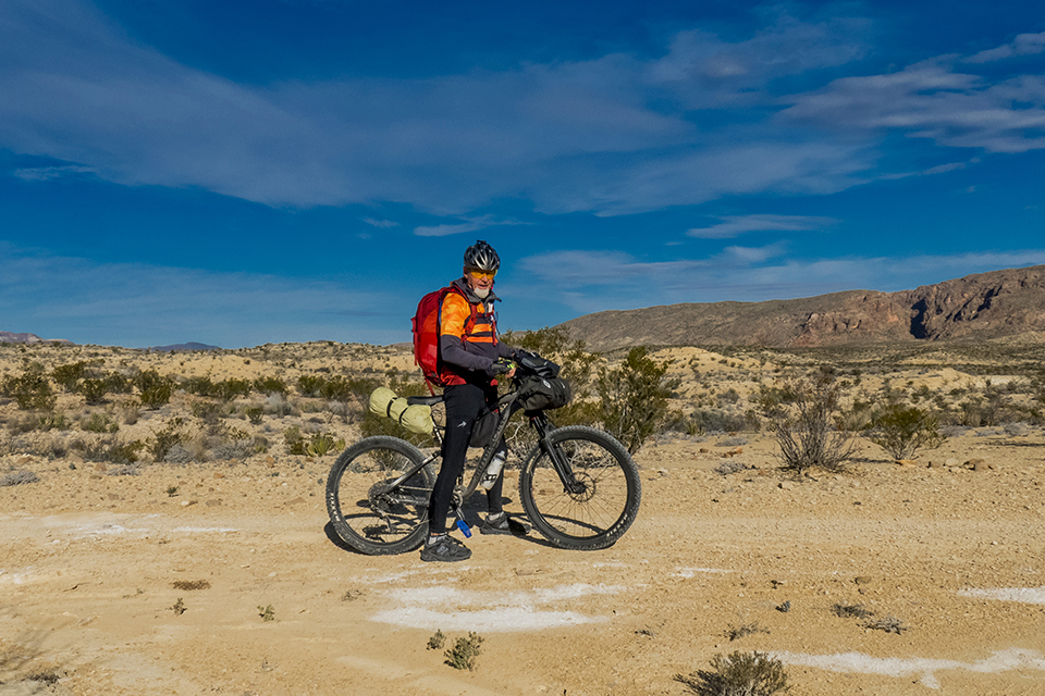
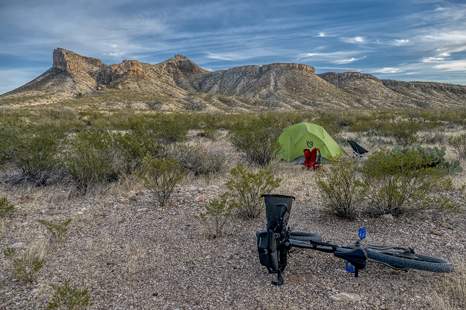
Yes, you’re reading correctly…that’s BIKEpacking, not BACKpacking. A fairly recent phenomenon is emerging, and it’s called bikepacking…hitting the trails for overnight camping using a mountain bike. More and more trails systems are allowing mountain bikes on the trails, along with animals such as llamas and horses. One such system is found in my back yard, in Big Bend Ranch State Park.
Here is a look at the trail system originating at the East Contraband Trailhead, and marked in yellow is the 8.5 mile long route I followed on my first bikepacking shakedown trip:
After checking in at the park headquarters at the Barton Warnock Center in Lajitas, TX, and obtaining the necessary permits for entry and overnight camping, I parked in the park maintenance area (for a better degree of protection for my Jeep than on the road at the trailhead) and hit the trail.
Here is a look at my basic bike setup…full-suspension mountain bike with a front handlebar pack and an under-seat pack for my tent:
The trail I followed is a the least technical route from this trailhead, not wanting to test my riding skills too quickly with an extra 10 pounds of gear on my bike, and a small backpack weighing in at about 15 pounds, due to the quantity of water needed for backpacking in the desert. In this case, I’m carrying 4 liters of water, which amounts to about 12 pounds of weight:
The trail is a combination of mining road and some sections of single-track which wind through the hills, climbing from about 2400′ elevation up to 2750′ where I made camp.
There is a lot of history in this area, some dating back to early paleo-indians of some 10,000 years ago, and more recent history, such as this candelilla, or wax, factory along a dry arroyo:
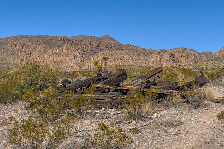
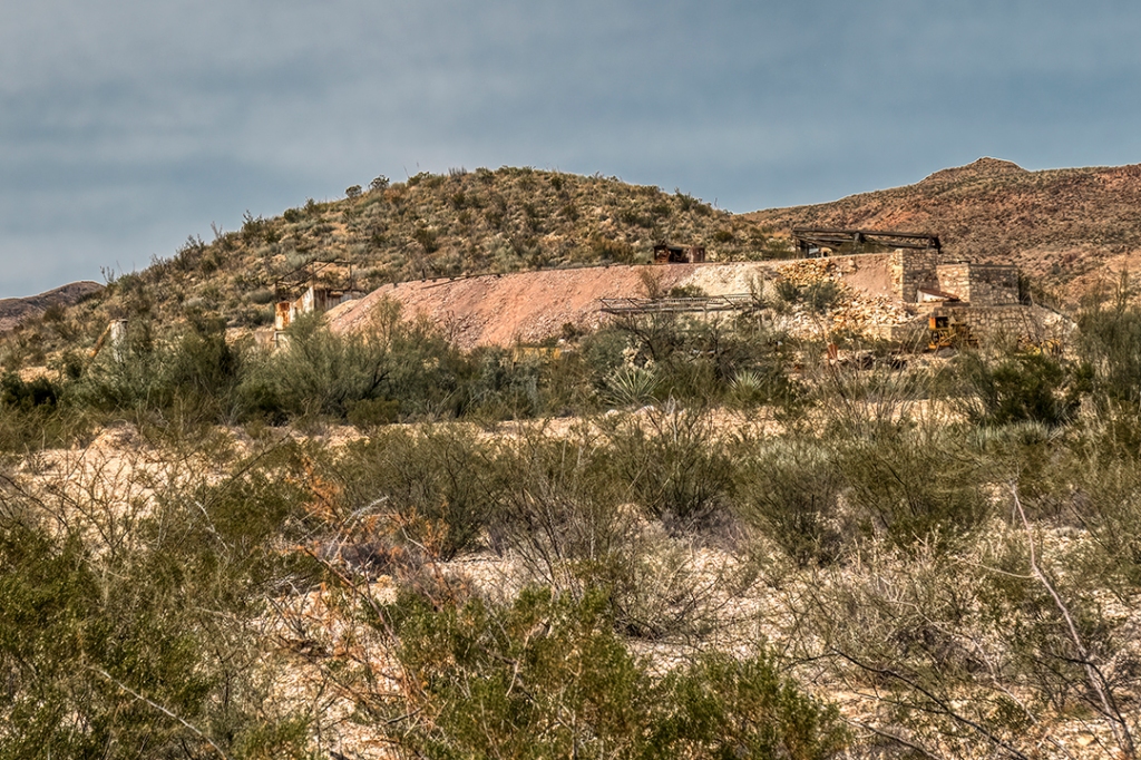
Buena Suerte trail climbs for some 7.5 miles up to an old mining area, which dates from the early 1900’s up until mid-20th. century. This is a private in-holding owned by the Lajitas Resort, so camping is not permitted on this property, but it’s an interesting site to explore if you’re very careful, as there is still a lot of derelict machinery here:
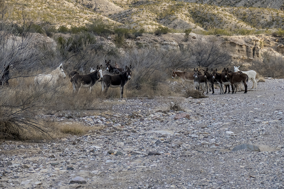
The trail splits to the left, or northeast, and becomes single-track before dropping into Fresno Creek at a major trail junction:
It was in Fresno Creek that I came upon the scourge of the desert: wild burros. These animals are remnants of early attempts at settling, mining, prospecting, wax making, plus invasives coming from Mexico. They are a menace to native plants and animals, and if I had a gun, I’d shoot every one:
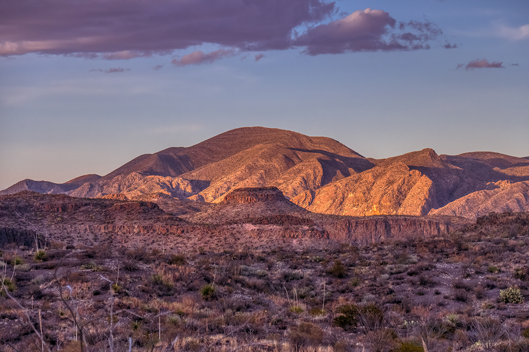
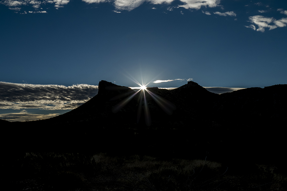
Back to the task at hand, my campsite for the evening, with a warm glow of the setting sun off the nearby hills:
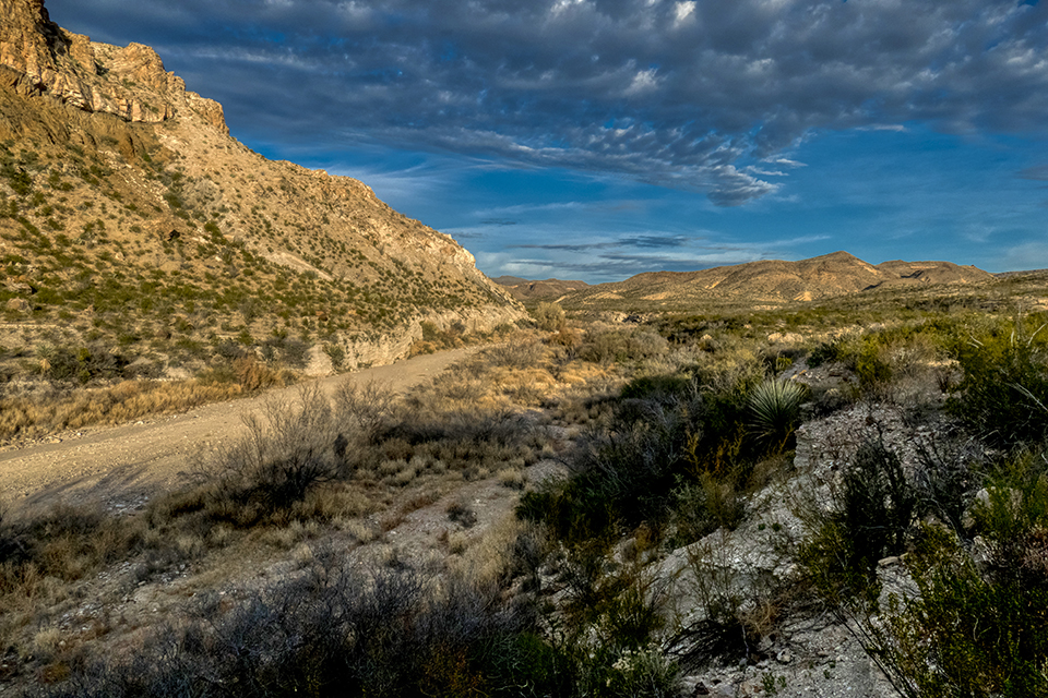
After a warm (50 degree) night, the morning sun was a welcome sight, along with views down the Fresno Creek drainage:
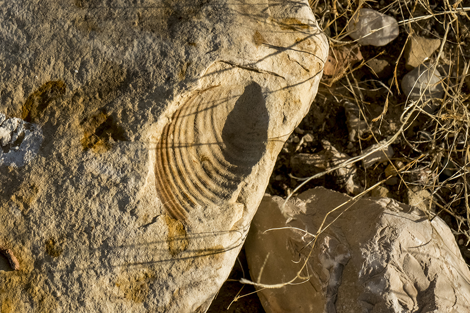
Shell fossils in the rocks are a reminder that this once was the bottom of a shallow inland sea:
The ride back to the trailhead was a “hoot” as it is mostly downhill. I made a detour down a more technical side loop to test my riding skills with the added weight and a backpack, and all went smoothly:
And so, if you’re new to bikepacking like myself, or a veteran of many technical trails, you can find a challenge to fit your taste here in Big Bend Ranch State Park. But keep in mind that this is very remote, rugged country which requires a level of expertise in self-rescue in the event of mechanical failure or an accident requiring medical attention. Also, plan to come here in late fall, winter, or early spring due to extreme, deadly heat other times of the year.
As fall approaches, so have the rains arrived in the Big Bend. And so, it’s time again to backpack up into the High Chisos trails and camp on the South Rim.
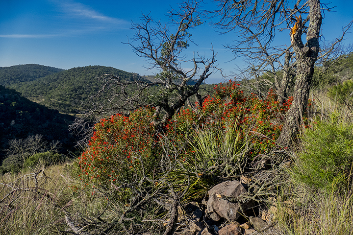
You certainly don’t hear “fall” and “flowers” spoken in the same sentence, but then again, it’s a different place, the Big Bend. It was not long before the bloom brought on by a couple of weeks of soaking, and sometimes flooding, rains on the mountain put on a show:
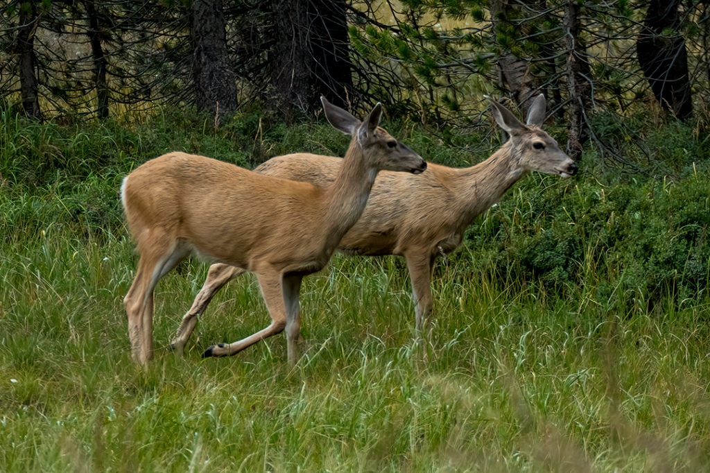
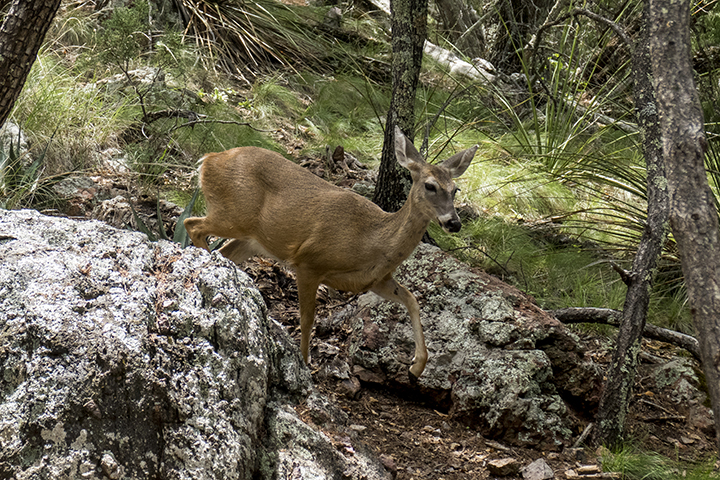
In addition to a wonderful array of flowers, the critters were all on the move, enjoying the explosive availability of water throughout the high country. The del Carmen whitetail deer, found only on this mountain and across the Rio Grande River in the Sierra del Carmen Mountains, display a real lack of fear born from evolving on this protected mountain alongside human contact:
A young buck in full velvet in preparation for the fall rut:
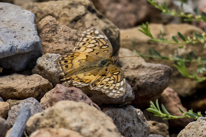
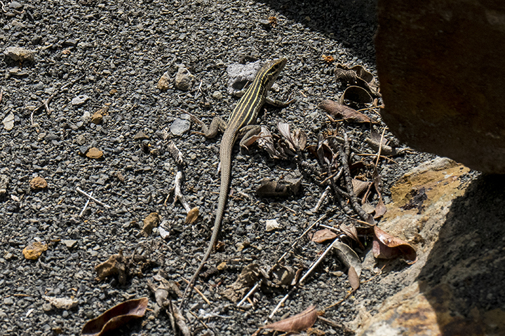
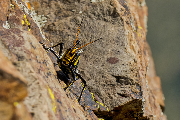
A couple of smaller visitors:
The desert 2000′ below the rim has turned green, nourished by the monsoon rains:
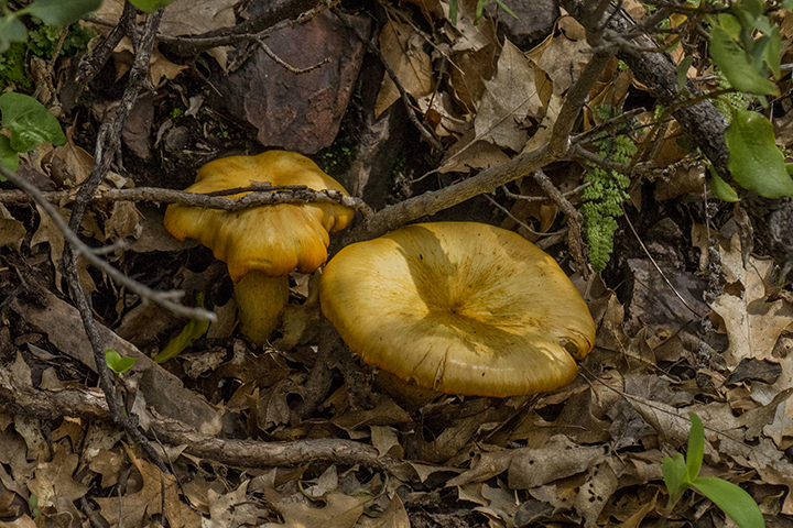
Even mushrooms grow in the dry, cool protection of shady plants:
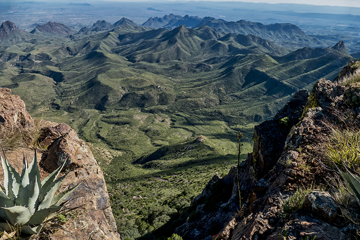
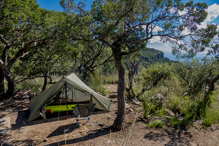
Campsite on the South Rim is cozy, with all the desert running away to Mexico:
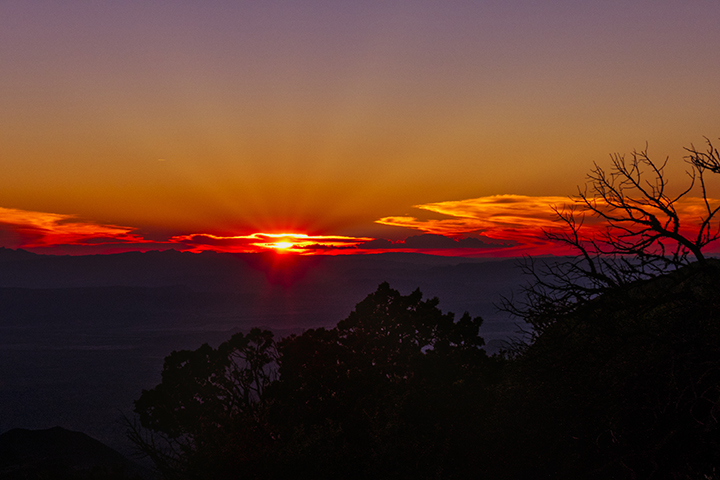
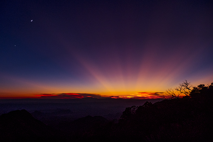
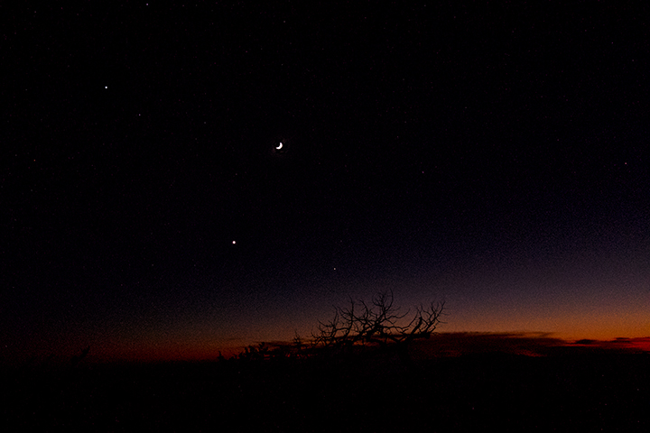
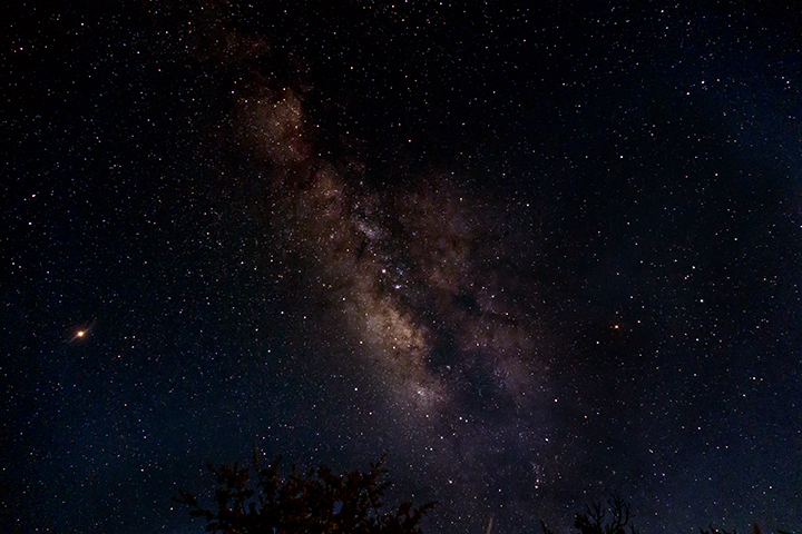
Sunset is a beautiful time of the day up here, giving way to the moon and Venus, the first lights of the night:
Add Jupiter and Saturn, the bring on the Milky Way and Mars as its escort:
Next morning, it’s time to head home, but one last visit from a setting of flowers, and an escort by another whitetail doe down the trail.
Rain is the lifeblood of the desert, and proves that there’s something to see year-round if you slow down and look. As I have often quoted from Edward Abbey in Desert Solitaire, “…crawl, on hands and knees, over the sandstone and through the thornbush and cactus. When traces of blood begin to mark your trail you’ll see something, maybe.”